Straumgjerde
| Straumgjerde | |
|---|---|
| Village | |
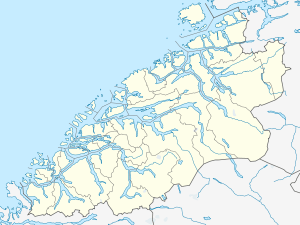 Straumgjerde  Straumgjerde Location in Møre og Romsdal | |
| Coordinates: 62°20′05″N 06°35′43″E / 62.33472°N 6.59528°ECoordinates: 62°20′05″N 06°35′43″E / 62.33472°N 6.59528°E | |
| Country | Norway |
| Region | Western Norway |
| County | Møre og Romsdal |
| District | Sunnmøre |
| Municipality | Sykkylven Municipality |
| Area[1] | |
| • Total | 0.47 km2 (0.18 sq mi) |
| Elevation[2] | 3 m (10 ft) |
| Population (2013)[1] | |
| • Total | 495 |
| • Density | 1,053/km2 (2,730/sq mi) |
| Time zone | CET (UTC+01:00) |
| • Summer (DST) | CEST (UTC+02:00) |
| Post Code | 6220 Straumgjerde |
Straumgjerde is a village in Sykkylven Municipality in Møre og Romsdal county, Norway. The village is located where the lake Fitjavatnet empties into the Sykkylvsfjorden. It is about 6 kilometres (3.7 mi) south of the municipal center of Aure and about 11 kilometres (6.8 mi) south of Ikornnes. The mountain Råna lies 6 kilometres (3.7 mi) south of the village.[3]
The 0.47-square-kilometre (120-acre) village has a population (2013) of 495. This gives it a population density of 1,053 inhabitants per square kilometre (2,730/sq mi).[1]
References
- 1 2 3 Statistisk sentralbyrå (1 January 2013). "Urban settlements. Population and area, by municipality.".
- ↑ "Straumgjerde" (in Norwegian). yr.no. Retrieved 2010-10-06.
- ↑ Store norske leksikon. "Straumgjerde" (in Norwegian). Retrieved 2010-10-06.
This article is issued from Wikipedia - version of the 8/1/2016. The text is available under the Creative Commons Attribution/Share Alike but additional terms may apply for the media files.