Sunda, Faroe Islands
| Sunda | |
|---|---|
| Municipality | |
|
Hósvík village within the municipality | |
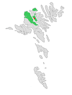 Location in the Faroe Islands | |
| Coordinates: 62°9′N 6°56′W / 62.150°N 6.933°WCoordinates: 62°9′N 6°56′W / 62.150°N 6.933°W | |
| State | Denmark |
| Constituent country |
|
| Islands | Streymoy and Eysturoy |
| Government | |
| • Mayor | Kim Durhuus |
| Population (2010) | |
| • Total | 1,655 |
| Time zone | GMT |
| • Summer (DST) | WEST (UTC+1) |
.JPG)
Sunda kommuna is an amalgamated-municipality stretching across vast areas of the two large Faroese islands Streymoy and Eysturoy.
Sunda kommuna is formed by the former municipalities of Hósvíkar kommuna, Hvalvíkar kommuna, Saksunar kommuna, Haldarsvíkar kommuna, (former) Sunda kommuna and Gjáar kommuna.
It now contains the following villages:
- Hósvík
- Norðskáli
- Hvalvík
- Streymnes
- Haldórsvík
- Oyri
- Oyrarbakki
- Tjørnuvík
- Gjógv
- Langasandur
- Saksun
- Nesvík
Originally Sunda kommuna was a loose cooperation between the small municipalities, but since 2005 these municipalities agreed to amalgamate. Altogether Sunda kommuna accounts for 1,655 inhabitants, and the population is steadily increasing. The increase is mainly due to the highway that runs right through the municipality connecting the north-eastern Faroes with the western and southern parts of the Faroes. This highway - currently one of the main-arteries of the Faroes - also features a bridge across the sound that divides Eysturoy and Streymoy, thus creating a region centred on the bridge.
The major is Kim Durhuus from Hósvík, who in 2009 replaced Heðin Zachariasen.
Photos
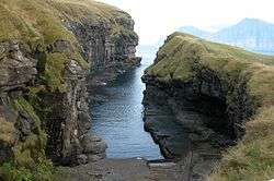
.JPG) The village of Gjógv, the island Kalsoy is in the back ground.
The village of Gjógv, the island Kalsoy is in the back ground. The church of Saksun in north Streymoy
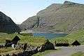
.JPG) Waterfall in Hósvík
Waterfall in Hósvík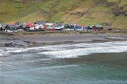
.JPG) Old wooden houses with turf roof in Tjørnuvík.
Old wooden houses with turf roof in Tjørnuvík.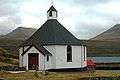 The octagonal church in Haldarsvík in north Streymoy.
References
External links
Municipalities of the Faroe Islands | ||
|---|---|---|
 | ||