Sunflower Landing, Mississippi
| Sunflower Landing, Mississippi | |
|---|---|
| Unincorporated community | |
 Sunflower Landing  Sunflower Landing | |
| Coordinates: 34°09′58″N 90°48′07″W / 34.16611°N 90.80194°WCoordinates: 34°09′58″N 90°48′07″W / 34.16611°N 90.80194°W | |
| Country | United States |
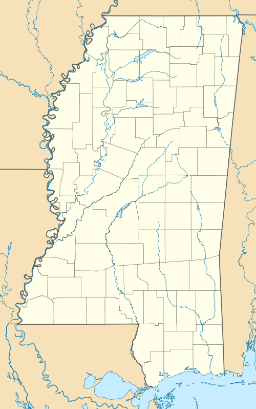
| State | Mississippi |
| County | Coahoma |
| Elevation | 151 ft (46 m) |
| Time zone | Central (CST) (UTC-6) |
| • Summer (DST) | CDT (UTC-5) |
| GNIS feature ID | 692250[1] |
Sunflower Landing is an unincorporated community in Coahoma County, Mississippi.[1]
The settlement is located on the easternmost shore of Desoto Lake, an oxbow lake.[2] Prior to 1942, Desoto Lake was part of the contiguous Mississippi River, and Sunflower Landing was a riverport on the eastern shore of Sunflower Bend.[3]
History
.jpg)
1862 map
A commission appointed by Franklin D. Roosevelt in 1935 determined that Sunflower Landing was the "most likely" place where explorer Hernando Desoto and his expedition crossed the Mississippi River in 1541. It was theorized that Desoto and his men spent a month building flatboats near Sunflower Landing, and then crossed the river at night to avoid the Native Americans who were patrolling the river, and with whom Desoto had previously hostile relations.[4][5] More recent research suggests other Mississippi locations may have also been the site of Hernando's crossing.[6]
By 1838, Sunflower Landing was a well known steamboat landing.[3]
In 1863, the Bolivar Troop, a Confederate States Army company of the First Regiment Mississippi Cavalry, under the command of Frank A. Montgomery, engaged in a land skirmish with about 250 Union troops at Sunflower Landing. Union soldiers had been removing slaves and taking cotton from farms in the vicinity.[7]
In 1942, the United States Army Corps of Engineers removed Sunflower Bend from the course of the Mississippi River. The resulting oxbow lake was named "Desoto Lake".[3]
References
- 1 2 U.S. Geological Survey Geographic Names Information System: Sunflower Landing
- ↑ U.S. Geological Survey Geographic Names Information System: Desoto Lake
- 1 2 3 Bragg, Marion (1977). Historic Names and Places on the Lower Mississippi River (PDF). Mississippi River Commission. pp. 106, 107.
- ↑ Flowers, Judith Coleman (2016). Clarksdale and Coahoma County. Arcadia.
- ↑ Marley, David (1998). Wars of the Americas: A Chronology of Armed Conflict in the New World, 1492 to the Present. ABC-CLIO. p. 45.
- ↑ McNutt, Charles H. (1996). McNutt, Charles H., ed. The Central Mississippi Valley: A Summary. Prehistory of the Central Mississippi Valley. University of Alabama Press. p. 251.
- ↑ "War on the Mississippi". The New York Times. August 21, 1862.
Municipalities and communities of Coahoma County, Mississippi, United States | ||
|---|---|---|
| City | 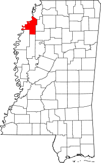 | |
| Towns | ||
| CDP | ||
| Other unincorporated communities | ||
| Ghost towns | ||
| Footnotes | ‡This populated place also has portions in an adjacent county or counties | |