Swalecliffe
| Swalecliffe | |
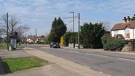 View facing West on St. Johns Road in Swalecliffe |
|
 Swalecliffe |
|
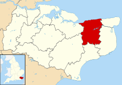
| District | City of Canterbury |
|---|---|
| Shire county | Kent |
| Region | South East |
| Country | England |
| Sovereign state | United Kingdom |
| Post town | WHITSTABLE |
| Postcode district | CT5 2 |
| Dialling code | 01227 |
| Police | Kent |
| Fire | Kent |
| Ambulance | South East Coast |
| EU Parliament | South East England |
| UK Parliament | Canterbury |
Coordinates: 51°21′47″N 1°04′12″E / 51.363°N 1.070°E
Swalecliffe is a part of the ribbon development of the north Kent coast between Whitstable and Herne Bay in Southeast England. At the 2011 Census the area formed part of Chestfield and Swaleciffe ward of the City of Canterbury Council.
History
In 2005 Calmont purchased the land that used to be the petrol station and garage "Quinneys Auto services" and converted it into a prosperous development named after the petrol station. The development features 16 houses and 4 apartments, 12 are semi-detached houses under the name of "Albany" and 4 terraced homes under the name of "Carlton", both of which are 3 bedroom houses. The apartments each have their own names; Bloomsbury, Belgravia, Chelsea and Mayfair. The private road on which the houses lie is called "Quinneys Place", some mapping tools and postcode finders still do not have this road indexed in their databases.
Transport
Both the railway and A2990 Thanet Way run between Swalecliffe and the neighbouring settlement of Chestfield.
Religion
There two Churches, St John the Baptist C of E and the Swalecliffe Free Church. Both Churches have Halls
Gallery
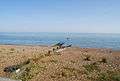 An old groyne
 Swalecliffe mudflats
 Bright colours on the beach huts at Tankerton Bay catch the eye
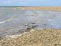 Long Rock, the estuary of the Burnham, a chalk stream whose source is on the Blean ridge near Dunkirk. On the skyline are some of the wind turbines in the Thames Estuary
Notes and references
External links
| Wikimedia Commons has media related to Swalecliffe. |