Szentlőrinc
| Szentlőrinc | ||
|---|---|---|
|
Szentlőrinc - Palace | ||
| ||
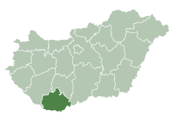
 Szentlőrinc Location of Szentlőrinc | ||
| Coordinates: 46°02′32″N 17°59′08″E / 46.04226°N 17.98563°ECoordinates: 46°02′32″N 17°59′08″E / 46.04226°N 17.98563°E | ||
| Country |
| |
| County | Baranya | |
| Area | ||
| • Total | 27.80 km2 (10.73 sq mi) | |
| Population (2008) | ||
| • Total | 7,060 | |
| • Density | 253.95/km2 (657.7/sq mi) | |
| Time zone | CET (UTC+1) | |
| • Summer (DST) | CEST (UTC+2) | |
| Postal code | 7940 | |
| Area code(s) | 73 | |


Szentlőrinc (Croatian: Selurinac, Selovrenac, Selurac, Selurince, Selerenac) is a town in Baranya county, Hungary.
Szentlőrinc is twinned with:
This article is issued from Wikipedia - version of the 9/7/2015. The text is available under the Creative Commons Attribution/Share Alike but additional terms may apply for the media files.