Taholah, Washington
| Taholah, Washington | |
|---|---|
| CDP | |
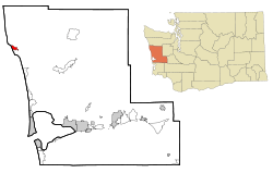 Location of Taholah, Washington | |
| Coordinates: 47°20′44″N 124°17′16″W / 47.34556°N 124.28778°WCoordinates: 47°20′44″N 124°17′16″W / 47.34556°N 124.28778°W | |
| Country | United States |
| State | Washington |
| County | Grays Harbor |
| Area | |
| • Total | 2.0 sq mi (5.3 km2) |
| • Land | 1.7 sq mi (4.4 km2) |
| • Water | 0.3 sq mi (0.9 km2) |
| Elevation | 7 ft (2 m) |
| Population (2000) | |
| • Total | 824 |
| • Density | 485.7/sq mi (187.5/km2) |
| Time zone | Pacific (PST) (UTC-8) |
| • Summer (DST) | PDT (UTC-7) |
| ZIP code | 98587 |
| Area code(s) | 360 |
| FIPS code | 53-70175[1] |
| GNIS feature ID | 1531522[2] |
Taholah is a census-designated place (CDP) on the Quinault Indian Reservation, in Grays Harbor County, Washington, United States. Named for a Quinault chief in 1905,[3] its population was 824 at the 2000 census. The headquarters for the Quinault Indian Nation was moved to Taholah from the town of Quinault on the shore of Lake Quinault.
Geography
Taholah is located at 47°20′44″N 124°17′16″W / 47.34556°N 124.28778°W (47.345610, -124.287767).[4]
The Quinault River empties into the Pacific Ocean on the northern edge of Taholah.
According to the United States Census Bureau, the CDP has a total area of 2.0 square miles (5.3 km²), of which, 1.7 square miles (4.4 km²) of it is land and 0.3 square miles (0.9 km²) of it (17.16%) is water.
Climate
The climate in this area has mild differences between highs and lows, and there is adequate rainfall year round. According to the Köppen Climate Classification system, Taholah has a marine west coast climate, abbreviated "Cfb" on climate maps.[5]
Demographics
As of the census[1] of 2000, there were 824 people, 240 households, and 197 families residing in the CDP. The population density was 485.7 people per square mile (187.1/km²). There were 249 housing units at an average density of 146.8/sq mi (56.6/km²). The racial makeup of the CDP was 4.85% White, 93.20% Native American, 0.12% Asian, 0.73% from other races, and 1.09% from two or more races. Hispanic or Latino of any race were 1.46% of the population.
There were 240 households out of which 44.6% had children under the age of 18 living with them, 39.6% were married couples living together, 28.3% had a female householder with no husband present, and 17.9% were non-families. 13.3% of all households were made up of individuals and 2.9% had someone living alone who was 65 years of age or older. The average household size was 3.43 and the average family size was 3.63.
In the CDP the population was spread out with 38.1% under the age of 18, 8.1% from 18 to 24, 27.4% from 25 to 44, 21.1% from 45 to 64, and 5.2% who were 65 years of age or older. The median age was 28 years. For every 100 females there were 116.3 males. For every 100 females age 18 and over, there were 113.4 males.
The median income for a household in the CDP was $24,688, and the median income for a family was $25,875. Males had a median income of $21,964 versus $24,250 for females. The per capita income for the CDP was $9,373. About 29.0% of families and 34.9% of the population were below the poverty line, including 41.5% of those under age 18 and 30.0% of those age 65 or over.
The Taholah School District's mascot is the Chitwhin, meaning black bear in Quinault.
References
- 1 2 "American FactFinder". United States Census Bureau. Retrieved 2008-01-31.
- ↑ "Taholah". Geographic Names Information System. United States Geological Survey.
- ↑ Majors, Harry M. (1975). Exploring Washington. Van Winkle Publishing Co. p. 65. ISBN 978-0-918664-00-6.
- ↑ "US Gazetteer files: 2010, 2000, and 1990". United States Census Bureau. 2011-02-12. Retrieved 2011-04-23.
- ↑ Climate Summary for Taholah, Washington
Municipalities and communities of Grays Harbor County, Washington, United States | ||
|---|---|---|
| Cities | 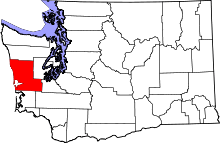 | |
| CDPs | ||
| Other unincorporated communities | ||
| Indian reservations | ||
| Footnotes | ‡This populated place also has portions in an adjacent county or counties | |