Tahu, Palpa
| Tahu ताहुँ Tahoon | |
|---|---|
| Village development committee | |
 | |
| Nickname(s): nepal | |
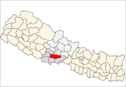
 Tahu Location in Nepal palpa | |
| Coordinates: 27°50′N 83°44′E / 27.84°N 83.73°ECoordinates: 27°50′N 83°44′E / 27.84°N 83.73°E | |
| Zone | Lumbini Zone |
| District | Palpa District |
| Population (1991) | |
| • Total | 3,776 |
| Time zone | Nepal Time (UTC+5:45) |
| Area code(s) | 075 |
Tahu is a village development committee in Palpa District in the Lumbini Zone of southern Nepal. At the time of the 1991 Nepal census it had a population of 3776.[1]
Tahu Village is 32 km east from the district headquarters Tansen and is linked by a fair weather motorable road which diverts from Aryabhanjyang in the Siddhartha Highway. The total distance to place from Aryabhanjyang is about 14 km.
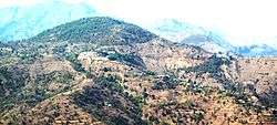
Tahu is an attractive place having natural surroundings of mountains, forests and farmlands. One can view the panoramic beauty of Dhaulagiri, Annapurna and Machhapuchhare Mountains from this VDC. Hatti Lekh, Rambha forest, Bakumgadhi, Rimigha lekh, and Purba khola valley are other natural attractions within and around this VDC. Among the cultural attractions, Rambha Devi and Jalpa Devi temples hold the overriding position. Usually on full-moon days and other festivals a large crowd gather here to worship from different places.
Transport
Buses and jeeps are the dominant form of transportation. Private operators offer service to various destinations. Many Peoples are using motorcycles as private means of transport. There are direct Bus services to Tansen, Butwal & Kathmandu.
Education
Tahu is center of education for nearby village areas.There is a Campus affiliated to Tribhuwan University.
- Rambha Multiple Campus, Tahu-8
- Rambha Higher Secondary School, Tahu-8
- Malagiri English Boarding School, Tahu-8
- Rambha Devi English Boarding School, Tahu-6(Deurali)
- shree pasupati pravi school ( dhobadi)
- shree janta pravi school ( thak khola)
Agriculture
Agriculture is the main occupation in the local economy. Most of the farmers have been subsistence farmers but lately many are also engaged in producing cash-crops which is sold in the Local markets.
Paddy, wheat, maize, millet and legumes are the principal crops of the region. The production of rice and wheat crops in the same year is the predominant cropping pattern in the area.
The more fertile irrigated fields for those crops are at valley bottoms and foothills whereas the non irrigated terraces are at higher altitude.Ginger grown in the terraced land is the one of main cash crop. The other produces are oranges and green vegetables. In the recent years many farmers have also started coffee production. Coffee is being cultivated between 700 m to 1300 m above sea level in fertile, loam to infertile gravel mixed soil in this parts of Tahu VDC.
Banks
- Triveni Bikas Bank Limited
- Muktinath Bikas Bank Limited
Places of interest
- Tahun bazaar
- Rambha Devi Temple
- Dhobadi
- Jalpa Devi Temple
- Nachan Danda
Gallery
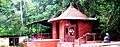 Rambh Devi Temple
 Tahu
Tahu
References
- ↑ "Nepal Census 2001". Nepal's Village Development Committees. Digital Himalaya. Retrieved 12 December 2008.