Talas, Kyrgyzstan
- For the medieval city of "Talas" see Taraz. For information on the Buffalo, NY band, see Billy Sheehan.
| Talas | |
|---|---|
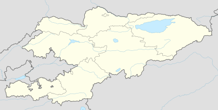 Talas Location in Kyrgyzstan | |
| Coordinates: 42°31′N 72°14′E / 42.517°N 72.233°ECoordinates: 42°31′N 72°14′E / 42.517°N 72.233°E | |
| Country |
|
| Province |
|
| Elevation | 1,244 m (4,081 ft) |
| Population (2009) | |
| • Total | 32,886 |
| Time zone | KGT (UTC+6) |
Talas is a town in northwestern Kyrgyzstan, located in the Talas River valley between two mountain ranges. Its geographical location is 42°31′N 72°14′E / 42.517°N 72.233°E and its population is 32,886 (as of 2009). It is the administrative headquarters of Talas province. The town was founded by East Slavic settlers in 1877.[1] To the south is the Besh-Tash (five rocks) valley with the Besh-Tash National Park.
Overview
Its economy has traditionally been oriented towards the ancient city of Taraz (once named Talas and Dzhambul) in present day Kazakhstan. The Talas valley has suffered severely from the imposition of rigid border controls by Kazakhstan following the demise of the Soviet Union, as transport and trade links to the rest of Kyrgyzstan are now constrained by the mountains separating it from the Chuy Valley and Bishkek. Though much transportation does occur from Bishkek to Talas by transiting through Kazakhstan via the border crossings at Chaldovar in Chuy and then re-crossing into the Talas valley of Kyrgyzstan at Taraz. The only driveable road within the borders of Kyrgyzstan to Bishkek and the rest of the country crosses two mountain passes that rise to heights of more than 3500 meters above sea level over the Ötmök Pass into the Susamar Valley and then again the Ashuu Pass before descending to the Chuy Valley and Bishkek.
Climate
| Climate data for Talas, Kyrgyzstan (1961–1990) | |||||||||||||
|---|---|---|---|---|---|---|---|---|---|---|---|---|---|
| Month | Jan | Feb | Mar | Apr | May | Jun | Jul | Aug | Sep | Oct | Nov | Dec | Year |
| Average high °C (°F) | 1.8 (35.2) |
2.7 (36.9) |
8.7 (47.7) |
16.4 (61.5) |
21.1 (70) |
25.9 (78.6) |
28.1 (82.6) |
26.9 (80.4) |
22.4 (72.3) |
15.8 (60.4) |
9.6 (49.3) |
4.5 (40.1) |
15.4 (59.7) |
| Daily mean °C (°F) | −6.6 (20.1) |
−4.3 (24.3) |
1.6 (34.9) |
8.7 (47.7) |
14.1 (57.4) |
18.0 (64.4) |
20.2 (68.4) |
18.6 (65.5) |
13.5 (56.3) |
7.5 (45.5) |
0.6 (33.1) |
−3.8 (25.2) |
7.3 (45.1) |
| Average low °C (°F) | −11.3 (11.7) |
−9.4 (15.1) |
−2.8 (27) |
3.5 (38.3) |
7.7 (45.9) |
11.2 (52.2) |
12.8 (55) |
10.8 (51.4) |
6.2 (43.2) |
1.4 (34.5) |
−3.0 (26.6) |
−7.5 (18.5) |
1.7 (35.1) |
| Average precipitation mm (inches) | 18 (0.71) |
20 (0.79) |
37 (1.46) |
52 (2.05) |
51 (2.01) |
31 (1.22) |
18 (0.71) |
9 (0.35) |
13 (0.51) |
27 (1.06) |
29 (1.14) |
20 (0.79) |
325 (12.8) |
| Average precipitation days (≥ 1.0 mm) | 4.4 | 4.6 | 7.3 | 8.0 | 8.1 | 5.2 | 4.1 | 1.8 | 2.5 | 5.0 | 5.0 | 4.0 | 60.0 |
| Average relative humidity (%) | 67 | 70 | 72 | 66 | 60 | 55 | 51 | 50 | 51 | 58 | 66 | 67 | 61 |
| Source: Deutscher Wetterdienst[2] | |||||||||||||
Manas
The mythical Kyrgyz national hero, Manas, is said to have been born in the Ala Too mountains in Talas oblast. A few kilometers outside Talas lies a mausoleum, supposedly that of Manas, called the Kümböz Manas. However, the inscription on its richly-decorated facade dedicates it to "...the most glorious of women Kenizek-Khatun, the daughter of the Emir Abuka". Legend explains that Manas' wife Kanikey ordered a deliberately false inscription in order to mislead her husband's enemies and prevent the desecration of his body. The building, known as "Manastin Khumbuzu" or "The Ghumbez of Manas", is thought to have been built in 1334. It now contains a museum dedicated to the epic. A ceremonial mound also lies nearby.
Sports
References
- ↑ Official website of Talas
- ↑ "Klimatafel von Talas / Kirgisistan" (PDF). Baseline climate means (1961-1990) from stations all over the world (in German). Deutscher Wetterdienst. Retrieved 18 February 2016.
- ↑ http://www.canadabandy.ca/pages/feb7_release.php
- Kyzlasov I.L., "Runic Scripts of Eurasian Steppes", Moscow, Eastern Literature, 1994, ISBN 5-02-017741-5
External links
- Talasmost.kg: A new web site for former Talas residents and anyone interested in the city (in Russian)
- The web site of the citizen radio Radiomost in Talas (in Russian)
Administrative seats of the regions of Kyrgyzstan | |||
|---|---|---|---|