Tangail Sadar Upazila
| Tangail Sadar টাংগাইল সদর | |
|---|---|
| Upazila | |
|
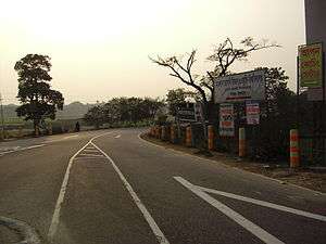
Entrance of Tangail Sadar | |
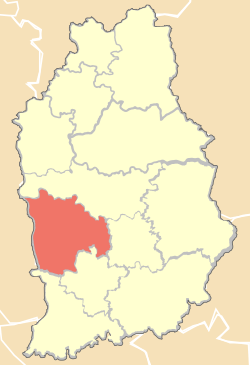 Location of Tangail Sadar in Tangail District | |
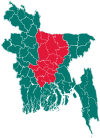
 Tangail Sadar Location in Bangladesh | |
| Coordinates: 24°15′26″N 89°55′40″E / 24.257307°N 89.927783°ECoordinates: 24°15′26″N 89°55′40″E / 24.257307°N 89.927783°E | |
| Country |
|
| Division | Dhaka Division |
| District | Tangail District |
| Area | |
| • Total | 129.06 sq mi (334.26 km2) |
| Population (2011) | |
| • Total | 521,104 |
| • Density | 4,000/sq mi (1,600/km2) |
| Time zone | BST (UTC+6) |
| Website | Official Website of Tangail |
Tangail Sadar (Bengali: টাঙ্গাইল সদর) is an Upazila of Tangail District in the Division of Dhaka, Bangladesh.
Geography
Tangail Sadar is located at 24°15′00″N 89°55′00″E / 24.2500°N 89.9167°E . It has 69783 households and total area 334.26 km².The upazila is surrounded by Kalihati Upazila on the north, Nagarpur and Delduar Upazila on the south, Kalihati and Basail Upazila on the east, and the Jamuna River on the west.
Demographics
As of the 2011 Bangladesh census, Tangail Sadar has a population of 521104. Males constitute 51.05% of the population, and females 48.95%.Tangail Sadar has an average literacy rate of 53.1% (7+ years).[1]
Administration
Tangail Sadar Upazila has 1 municipality(Tangail), 12 Unions, 249 Mauzas/Mahallas, and 276 villages.
The Union Parishads are-
- Baghil Union
- Danya Union
- Gala Union
- Gharinda Union
- Mahamudnagar Union
- Hugra Union
- Karatia Union
- Katuli Union
- Kakua Union
- Magra Union
- Silimpur Union
- Porabari Union
See also
- Union Councils of Tangail District
- Upazilas of Bangladesh
- Districts of Bangladesh
- Divisions of Bangladesh
References
- ↑ "Population Census Wing, BBS.". Archived from the original on 2005-03-27. Retrieved November 10, 2006.
| Upazila/Thana: | ||
|---|---|---|