Ted's Place, Colorado
| Ted's Place, Colorado | |
|---|---|
| Unincorporated community | |
 Ted's Place, Colorado  Ted's Place, Colorado | |
| Coordinates: 40°39′50″N 105°11′22″W / 40.66389°N 105.18944°WCoordinates: 40°39′50″N 105°11′22″W / 40.66389°N 105.18944°W | |
| Country | United States |
| State | Colorado |
| County | Larimer |
| Elevation | 5,240 ft (1,600 m) |
| Time zone | Mountain (MST) (UTC-7) |
| • Summer (DST) | MDT (UTC-6) |
| Area code(s) | 970 |
Ted's Place is an unincorporated community in Larimer County, Colorado, United States. Ted's Place is located near the mouth of the Poudre Canyon, approximately 5 miles (8.0 km) northwest of Fort Collins.
In May, 1922, Ted Herring opened a filling station and store at the intersection of US 287 and Colorado State Highway 14.[1][2] The popular stop near the canyon was quickly named 'Ted's Place' by local residents.[3] After Herring's death in 1963, the property had various owners and in 2016 is owned by Shell.[4]
References
- ↑ Fleming, Barbara. "Walk through history: Why we call it Ted's Place". Coloradoan. Retrieved 6 March 2016.
- ↑ The Colorado Mountain Club (24 June 2010). The Best Front Range Hikes. Mountaineers Books. p. 222. ISBN 978-1-937052-23-2.
- ↑ Tobin, Bob. "How'dYouKnow?: Ted's Place, Poudre Canyon". Denver Post. Retrieved 6 March 2016.
- ↑ Fleming, Barbara; McNeill, Malcolm (2015). Poudre Canyon. Charleston, SC: Arcadia Publishing. p. 68. ISBN 978-1-4671-3370-8.
External links
Municipalities and communities of Larimer County, Colorado, United States | ||
|---|---|---|
| Cities | 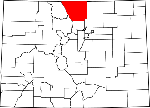 | |
| Towns | ||
| CDPs | ||
| Unincorporated communities | ||
| Ghost towns | ||
| Footnotes | ‡This populated place also has portions in an adjacent county or counties | |
This article is issued from Wikipedia - version of the 11/1/2016. The text is available under the Creative Commons Attribution/Share Alike but additional terms may apply for the media files.