Texas State Highway 357
| ||||
|---|---|---|---|---|
 | ||||
| Route information | ||||
| Maintained by TxDOT | ||||
| Length: | 11.049 mi[1] (17.782 km) | |||
| Existed: | 1946 – present | |||
| Major junctions | ||||
| West end: |
| |||
|
| ||||
| East end: |
| |||
| Highway system | ||||
| ||||

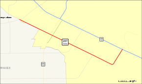
State Highway 357 or SH 357 is a Texas state highway that runs along the southwestern end of Corpus Christi. The route was designated in 1946, replacing FM 692.
Route description
SH 357 begins in southwestern Corpus Christi at FM 665 and heads towards the southeast along Saratoga Boulevard. As it heads to the southeast, it passes under SH 286 (Crosstown Expressway) at a diamond interchange. As it heads southeast from the interchange, the highway intersects FM 43 (Weber Road) and FM 2444 (Staples Street). Saratoga Boulevard comes to an end at an intersection with Rodd Field Road. SH 357 follows Rodd Field Road from this intersection to the northeast to its eastern terminus at SH 358 (South Padre Island Drive).[2]
Junction list
The entire route is in Corpus Christi, Nueces County.
| mi | km | Destinations | Notes | ||
|---|---|---|---|---|---|
| Interchange | |||||
| Interchange | |||||
| 1.000 mi = 1.609 km; 1.000 km = 0.621 mi | |||||
References
- ↑ Transportation Planning and Programming Division (n.d.). "State Highway No. 357". Highway Designation Files. Texas Department of Transportation. Retrieved 2008-03-12.
- ↑ Google (2008-03-12). "overview map of SH 357" (Map). Google Maps. Google. Retrieved 2008-03-12.