Toosa
| Toosa Toosey | |
|---|---|
| town | |
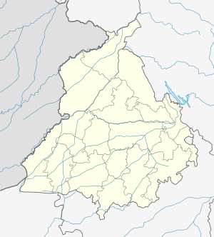 Toosa  Toosa Location in Punjab, India | |
| Coordinates: 30°44′45.31″N 75°41′14.53″E / 30.7459194°N 75.6873694°ECoordinates: 30°44′45.31″N 75°41′14.53″E / 30.7459194°N 75.6873694°E | |
| Country |
|
| State | Punjab |
| District | Ludhiana |
| Area | |
| • Total | 2.4 km2 (0.9 sq mi) |
| Elevation | 243.4 m (798.6 ft) |
| Languages | |
| • Official | Punjabi |
| Time zone | IST (UTC+5:30) |
| PIN | 141105 |
| Vehicle registration | PB-10 |
| Nearest city | Sudhar , Pakhowal |
| Lok Sabha constituency | Fatehgarh Sahib |
| Vidhan Sabha constituency | Raikot |
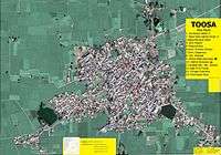
Toosa is one of the largest villages in Punjab, India. It is located in the Ludhiana district, on the Ludhiana Jodhan Raikot road about 23 km south of Ludhiana, near Sudhar.
Village structure
The village is divided into 3 parts which developed based on its growth:
- Older Village inside redline (inside the Darwazas)
- Andarli Firni (1st Firni, inner ring)
- Bahrli Firni (2nd Firni, outer ring)
- Halwara Road Extension
- Rattowal Road Extension
- Leel Road Extension
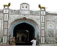
Before 1950, all villagers lived within the redline area between two Darwazas (known as Vadda Darwaza and Shera Vala Darwaza). The houses are small traditional Punjabi houses.
After 1950, people started moving toward outside the redline. The 1st Firni was drawn in a ring shape outside the redline area for use as a common road. Houses were built in this area until circa 1980, at which time the village needed another Firni because of lack of space. Housing continued to be built in this outer ring area.
In the present, people are moving toward the outer roads of Toosa, which connect to nearby villages. check out the blog of the village here.
Demographics
The population is above 5,000 and the area is 2,117 hectares according to the 2001 census.
Neighbouring villages
- Rattowal to the north 1.5 km
- Sarabha to the north-east 4.8 km
- Leel to the south-east 2.3 km
- Halwara in south-west 2.5 km
Near to Sudhar