Topping, Virginia
| Topping, Virginia | |
|---|---|
| Unincorporated community | |
 Topping, Virginia  Topping, Virginia | |
| Coordinates: 37°35′17″N 76°28′28″W / 37.58806°N 76.47444°WCoordinates: 37°35′17″N 76°28′28″W / 37.58806°N 76.47444°W | |
| Country | United States |
| State | Virginia |
| County | Middlesex |
| Elevation | 46 ft (14 m) |
| Time zone | Eastern (EST) (UTC-5) |
| • Summer (DST) | EDT (UTC-4) |
| ZIP code | 23169 |
| Area code(s) | 804 |
| GNIS feature ID | 1475786[1] |
Topping is an unincorporated community in Middlesex County, Virginia, United States. Topping is located on Virginia State Route 3 6.75 miles (10.86 km) east of Saluda. Topping has a post office with ZIP code 23169.[2][3]
Topping, VA is home to Middlesex County's own airport named Hummel Field. This airfield was created by Fred Hummel, an early bird of aviation, in 1925. Hummel then donated the site to Middlesex County in 1970.
Prospect was listed on the National Register of Historic Places in 2004.[4]
References
- ↑ "Topping". Geographic Names Information System. United States Geological Survey.
- ↑ United States Postal Service (2012). "USPS - Look Up a ZIP Code". Retrieved 2012-02-15.
- ↑ "Postmaster Finder - Post Offices by ZIP Code". United States Postal Service. Retrieved August 21, 2012.
- ↑ National Park Service (2010-07-09). "National Register Information System". National Register of Historic Places. National Park Service.
Municipalities and communities of Middlesex County, Virginia, United States | ||
|---|---|---|
| Town | 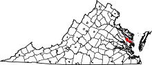 | |
| CDPs | ||
| Unincorporated communities | ||
| Footnotes | ‡This populated place also has portions in an adjacent county or counties | |
This article is issued from Wikipedia - version of the 7/28/2016. The text is available under the Creative Commons Attribution/Share Alike but additional terms may apply for the media files.