Transport in Oman
This article is about transport in Oman.
Highways

total:
62,240 km
paved:
29,685 km (including 1943 km of expressways)
unpaved:
30,545 km (2012)[1]
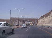
Oman has two expressway grade highways, with the first 8 lane expressway set to open in 2017. Al Batinah Coastal Road runs along the Batinah Coast of the Sea of Oman. It forks near Shinas, with one leading inland to Wadi Hatta and another to Fujairah. The speed limit is generally 120 km/h. In the Muscat area, this highway is known as Sultan Qaboos Street, and it is the trunk road running through the city. Outside the Muscat area, the interchanges take the form of roundabouts spaced approximately 7 km apart. Each roundabout contains unique features to enliven the streetscape. The roundabouts are named for driver navigation.
The other highway is Muscat Expressway, a 54 kilometre[2] highway running from Al Qurum area of Muscat to Halban area on the outskirts of Muscat. Al Batinah Expressway is a 256 kilometre, 8 lane highway that continues from the Muscat Expressway in Halban up to the Oman-UAE border at Khatmat Malaha.[3]
Other roads in Muscat Governorate and some cities such as Sohar and Salalah are dual-carriageways, with four or six lanes each with a speed limit ranging from 60 to 120 km/h; while in the rest of Oman, the roads are mostly single-carriageways.
Maps
Links to neighboring countries
- United Arab Emirates: Oman has several good road connections at Buraimi (Al Ain), Waddi Hatta(Wajaja), Khamat Mulahah (Fujairah) and Bukha.
- Yemen: Route 47: Raysut to Sarfait in Oman - Yemen border. The road then goes to Hawf, Al Faydami, Al Ghaydah. Another road is from Thumrait to Al Mazyonah in Oman - Yemen border.The road then goes to Shisan, Al Kurah, Al Ghaydah.
- Saudi Arabia: Desert road through Al Mashash. However, there is a new road under construction to link the two countries.
Railways
There are no main line railways in Oman, but some are planned, including links to adjacent countries. The narrow gauge Al Hoota Cave Train takes tourists into the cave complex in a journey of 4 minutes and distance of 400m.
Timeline
- 2008
- Joint Gulf Railway proposed to link gulf states at cost of $14b by 2014.[4]
- 2010
- Bids are invited for construction of a rail network in three phases: The first phase would be a double-track electrified coastal route from Masqat to Suhar; the second phase would be an extension from Masqat to Daq; the third phase an extension from Suhar to Al-Ayn (in UAE).[5]
- 2014
- Oman Rail was created.
Pipelines
crude oil 1,300 km; natural gas 1,030 km
Ports and harbors
Gulf of Oman
Arabian Sea
Merchant marine
total:
3 ships (1,000 GRT or over) totaling 16,306 GRT/8,210 tonnes deadweight (DWT)
ships by type:
cargo 1, passenger 1, passenger/cargo 1 (1999 est.)
Airports
142 (1999 est.)
Airports - with unpaved runways
total:
136
over 3,047 m:
2
2,438 to 3,047 m:
6
1,524 to 2,437 m:
56
914 to 1,523 m:
37
under 914 m:
35 (1999 est.)
See also
- Oman
- List of airports in Oman
- Salalah Airport
- Oman Air
- Railway stations in Oman
- North-South Transport Corridor
- Ashgabat agreement, a Multimodal transport agreement signed by India, Oman, Iran, Turkmenistan, Uzbekistan and Kazakhstan, for creating an international transport and transit corridor facilitating transportation of goods between Central Asia and the Persian Gulf.[6]
![]() This article incorporates public domain material from the CIA World Factbook website https://www.cia.gov/library/publications/the-world-factbook/index.html.
This article incorporates public domain material from the CIA World Factbook website https://www.cia.gov/library/publications/the-world-factbook/index.html.
References
- ↑ The World Factbook. CIA https://www.cia.gov/library/publications/the-world-factbook/geos/mu.html. Missing or empty
|title=(help) - ↑ Parsons http://www.parsons.com/projects/Pages/muscat-expressway.aspx. Missing or empty
|title=(help) - ↑ Times of Oman http://www.timesofoman.com/News/43524/Article-Omans-8-lane-Batinah-Expressway-to-be-ready-by-2017. Missing or empty
|title=(help) - ↑ http://railwaysafrica.com/index.php?option=com_content&task=view&id=3587&Itemid=37
- ↑ "Railway Gazette: News in Brief". Retrieved 2010-07-20.
Suhar to Al-Ayn in UAE
- ↑ The Hans India - India accedes to Ashgabat agreement