Transport in Afghanistan
Transport in Afghanistan is limited and in the developing stage. Much of the nation's road network was built during the 1960s but left to ruin during the 1980's and 90's wars. New national highways, roads, and bridges have been rebuilt in the last decade to help increase travel as well as trade with neighboring countries. In 2008, there were about 731,607 vehicles registered inside the country, which serve a 29 million people.[1]
Landlocked Afghanistan has no seaports but the Amu Darya river, which forms part of the nation's border with Turkmenistan, Uzbekistan, and Tajikistan, does have barge traffic. Rebuilding of airports, roads, and a railway line has led to rapid economic boost recent years. The nation has about 53 airports and a number of heliports.[2]
Highways and roads

Most major roads were built in the 1960's with assistance from the United States and the Soviet Union. The Soviets built a road and tunnel through the Salang pass in 1964, connecting northern and southern Afghanistan. A highway connecting the principal cities of Herat, Kandahar, Ghazni, and Kabul with links to highways in neighboring Pakistan formed the primary road system.
The network includes 12,350 kilometers of paved roads and 29,800 kilometers of unpaved roads, for an approximate total road system of 42,150 kilometers as of 2006.[3] Traffic in Afghanistan is right hand, with about 731,607 registered vehicles in the country.[1] The Afghan government passed a law banning the import of cars older than 10 years
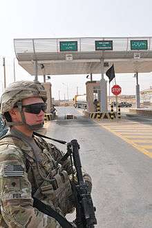
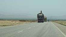
Long distant road journeys are made by company-owned Mercedes-Benz coach buses or various types of vans, trucks and private cars. Although nationwide bus service is available between major cities, flying is safer, especially for foreigners. There are occasional highway robberies by bandits or militant groups. The roads are also dangerous due to accidents and lack of security forces.
Major highways
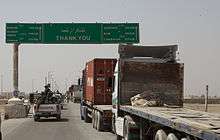
The highway system is currently going through a total reconstruction phase. Most of the regional roads are also being repaired or improved. For the last 30 years, the poor state of the Afghan transportation and communication networks have further fragmented and hampered the struggling economy. Since the fall of the Taliban many roads have been rebuilt, including the following:
- Kabul-Kandahar Highway (A-1)
- Kabul-Jalalabad Road (A-1), which links the national capital to the eastern city of Jalalabad and the Pakistani border at Torkham
- Kabul-Gardez Highway
- Kabul-Herat Highway (A-77)
- Kabul-Mazar Highway (A-76)
- Kabul-Fayzabad Highway
- Kandahar-Bamyan Highway
- Kandahar-Boldak Highway
- Kandahar-Herat Highway
- Kandahar-Tarin Kowt Highway
- Kunduz-Khomri Highway
- Herat-Islam Qala Highway
- Herat-Mazar Highway
- Route Trident (Lashkar Gah to Gereshk)
- Delaram-Zaranj Highway
A road bridge linking Tajikistan and Afghanistan which cost $37 million was inaugurated in 2007. The bridge, nearly 700 metres long and 11 metres across, straddles the Panj river which forms a natural border between the two countries, between the ports of Nizhny Panj on the Tajik side and Shir Khan Bandar in Afghanistan.[4] The Delaram-Zaranj highway was constructed with Indian assistance and was inaugurated in January 2009.[5]
Railways
Afghanistan-Uzbekistan rail connection
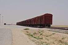
There is a 75 kilometers railway service between Uzbekistan and the northern Afghan city of Mazar-i-Sharif, all of which is built to 1,520 mm (4 ft 11 27⁄32 in) broad gauge.[6] The line begins from Termez and crosses the Amu Darya river on the Soviet-built Afghanistan–Uzbekistan Friendship Bridge, finally reaching a site next to the Mazar-i-Sharif Airport. The Afghan government expects to have the rail line extended to Kabul and then to the eastern border town of Torkham, connecting with Pakistan Railways. The work is carried out by China Metallurgical Group Corporation (MCC) and is expected to be completed by 2014.[7] For strategic reasons, past Afghan governments preferred to discourage the construction of railways which could aid foreign interference in Afghanistan by Britain or Russia.[8]
Turkmenistan-Afghanistan rail connection
A 10 kilometer long 1,520 mm (4 ft 11 27⁄32 in) broad gauge line extends from Serhetabat in Turkmenistan to the town of Towraghondi in Afghanistan. An upgrade of this Soviet-built line began in 2007.[9] There is another 3.5 kilometer similar line that extends from the Aqina dry port in the Andkhoy district of Afghanistan's Faryab province to neighboring Imam Nazar in Turkmenistan. This line is expected to be extended by 300 kilometers to other northern provinces of Afghanistan.[10]
Iranian border
The nearest rail-head in Iran is a 1,435 mm (4 ft 8 1⁄2 in) standard gauge line which terminates at Mashhad.[11] This line is being extended 191 kilometers east to Herat, of which 77 km is located inside Iran and the remaining 114 km in Afghanistan.[12]
Pakistan border
two broad gauge 1,676 mm (5 ft 6 in) Pakistan Railways lines terminate near the border at Chaman in Balochistan near the Khojak Pass; and at Torkham, the border town near the Khyber Pass. Various proposals exist to extend these lines on to Kandahar and Kabul respectively. In July 2010, Pakistan and Afghanistan signed a Memorandum of understanding for going ahead with the laying of rail tracks between the two countries. Work on the proposed project was set to start in late 2010.[13]
Other borders
There are no rail links to China or Tajikistan, though a connection to the latter was proposed in 2008.[14]
Pipelines
There are petroleum pipelines from Bagram into Uzbekistan and Shindand into Turkmenistan. These pipelines have been in disrepair and disuse for years. There are 180 kilometers of natural gas pipelines. The $3 billion Trans-Afghanistan Pipeline proposal for a natural gas pipeline across Afghanistan into Pakistan is moving forward.
Ports and Harbours
The chief inland waterway of land-locked Afghanistan is the Amu Darya River which forms part of Afghanistan's northern border. The river handles barge traffic up to about 500 metric tons. The main river ports are located at Kheyrabad and Shir Khan Bandar.
Air transport


Air transport in Afghanistan is provided by the national carrier Ariana Afghan Airlines, and by private companies such as Afghan Jet International, East Horizon Airlines, Kam Air, Pamir Airways, and Safi Airways. Airlines from a number of nations also provide air services to fly in and out of the country. These include Air India, Emirates, Gulf Air, Iran Aseman Airlines, Pakistan International Airlines, Turkish Airlines and others.
Kabul International Airport is the country's main airport. As of May, 2014 the country had four international airports (Herat International Airport, Kabul International Airport, Kandahar International Airport, Mazari Sharif Airport) and around a dozen domestic airports which had regularly scheduled flights to Kabul and/or Herat.
The nation has approximately 53 airports, about 19 of these have paved runways. Of those, 4 have runways over 3,000 meters, 3 have runways between about 2,500 and 3,000 meters, 8 have runways between 1500 and 2500 meters, and 2 has a runway under 1000 meters. About 34 have unpaved runways. Of those, 5 have runways between 2500 and 3000 meters, 14 have runways between 1500 and 2500 meters, 6 have runways between 1000 and 1500 meters, and 9 have runways under 1000 meters.[2]
- Kabul International Airport (3500 m runway) is the nation's largest airport and the primary hub for international civilian flights.
- Kandahar International Airport (3200 m runway) is a dual-use airport serving southern Afghanistan.
- Mazari Sharif Airport (3100 m runway) is a dual-use airport serving the northern and central portions of the country.
- Herat International Airport (2600 m runway) is the primary civil airport for the western portion of the country.
- Ghazni International Airport (4 km long) is under construction as of April 2012 and will be operational in 2013.[15]
- Jalalabad Airport (1800 m runway)
Bagram Air Base is used by NATO-led forces. It has heavy military traffic, especially helicopters. It can also handle larger airliners such as Boeing 747s, C-5 Galaxy and C-17 Globemaster III military cargo planes. KBR and some other companies fly into and out of Bagram on a regular basis.
Heliports
There are at least eleven heliports.[16]
References
- 1 2 "Afghanistan" (pdf). World Health Organization (WHO). Retrieved January 8, 2012.
- 1 2 "Airports in Afghanistan: 53 (2010)". Central Intelligence Agency (CIA). United States: The World Factbook. Retrieved 2010-10-15.
- ↑ "Roadway in Afghanistan: total: 42,150 km; paved: 12,350 km; unpaved: 29,800 km (2006)". Central Intelligence Agency (CIA). United States: The World Factbook. Retrieved 2010-10-15.
- ↑ Afghanistan-Tajikistan Bridge Links Central, South Asia
- ↑ "India hands over strategic highway to Afghanistan". The Hindu. 2007-07-12.
- ↑ "First major Afghan railway opens". Railway Gazette International. 25 August 2011. Retrieved 25 August 2011.
- ↑ Construction on Kabul-Torkham Railway to Start Soon, Ministry of Mines Says. Tamim Shaheer, October 18, 2011.
- ↑ Railways in Afghanistan, past and future
- ↑ "Afghan rebuild underway". Railway Gazette International. 2007-07-12.
- ↑ "Work on Afghanistan-Turkmenistan railroad begins". Pajhwok Afghan News. 16 June 2013.
- ↑ "Modern construction methods mastered on Mashhad - Bafgh line". Railway Gazette International. 2007-07-01.
- ↑ Murray Hughes (2008-01-29). "Opening up Afghan trade route to Iran". Railway Gazette International.
- ↑ Pakistan, Afghanistan ink MoU on rail links by Javed Hamim Kakar, Pajhwok Afghan news, Jul 7, 2010 19:05. Footnote upgraded 2010-07-12.
- ↑ "Pointers". Railway Gazette International. 2008-06-15.
- ↑ Mirwais Himmat, ed. (April 11, 2012). "Ghazni to have first-ever international airport". Pajhwok Afghan News (PAN). Retrieved 2012-06-08.
- ↑ "Heliports in Afghanistan: 11 (2010)". Central Intelligence Agency (CIA). United States: The World Factbook. Retrieved 2010-10-15.
External links
| Wikimedia Commons has media related to Transport in Afghanistan. |
![]() This article incorporates public domain material from the CIA World Factbook document "2010 edition".
This article incorporates public domain material from the CIA World Factbook document "2010 edition".