Trengune
Coordinates: 50°42′47″N 4°34′01″W / 50.713°N 4.567°W

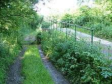
Ford and bridge at Trengune
Trengune is a hamlet in Cornwall, England, United Kingdom. It is part of the civil parish of Warbstow and is located 1.5 miles north and 1 mile west of the village. The River Ottery passes through Trengune.[1][2] The earliest record of Trengune was in 1356; the meaning is "farm at the downs".[3]
References
- ↑ Google Maps
- ↑ Philip's Street Atlas Cornwall. London: Philip's, 2003; pp. 10-11
- ↑ Weatherhill, Craig (2009) A Concise Dictionary of Cornish Place-names. Westport, Co. Mayo: Evertype; p. 74
This article is issued from Wikipedia - version of the 1/31/2016. The text is available under the Creative Commons Attribution/Share Alike but additional terms may apply for the media files.