Trudoxhill

Coordinates: 51°11′25″N 2°21′59″W / 51.1902°N 2.3663°W
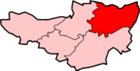
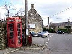
Trudoxhill is a village and civil parish near Nunney in the Mendip district of Somerset, England.
History
The name Trudoxhill comes from the Old English treow meaning tree, dox for dark and hyll for hill.[2]
The parish includes the village of Marston Bigot which includes Marston Bigot Park which encompasses approximately 222 hectares (2,220,000 m2) and includes Marston House, Marston Pond and the remains of the medieval shrunken village of Lower Marston.[3]
Nearby is Marston Moat the site of a fortified manor house.
Governance
The parish council has responsibility for local issues, including setting an annual precept (local rate) to cover the council’s operating costs and producing annual accounts for public scrutiny. The parish council evaluates local planning applications and works with the local police, district council officers, and neighbourhood watch groups on matters of crime, security, and traffic. The parish council's role also includes initiating projects for the maintenance and repair of parish facilities, as well as consulting with the district council on the maintenance, repair, and improvement of highways, drainage, footpaths, public transport, and street cleaning. Conservation matters (including trees and listed buildings) and environmental issues are also the responsibility of the council.
The village falls within the Non-metropolitan district of Mendip, which was formed on 1 April 1974 under the Local Government Act 1972, having previously been part of Frome Rural District,[4] which is responsible for local planning and building control, local roads, council housing, environmental health, markets and fairs, refuse collection and recycling, cemeteries and crematoria, leisure services, parks, and tourism.
Somerset County Council is responsible for running the largest and most expensive local services such as education, social services, libraries, main roads, public transport, policing and fire services, trading standards, waste disposal and strategic planning.
The village is in the 'Postlebury' electoral ward. The ward stretches from Trudoxhill south west to Lamyat. The total ward population at the 2011 census was 2,061.[5]
It is also part of the Somerton and Frome county constituency represented in the House of Commons of the Parliament of the United Kingdom. It elects one Member of Parliament (MP) by the first past the post system of election, and part of the South West England constituency of the European Parliament which elects seven MEPs using the d'Hondt method of party-list proportional representation.
Geography
South of the village, Postlebury Wood is a large and relatively undisturbed woodland with the first records of the woodland being from documents dated 1182, shortly after which it was incorporated in the Royal Forest of Selwood, and has been coppiced and has been used for charcoal production in the past.[6]
Religious sites
The parish Church of St Leonard was built in 1789, and altered in 1844 by Edward Davis of Bath for the Earl of Cork and Orrery. It is Grade I listed.[7]
The former Church of St Michael at Gare Hill, on the border with Wiltshire, is now disused. It was built circa 1857 by William Butterfield for the Duke of Somerset. It is a Grade II* listed building.[8]
There is also a small Grade I listed Church of St Leonard, at Marston Bigot.[9]
Chapel House was built in 1699, but purchased and converted into a congregational chapel in 1717, when pews, pulpit and gallery were installed.[10][11]
References
- ↑ "Trudoxhill Parish". Neighbourhood Statistics. Office for National Statistics. Retrieved 1 January 2014.
- ↑ Robinson, Stephen (1992). Somerset Place Names. Wimborne: Dovecote Press. p. 134. ISBN 1-874336-03-2.
- ↑ Firth, Hannah (2007). Mendip from the air. Taunton: Somerset County Council. ISBN 978-0-86183-390-0.
- ↑ "Frome RD". A vision of Britain Through Time. University of Portsmouth. Retrieved 4 January 2014.
- ↑ "Postlebury ward 2011.Retrieved 7 March 2015".
- ↑ English Nature citation sheet for the site (accessed 7 August 2006)
- ↑ "Church of St Leonard". Images of England. Retrieved 25 November 2006.
- ↑ "Former Church of St Michael". Images of England. Retrieved 25 November 2006.
- ↑ "Church of St Leonard". Images of England. Retrieved 2 September 2007.
- ↑ Dunning, Robert (1996). Fifty Somerset Churches. Somerset Books. pp. 118–120. ISBN 978-0861833092.
- ↑ "Chapel House". National Heritage List for England. Historic England. Retrieved 16 February 2016.
External links
![]() Media related to Trudoxhill at Wikimedia Commons
Media related to Trudoxhill at Wikimedia Commons