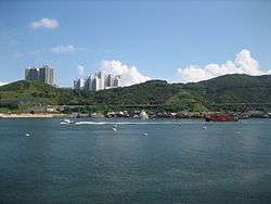
Tsing Yi North Coastal Road
| Tsing Yi North Coastal Road | |
|---|---|
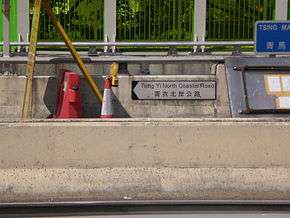
|
Street name sign of the road in Tsing Yi | |
| Route information | |
| Maintained by Highways Department | |
| Length: | 2.2 km[1] (1.4 mi) |
| Existed: | February 2, 2002 – present |
| History: | Construction began in February 1999 |
| Major junctions | |
| East end: | Tsing Tsuen Road in Tsing Yi |
| West end: |
|
| Location | |
| Districts: | Kwai Tsing |
| Highway system | |
| Hong Kong Strategic Route and Exit Number System | |
Tsing Yi North Coastal Road, also abbreviated as TYNCR,[1] (Chinese: 青衣北岸公路; Jyutping: cing1 ji1 bak1 ngon6 gung1 lou6; pinyin: Qīngyī Běi'àn Gōnglù) is a dual carriageway in Tsing Yi, Hong Kong. The road starts at Tsing Tsuen Road, where it travels through the northern part of the island. It ends at Route 3 and Route 8 on the western side of the island at a left-in/left-out interchange, 2.2 kilometres (1.4 mi) from its eastern terminus. The road was first planned in 1998 to relieve traffic coming from Lantau. It was constructed in 1999, and was opened in February 2002.
Description
The road starts at the border of the Tsing Ma Control Area,[1] on the eastern exit ramps of the Tam Kong Shan Interchange and the western terminus of Tsing Tsuen Road.[2] The road travels westward, with ramps reemerging from the interchange, which is surrounded by noise barriers. TYNCR then travels across multiple viaducts on the northern side of Tsing Yi, with hills south of the road, and the coastline north of it. About 1.4 kilometres (0.87 mi) from the eastern terminus,[3] TYNCR travels to Tam Kong Shan Road, near a shipyard and a cement factory. The exit ramp is accessible from westbound lanes, and the entrance ramp from Tam Kong Shan Road to eastbound lanes. The road continues eastward and ends at a left-in/left-out intersection, located east of the Lantau Link Visitors Centre.[2] The interchange then connects to Routes 3 and 8.[3]
In 2014, 15,240 vehicles traveled the road between Tam Kong Shan Road interchange and Tsing Tsuen Road. It is measured in average annual daily traffic (AADT), which measures the amount of traffic daily on average. The road is classified as a District Distributor by the Transport Department.[4]
History
Planning for the road began around 1996,[5] as part of the Tsing Ma Control Area, a small region of highways with special management. The road was to relieve the higher traffic traveling through Tsing Yi, especially with the new Hong Kong International Airport and developments in Lantau being built.[1] The project included the road and its ramps, pedestrian pathways, noise barriers around the highway, surveillance system, and a maintenance centre in Tsing Yi.[1][6] The Highways Department signed a contract with Gammon Construction Limited for HKD$775.6 million in February 1999,[7] after it invited qualified contractors in October 1998.[6] Construction began later that month.[7]
During construction, techniques were used to prevent air pollution. Water was sprayed on roads, vehicles, and other areas to keep dust from leaving the site.[8] Multiple viaducts, road embankments, and retaining walls were constructed in the project, with a set of walls replaced after its footings were damaged.[9] Construction of the traffic control system began in November 2000, after the Transport Department signed an agreement with ABB Industrial and Building Systems Limited.[10] The road was opened on February 2, 2002,[11] after Donald Tsang inaugurated the road in a ceremony on February 1.[12] New speed limits were set to 70 kilometres per hour (43 mph) upon opening.[13]
Major intersections
The entire road is in Kwai Tsing District.
| Location | km[3] | mi | Destinations[2] | Notes | |
|---|---|---|---|---|---|
| Tsing Yi | 0.0 | 0.0 | Tsing Tsuen Road | Road continues eastbound as Tsing Tsuen Road | |
| 0.0– 0.5 | 0.0– 0.31 | Tam Kon Shan Road / Tsuen King Road / Tsing Tsuen Road / Fung Shue Wo Road (Tam Kong Shan Interchange) | Roundabout | ||
| 0.6– 1.0 | 0.37– 0.62 | Tam Kon Shan Road | To and from eastbound only | ||
| Shek Wan | 2.2 | 1.4 | Left-in/left-out | ||
| 1.000 mi = 1.609 km; 1.000 km = 0.621 mi | |||||
See also
References
- 1 2 3 4 5 Public Works Subcommittee (22 July 1998). ITEM FOR PUBLIC WORKS SUBCOMMITTEE OF FINANCE COMMITTEE (Report). The Legislative Council Commission. Retrieved 2 April 2016.
- 1 2 3 萬里地圖製作中心 (2015). "青衣" (Map). 2015香港大地圖:新界及離島篇 (in Chinese and English). 萬里機構出版有限公司. p. 43. ISBN 9789622774438. Retrieved 8 May 2016.
- 1 2 3 Google (30 March 2016). "Tsing Yi North Coastal Road" (Map). Google Maps. Google. Retrieved 30 March 2016.
- ↑ The Annual Traffic Census -2014- (PDF) (Report). Transport Department. August 2015. Retrieved 8 May 2016.
- ↑ Progress Report (Report). Transport Bureau. 8 October 1997. Retrieved 2 April 2016.
To cater for increased traffic generated by the opening of the new airport by constructing the Tsing Yi North Coastal Road, a 2.1 kilometre dual two-lane carriageway linking the Tsing Tsuen Bridge and the Lantau Fixed Crossing.
- 1 2 "Tenders for construction of Tsing Yi North Coastal Road". Daily Information Bulletin. Hong Kong. 9 October 1998. Retrieved 3 April 2016.
- 1 2 "Tsing Yi North Coastal Road - another key access to airport". Daily Information Bulletin. Hong Kong. 8 February 1999. Retrieved 3 April 2016.
- ↑ "Achievements in environmental pollution control on construction activities". epd.gov.hk. Environmental Protection Department. Retrieved 8 May 2016.
- ↑ Ho, K.K.S.; Li, K.S. (10–14 December 2001). Geotechnical Engineering: Meeting Society's Needs. Fourteenth Southeast Asian Geotechnical Conference. 1. Hong Kong: A.A. Balkema. pp. 361–366. ISBN 9789058092502. Retrieved 8 May 2016.
- ↑ "Construction of TYNCR Traffic Control and Surveillance System commences" (Press release). Hong Kong: Transport Department. Transport Department. 23 November 2000. Retrieved 8 May 2016.
- ↑ "耗資七億七 青衣北公路今啟用 荃灣往機場省時八分鐘". 蘋果日報 (in Chinese). Hong Kong. 2 February 2002. Retrieved 8 May 2016.
- ↑ "Government is committed to providing quality transport system" (Press release). Hong Kong: info.hk.gov. Government of Hong Kong Special Administrative Region. 1 February 2002. Retrieved 8 May 2016.
- ↑ "Speed Limit of Tsing Yi North Coastal Road" (PDF). gld.hk.gov. Transport Department. 2 February 2002. Retrieved 8 May 2016.
External links
 Media related to Tsing Yi North Coastal Road at Wikimedia Commons
- Tsing Yi North Coastal Road Environmental Impact Assessment