Tumaraa
| Tumaraa | |
|---|---|
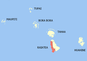 Location of the commune (in red) within the Leeward Islands | |
| Coordinates: 16°47′00″S 151°29′00″W / 16.7833°S 151.4833°WCoordinates: 16°47′00″S 151°29′00″W / 16.7833°S 151.4833°W | |
| Country | France |
| Overseas collectivity | French Polynesia |
| Government | |
| • Mayor | Cyril Tetuanui |
| Area | 63.2 km2 (24.4 sq mi) |
| Population (August 2007 census)1 | 3,632 |
| • Density | 57/km2 (150/sq mi) |
| INSEE/Postal code | 98754 / 98735 |
| Elevation | 0–1,017 m (0–3,337 ft) |
| 1 Population without double counting: residents of multiple communes (e.g., students and military personnel) only counted once. | |
Tumaraa is a commune of French Polynesia, an overseas territory of France in the Pacific Ocean. The commune of Tumaraa is located on the island of Raiatea, in the administrative subdivision of the Leeward Islands, themselves part of the Society Islands. Tumaraa is the second most populous commune on Raiatea.[1]
Tumaraa consists of the following associated communes:
- Fetuna
- Tehurui
- Tevaitoa
- Vaiaau
The administrative centre of the commune is the settlement of Tevaitoa. The tallest mountain on Raiatea - Mont Temehani - is located within Tumaraa.[2]
References
| Wikimedia Commons has media related to Tumaraa. |
This article is issued from Wikipedia - version of the 6/23/2016. The text is available under the Creative Commons Attribution/Share Alike but additional terms may apply for the media files.