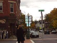
U.S. Route 4 in Vermont
| |||||||
|---|---|---|---|---|---|---|---|
| Leonard F. Wing Blue Star Drive[1] | |||||||
|
Map of central Vermont with US 4 highlighted in red | |||||||
| Route information | |||||||
| Maintained by VTrans | |||||||
| Length: | 66.059 mi[2] (106.312 km) | ||||||
| Existed: | 1926 – present | ||||||
| Major junctions | |||||||
| West end: |
| ||||||
|
| |||||||
| East end: |
| ||||||
| Location | |||||||
| Counties: | Rutland, Windsor | ||||||
| Highway system | |||||||
| |||||||


In the U.S. state of Vermont, U.S. Route 4 (US 4) extends for 66.06 miles (106.31 km) between the New York state line at Fair Haven and the New Hampshire state line at White River Junction. It is one of the main arteries between New York and New Hampshire.[3]
Route description
Upon crossing into Vermont from New York, US 4 immediately expands from a two-lane highway to a four-lane expressway. US 4 changes from being signed north–south (in New York) to being signed east–west (in Vermont). The historic routing of US 4 runs nearby as VT 4A, which later becomes US 4 Business as it enters the town of Rutland.
The 19-mile (31 km) US 4 expressway was built in anticipation of the proposed, but never built, East-West Highway which was supposed to link the population centers of northern New England. As such, this section of freeway meets Interstate Highway standards. The freeway has junctions with VT 22A in Fair Haven and VT 30 in Castleton. In West Rutland, the last numbered exit on the highway, exit 6, leads to US 4 Business, which provides access to the town centers of West Rutland and Rutland town. The expressway veers south just outside the limits of Rutland city, ending at an at-grade intersection with US 7 south of the city.[4]
US 4 overlaps with US 7 north into downtown Rutland, meeting the east end of its business route along the way. US 4 then leaves US 7 along Woodstock Avenue as it heads northeast out of the city. East of Rutland city, US 4 is a two-lane highway, meandering through the Green Mountains, passing by the town center of Mendon towards the town of Killington. In Killington, US 4 joins VT 100 as they pass through Killington center along the Ottauquechee River valley until the village of West Bridgewater at the Bridgewater town line. VT 100 splits off to the south while US 4 continues following the Ottauquechee River east through Bridgewater center into the town of Woodstock. Several miles later, US 4 enters the incorporated village of Woodstock, where it meets VT 12 and VT 106. Southbound VT 12 and eastbound US 4 overlap for about 4 miles (6.4 km) along the river and split at the village of Taftsville, in the northwest corner of the town of Hartland.[5]
US 4 continues following the Ottauquechee River into the town of Hartford, passing through Quechee State Park and circling south of Deweys Pond to cross the river on the Quechee Gorge Bridge, before heading north to the south bank of the White River. Here, US 4 has an interchange with Interstate 89, then turns eastward following the river bank into the village of White River Junction. In the village, US 4 joins US 5 as they cross the White River. At a four-way intersection immediately after the crossing, US 5 continues north, VT 14 begins to the west, and US 4 continues to the east. US 4 crosses the New Hampshire state line at the Connecticut River after a quarter of a mile.[6]
History

The road running from the New York state line (towards Whitehall, New York) at Fair Haven eastward through Rutland and Woodstock to White River Junction was designated as Route 13 of the New England road marking system in 1922.[7][8] In late 1926, New England Route 13 was incorporated into the newly established U.S. Highway System as US 4.[9] In the 1960s, construction of the 19-mile (31 km) expressway section of US 4 began. The middle segment of the expressway from exit 5 in Castleton to exit 6 in West Rutland opened to traffic in 1969. Two years later, the western segment from the New York line in Fair Haven to exit 5 also opened. The original surface alignment of US 4 was re-designated as VT 4A. The construction of the eastern segment (from exit 6 to the intersection with US 7) was delayed for several years and did not open to traffic until 1986.[10] The original surface alignment east of exit 6 was redesignated as US 4 Business.
Major intersections
| County | Location | mi[2] | km | Exit | Destinations | Notes |
|---|---|---|---|---|---|---|
| Rutland | Fair Haven | 0.000 | 0.000 | Continuation from New York | ||
| 0.150 | 0.241 | 1 | Exit 1 not signed eastbound, at-grade intersection with jughandle on westbound side, western terminus of VT 4A | |||
| 1.676 | 2.697 | 2 | ||||
| 2.573 | 4.141 | 3 | Via Dutton Avenue; Westbound exit and eastbound entrance | |||
| Castleton | 5.449 | 8.769 | 4 | |||
| 7.758 | 12.485 | 5 | To Castleton State College | |||
| West Rutland | 14.899 | 23.978 | 6 | Western terminus of US 4 Business, eastern terminus of VT 4A | ||
| Town of Rutland | 18.829 | 30.302 | Eastern end of freeway section; western end of concurrency with US 7 | |||
| City of Rutland | 20.929 | 33.682 | Eastern terminus of US 4 Business | |||
| 21.066 | 33.902 | Eastern end of concurrency with US 7 | ||||
| Killington | 31.593 | 50.844 | Western end of concurrency with VT 100 | |||
| Windsor | West Bridgewater | 38.030 | 61.203 | Eastern end of concurrency with VT 100 | ||
| Bridgewater | 43.642 | 70.235 | Northern terminus of VT 100A | |||
| Village of Woodstock | 51.624[11] | 83.081 | Northern terminus of VT 106 | |||
| 51.755 | 83.292 | Western end of concurrency with VT 12 | ||||
| Hartland | 55.637 | 89.539 | Eastern end of concurrency with VT 12 | |||
| Hartford | 62.417 | 100.450 | Exit 1 on I-89 | |||
| 65.261 | 105.027 | Western end of concurrency with US 5 | ||||
| White River Junction | 65.822 | 105.930 | Eastern end of concurrency with US 5; southern terminus of VT 14 | |||
| 66.059 | 106.312 | Continuation into New Hampshire at the Connecticut River | ||||
1.000 mi = 1.609 km; 1.000 km = 0.621 mi
| ||||||
Bannered routes
References
- ↑ State of Vermont Board of Libraries (April 28, 2008). "Vermont Named State Highways and Bridges" (PDF). Department of Libraries, State of Vermont. Retrieved April 1, 2015.
- 1 2 Traffic Research Unit (May 2013). "2012 (Route Log) AADTs for State Highways" (PDF). Policy, Planning and Intermodal Development Division, Vermont Agency of Transportation. Retrieved March 8, 2015.
- ↑ Shinn, Peggy (January 18, 2009). Not so fast (or else) on these Vermont highways. Boston Globe.
- ↑ Google (June 8, 2009). "Fair Haven to Rutland" (Map). Google Maps. Google. Retrieved June 8, 2009.
- ↑ Google (June 8, 2009). "Rutland to Taftville" (Map). Google Maps. Google. Retrieved June 8, 2009.
- ↑ Google (June 8, 2009). "Taftville to White River Junction" (Map). Google Maps. Google. Retrieved June 8, 2009.
- ↑ "Motor Sign Uniformity". New York Times. April 16, 1922.
- ↑ Automobile Legal Association Green Book, 1925 edition, (Scarborough Motor Guide Co., Boston, 1925). The book has a route log of the New England inter-state routes showing the planned alignment in 1922.
- ↑ Official Automobile Blue Book, Vol. 1, 1926 and 1927 editions, (Automobile Blue Books Inc., Chicago, 1926 and 1927). The 1926 map shows routes just prior to the designation of U.S. Highways.
- ↑ "State Highways History – Route Listing, Exclusive of Interstates with Route Log Notes" (PDF). Vermont Agency of Transportation, Policy and Planning Division – Mapping. October 5, 2007. Retrieved January 15, 2012.
- ↑ Division of Policy, Planning and Intermodal Development (October 7, 2014). "Vermont General Highway Map, Village of Woodstock, Windsor County" (PDF). Vermont Agency of Transportation. Retrieved March 12, 2015.
External links
| Previous state: New York |
Vermont | Next state: New Hampshire |