Hampton, New York
| Hampton | |
|---|---|
| Town | |
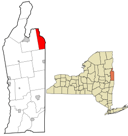 Location in Washington County and the state of New York. | |
| Coordinates: 43°33′N 73°18′W / 43.550°N 73.300°WCoordinates: 43°33′N 73°18′W / 43.550°N 73.300°W | |
| Country | United States |
| State | New York |
| County | Washington |
| Area | |
| • Total | 22.6 sq mi (58.6 km2) |
| • Land | 22.6 sq mi (58.4 km2) |
| • Water | 0.1 sq mi (0.2 km2) |
| Elevation | 633 ft (193 m) |
| Population (2010)[1] | |
| • Total | 938 |
| • Density | 38.6/sq mi (14.9/km2) |
| Time zone | Eastern (EST) (UTC-5) |
| • Summer (DST) | EDT (UTC-4) |
| ZIP code(s)[2] |
12837 (primary) 12887 Whitehall |
| Area code(s) | 518 |
| FIPS code | 36-31885 |
| GNIS feature ID | 0979041 |
Hampton is a town in northeastern Washington County, New York, United States. It is part of the Glens Falls Metropolitan Statistical Area.[3] The town population was 938 at the 2010 census increasing 7.2% since the 2000 census.[1] The town of Hampton is located in the northeast corner of Washington County.
The current Town Supervisor is Dave O'Brien. The current Town Board consists of Don Sady, Andrea Sweeney, Tamme Taran, and Dave Jensen. The current Highway Superintendent is Herb Sady. The current Town Clerk is Becky Jones.
History
This area of New York was part of a jurisdictional dispute between New York and Vermont. The matter was not settled until after 1790.
The town was formed in 1786 and was once called "Hampton Corners" and "Greenfield." It was founded by Gideon G. Warren, former American Revolutionary War officer. The first town meeting was conducted in his home. Many of the first settlers were from Massachusetts and Connecticut. The land contains parts of early land patents, including Skene's Little Patent and those issued to groups of British officers.
In 1783, the Poultney River at the east town line suddenly changed course and became unnavigable due to a sudden influx of water.
Red slate and other colored slate were mined here.
The William Miller Chapel and Ascension Rock was listed on the National Register of Historic Places in 1975.[4]
Notable people
- William Miller (1782-1849), American Baptist preacher who is credited with beginning the mid-nineteenth century North American religious movement now known as Adventism
- Nelson R. Norton, later a member of the Wisconsin State Assembly.
- George W. Weeden, later a member of the Wisconsin State Assembly.
Geography
According to the United States Census Bureau, the town has a total area of 22.6 square miles (59 km2), of which, 22.6 square miles (59 km2) of it is land and 0.1 square miles (0.26 km2) of it (0.35%) is water.
The eastern part of the town forms a border with Vermont. Part of the boundary is marked by the Poultney River, which flows into Lake Champlain.
US 4 cross the town in an east-west direction. NY 22A passes along the east side of the town.
Neighboring cities and towns
 |
West Haven, Vermont | Fair Haven, Vermont | Poultney, Vermont | |
| Whitehall | |
Poultney, Vermont | ||
| ||||
| | ||||
| Granville | Granville | Wells, Vermont |
Demographics
| Historical population | |||
|---|---|---|---|
| Census | Pop. | %± | |
| 1820 | 963 | — | |
| 1830 | 1,069 | 11.0% | |
| 1840 | 972 | −9.1% | |
| 1850 | 899 | −7.5% | |
| 1860 | 876 | −2.6% | |
| 1870 | 955 | 9.0% | |
| 1880 | 833 | −12.8% | |
| 1890 | 791 | −5.0% | |
| 1900 | 689 | −12.9% | |
| 1910 | 645 | −6.4% | |
| 1920 | 552 | −14.4% | |
| 1930 | 673 | 21.9% | |
| 1940 | 594 | −11.7% | |
| 1950 | 576 | −3.0% | |
| 1960 | 469 | −18.6% | |
| 1970 | 464 | −1.1% | |
| 1980 | 559 | 20.5% | |
| 1990 | 756 | 35.2% | |
| 2000 | 871 | 15.2% | |
| 2010 | 938 | 7.7% | |
| Est. 2014 | 929 | [5] | −1.0% |
As of the census of 2010, there were 938 people, 326 households, and 228 families residing in the town. The population density was 38.6 people per square mile (14.9/km²). There were 435 housing units at an average density of 19.3 per square mile (7.4/km²). The racial makeup of the town was 98.5% White, 0.6% African American, 0.1% Native American, 0.1% Asian, and 0.7% from two or more races. Hispanic or Latino of any race were 1.0% of the population.[1]
There were 326 households out of which 38.0% had children under the age of 18 living with them, 58.0% were married couples living together, 7.7% had a female householder with no husband present, and 30.1% were non-families. 20.6% of all households were made up of individuals and 5.8% had someone living alone who was 65 years of age or older. The average household size was 2.65 and the average family size was 3.10.[1]
In the town the population was spread out with 27.6% under the age of 18, 7.0% from 18 to 24, 29.3% from 25 to 44, 27.1% from 45 to 64, and 9.1% who were 65 years of age or older. The median age was 36 years. For every 100 females there were 98.4 males. For every 100 females age 18 and over, there were 106.9 males.[1]
The median income for a household in the town was $39,444, and the median income for a family was $46,250. Males had a median income of $29,107 versus $23,750 for females. The per capita income for the town was $17,433. About 3.8% of families and 7.1% of the population were below the poverty line, including 10.3% of those under age 18 and none of those age 65 or over.[1]
Communities and locations in Hampton
Communities
- Hampton – A hamlet in the southeast part of the town on NY 22A near the Vermont border.
- Hampton Corners – An historic community once located ten miles north of Hampton hamlet.
- Hampton Flats – A location north of Hampton hamlet on NY 22A.
- Low Hampton – A hamlet on US 4 in the northeast part of the town at the Vermont border.
Geographical locations
- Crystal Lake – A small lake southwest of Hampton hamlet.
- Hills Pond – A lake west of Crystal Lake.
References
- 1 2 3 4 5 6 "American FactFinder". United States Census Bureau. Retrieved 2008-01-31.
- ↑ Washington County GIS Web Map (Map). Washington County, NY. Retrieved 2010-06-19.
- ↑ "Metropolitan Areas and Components, 1999, with FIPS Codes". US Census Bureau. Retrieved July 7, 2009.
- ↑ National Park Service (2009-03-13). "National Register Information System". National Register of Historic Places. National Park Service.
- ↑ "Annual Estimates of the Resident Population for Incorporated Places: April 1, 2010 to July 1, 2014". Retrieved June 4, 2015.
- ↑ "Census of Population and Housing". Census.gov. Retrieved June 4, 2015.
External links
Municipalities and communities of Washington County, New York, United States | ||
|---|---|---|
| Towns | 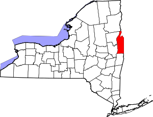 | |
| Villages | ||
| Hamlets | ||
| Footnotes | ‡This populated place also has portions in an adjacent county or counties | |