USA-206
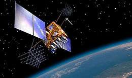 Artist's impression of a GPS IIRM satellite in orbit | |
| Mission type | Navigation |
|---|---|
| Operator | US Air Force |
| COSPAR ID | 2009-043A |
| SATCAT № | 35752 |
| Mission duration | 10 years (planned) |
| Spacecraft properties | |
| Spacecraft type | GPS Block IIRM |
| Bus | AS-4000 |
| Manufacturer | Lockheed Martin |
| Launch mass | 2,032 kilograms (4,480 lb) |
| Start of mission | |
| Launch date | 17 August 2009, 10:35:00 UTC |
| Rocket | Delta II 7925-9.5, D343 |
| Launch site | Cape Canaveral SLC-17A |
| Contractor | ULA |
| Orbital parameters | |
| Reference system | Geocentric |
| Regime |
Medium Earth (Semi-synchronous) |
| Perigee | 20,200 kilometres (12,600 mi) |
| Apogee | 20,200 kilometres (12,600 mi) |
| Inclination | 55 degrees |
| Period | 12 hours |
USA-206,[1] also GPS SVN-50, PRN-05 and NAVSTAR 64 and known before launch as GPS IIR-21, GPS IIRM-8 or GPS IIR-21(M), is an American navigation satellite which forms part of the Navstar Global Positioning System. It was the twenty-first and last Block IIR GPS satellite to be launched, and the eighth to use the modernised IIRM configuration.[2]
GPS IIR-21 was built by Lockheed Martin, based on the AS-4000 satellite bus, with the navigation payload being built by ITT.[2] It was launched by a United Launch Alliance Delta II rocket, using the 7925-9.5 configuration,[3] on 17 August 2009 at 10:35 GMT.[4] It was the last spacecraft to launch from Space Launch Complex 17A at the Cape Canaveral Air Force Station, a launch pad which was first used in August 1957 for test flights of the PGM-17 Thor missile.[5] It is also the final flight of an AS-4000 bus,[6] the final GPS launch on a Delta II, and the final Delta II launch to be overseen by the US Air Force.[3]
Following separation from its carrier rocket, GPS IIR-21 received its USA designation, USA-206. It was deployed into a transfer orbit, from which raised itself to a semi-synchronous medium Earth orbit on 19 August, using an onboard Star 37FM apogee motor. It is a 2,032-kilogram (4,480 lb) satellite,[1] and is expected to operate for at least ten years.[3] Once it had completed on-orbit testing, it began covering Slot 3 of Plane E of the GPS constellation, replacing USA-126, or GPS IIA-26, which was launched in July 1996.[4] It was declared operational on 27 August 2009.[7]
References
- 1 2 Krebs, Gunter. "Navstar 2RM". Gunter's Space Page. Retrieved 2009-08-15.
- 1 2 "Final LockMart Modernized GPS IIR Satellite Set For Launch". GPS Daily. 2009-08-11. Retrieved 2009-08-15.
- 1 2 3 "Delta II GPS IIR-21 Mission Booklet" (PDF). United Launch Alliance. Retrieved 2009-08-15.
- 1 2 Ray, Justin. "Mission Status Center". Delta Launch Report. Spaceflight Now. Retrieved 2009-08-15.
- ↑ Ray, Justin (2009-03-24). "Delta 2 rocket delivers another GPS satellite to orbit". Spaceflight Now. Retrieved 2009-08-13.
- ↑ Krebs, Gunter. "Martin Marietta -> Lockheed Martin: 4000". Gunter's Space Page. Retrieved 2009-08-15.
- ↑ "Air Force Sets Latest GPS Satellite Operational". Inside GNSS. 2009-08-27. Retrieved 2009-09-06.