Uma Bawang
| Uma Bawang | |
|---|---|
| Village | |
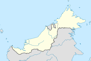
 Uma Bawang Location in Borneo | |
| Coordinates: 3°36′10.1″N 114°24′25.9″E / 3.602806°N 114.407194°ECoordinates: 3°36′10.1″N 114°24′25.9″E / 3.602806°N 114.407194°E | |
| Country | Malaysia |
| State | Sarawak |
| Division | Miri Division |
| Population | 100[1] |
| Time zone | MST (UTC+8) |
| • Summer (DST) | Not observed (UTC+8) |
Uma Bawang is a village located in Lirong Kawit, the settlement in state of Sarawak. This village consists of a single longhouse that located near Baram River and the population is 100 as of 1990 that consists of Kayan people.[1][2][3]
Sister cities
As designed by Sister Cities International, Uma Bawang has maintained sister cities with:
References
- 1 2 3 "Berkeley's Borneo Project Aims to Restore Lands by Teaching Mapping By MATTHEW ARTZ". The Berkeley Daily Planet. Retrieved 2014-02-07.
- ↑ "History of the Borneo Project". The Borneo Project. Retrieved 2014-02-07.
- ↑ "From Uma Bawang To Berkeley". The Borneo Project. Retrieved 2014-02-07.
- ↑ "Uma Bawang, Malaysia". Sister Cities International. Retrieved 2014-02-07.
This article is issued from Wikipedia - version of the 12/5/2015. The text is available under the Creative Commons Attribution/Share Alike but additional terms may apply for the media files.