Union Springs, New York
| Union Springs, New York | |
|---|---|
| Village | |
|
Aerial view of Union Springs from south by southwest, 2013. The village is on the cove of Cayuga Lake just above the center of the photo. | |
| Motto: "Beauty by the lake" | |
 Union Springs Location within the state of New York | |
| Coordinates: 42°50′35″N 76°41′35″W / 42.84306°N 76.69306°WCoordinates: 42°50′35″N 76°41′35″W / 42.84306°N 76.69306°W | |
| Country | United States |
| State | New York |
| County | Cayuga |
| Town | Springport |
| Area | |
| • Total | 1.75 sq mi (4.54 km2) |
| • Land | 1.74 sq mi (4.50 km2) |
| • Water | 0.02 sq mi (0.04 km2) |
| Elevation | 410 ft (125 m) |
| Population (2010) | |
| • Total | 1,197 |
| • Density | 689/sq mi (266.0/km2) |
| Time zone | Eastern (EST) (UTC-5) |
| • Summer (DST) | EDT (UTC-4) |
| ZIP code | 13160 |
| Area code(s) | 315 |
| FIPS code | 36-76155 |
| GNIS feature ID | 0968217 |
| Website |
unionspringsny |
.jpg)
Union Springs is a village in Cayuga County, New York, United States. The population was 1,197 at the 2010 census.[1] The name is derived from the mineral springs near the village. Union Springs is in the western part of the town of Springport and is southwest of Auburn.
History
The village is south of the former Cayuga village of Gwau-gwah (Cayuga Castle), which became a Jesuit mission. The native village was a target of the Sullivan Expedition of 1779. After the war, a reservation was established for the Cayuga who returned, but they gave up their land rights before 1800.
Mineral springs near the village made the village an important health spa.
The village was incorporated in 1848.
The current mayor of Union Springs is Mayor Ed Trufant.
Union Springs is the location of Union Springs Academy - a Seventh-day Adventist boarding school.
The Peter Yawger House was listed on the National Register of Historic Places in 2004.[2] The Almeron Durkee House, Charles Howland-William H. Chase House, and William Richardson House were listed in 2005.[2]
Geography
Union Springs is located at 42°50′35″N 76°41′35″W / 42.84306°N 76.69306°W (42.843046, -76.692996).[3]
According to the United States Census Bureau, the village has a total area of 1.8 square miles (4.7 km2), of which, 1.8 square miles (4.7 km2) of it is land and 0.55% is water.
The village is located on the east shore of Cayuga Lake on New York State Route 90. New York State Route 326 intersects NY-90 north of the village.
Frontenac Island, ceremonially important to the Cayuga, is located near the village in Cayuga Lake.
Demographics
| Historical population | |||
|---|---|---|---|
| Census | Pop. | %± | |
| 1870 | 1,150 | — | |
| 1880 | 1,210 | 5.2% | |
| 1890 | 1,066 | −11.9% | |
| 1900 | 994 | −6.8% | |
| 1910 | 798 | −19.7% | |
| 1920 | 642 | −19.5% | |
| 1930 | 794 | 23.7% | |
| 1940 | 905 | 14.0% | |
| 1950 | 957 | 5.7% | |
| 1960 | 1,066 | 11.4% | |
| 1970 | 1,183 | 11.0% | |
| 1980 | 1,201 | 1.5% | |
| 1990 | 1,142 | −4.9% | |
| 2000 | 1,074 | −6.0% | |
| 2010 | 1,197 | 11.5% | |
| Est. 2015 | 1,175 | [4] | −1.8% |
As of the census[6] of 2000, there were 1,074 people, 429 households, and 293 families residing in the village. The population density was 597.0 people per square mile (230.4/km²). There were 486 housing units at an average density of 270.1 per square mile (104.2/km²). The racial makeup of the village was 97.77% White, 1.21% African American, 0.19% Native American, 0.19% Asian, and 0.65% from two or more races. Hispanic or Latino of any race were 0.65% of the population.
There were 429 households out of which 30.8% had children under the age of 18 living with them, 57.1% were married couples living together, 7.7% had a female householder with no husband present, and 31.5% were non-families. 25.9% of all households were made up of individuals and 14.2% had someone living alone who was 65 years of age or older. The average household size was 2.50 and the average family size was 3.02.
In the village the population was spread out with 26.0% under the age of 18, 5.8% from 18 to 24, 26.7% from 25 to 44, 24.3% from 45 to 64, and 17.2% who were 65 years of age or older. The median age was 40 years. For every 100 females there were 92.5 males. For every 100 females age 18 and over, there were 94.9 males.
The median income for a household in the village was $42,778, and the median income for a family was $49,667. Males had a median income of $31,917 versus $23,750 for females. The per capita income for the village was $18,783. About 5.2% of families and 6.8% of the population were below the poverty line, including 4.2% of those under age 18 and 13.8% of those age 65 or over.
References
- ↑ "Geographic Identifiers: 2010 Demographic Profile Data (G001): Union Springs village, New York". U.S. Census Bureau, American Factfinder. Retrieved November 17, 2014.
- 1 2 National Park Service (2009-03-13). "National Register Information System". National Register of Historic Places. National Park Service.
- ↑ "US Gazetteer files: 2010, 2000, and 1990". United States Census Bureau. 2011-02-12. Retrieved 2011-04-23.
- ↑ "Annual Estimates of the Resident Population for Incorporated Places: April 1, 2010 to July 1, 2015". Retrieved July 2, 2016.
- ↑ "Census of Population and Housing". Census.gov. Archived from the original on May 11, 2015. Retrieved June 4, 2015.
- ↑ "American FactFinder". United States Census Bureau. Archived from the original on September 11, 2013. Retrieved 2008-01-31.
External links
Historic photos and maps:
Municipalities and communities of Cayuga County, New York, United States | ||
|---|---|---|
| City | 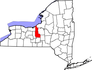 | |
| Towns | ||
| Villages | ||
| CDP | ||
| Other hamlets | ||
| Footnotes | ‡This populated place also has portions in an adjacent county or counties | |