Ustka
| Ustka | |||
|---|---|---|---|
|
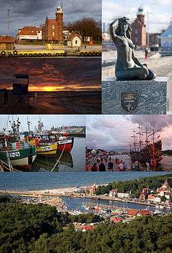
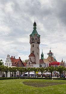
Collage of views of Ustka: lighthouse, beach in Ustka, mermaid , boats in the port, the entrance to the port, the port in Ustka bird's eye view | |||
| |||
 Ustka | |||
| Coordinates: 54°35′N 16°51′E / 54.583°N 16.850°E | |||
| Country |
| ||
| Voivodeship | Pomeranian | ||
| County | Słupsk | ||
| Gmina | Ustka (urban gmina) | ||
| Established | thirteenth century | ||
| Town rights | 1935 | ||
| Government | |||
| • Mayor | Jacek Graczyk | ||
| Area | |||
| • Total | 10.14 km2 (3.92 sq mi) | ||
| Elevation | 3 m (10 ft) | ||
| Population (2006) | |||
| • Total | 16,227 | ||
| • Density | 1,600/km2 (4,100/sq mi) | ||
| Time zone | CET (UTC+1) | ||
| • Summer (DST) | CEST (UTC+2) | ||
| Postal code | 76-270 | ||
| Area code(s) | +48 59 | ||
| Car plates | GSL | ||
| Website | http://www.ustka.pl | ||


Ustka [ˈustka] (German: Stolpmünde; Kashubian Ùskô) is a town in the Middle Pomerania region of northwestern Poland with 17,100 inhabitants (2001). It is also part of Słupsk County in Pomeranian Voivodeship since 1999, and was previously in Słupsk Voivodeship (1975–1998).
History
The first settlers arrived at Ustka as early as the 9th century, and established a fishing settlement with the original name of Ujść.[1][2][3]
The area at the mouth of the river Słupia (Stolpe) was ceded to the town of Słupsk (Stolp) in 1337 with the purpose of building a fishing harbour and a commercial port there to the Baltic Sea. According to documents in 1355 a church was built. In 1382 the city of Stolp (Słupsk) became a member of the Hanseatic League.
The town was given to Brandenburg-Prussia as part of the Duchy of Pomerania after the Treaty of Westphalia in 1648. On August 1, 1778, a blaze destroyed 18 houses which, however, were soon re-built. The first railway station was opened in 1878. The rails were transported by the sea and the bedding for the track was formed by sand taken from the dunes on the Western Beach. The first passenger train departed Ustka (then Stolpmünde) on 1 October 1878. The rail was also used as a main transport facilitating the trade from the harbour. The rail track was extended to run into the harbour, trading mostly grain and spirits. Records state that in 1887, the local harbour shipped 5 million litres of plain spirits. The Harbour lost its importance after the World War II, fishing taking priority over trade. The current shape of the harbour is a result of an investment between 1899 and 1903 creating the largest port between Szczecin (Stettin) and Gdańsk (Danzig).
The creation of the territory known as Polish Corridor at the end of World War I separated the German exclave of East Prussia from the German Province of Pomerania. As a result, the German Ministry for Transport established a ferry connection to East Prussia ("Sea Service East Prussia" or Seedienst Ostpreußen) in 1922, independent of the transit through Poland. These ships also harboured in Stolpmünde (Ustka). Because of the increasing traffic it was planned for the harbour to be enlarged and modernized. The gigantic new development kicked off at the beginning of 1938. A third pier was started as docking station for the largest vessels. The construction of the new port was halted on 23 September 1939 after the German Invasion of Poland.
The old part of the town has retained its layout since the Middle Ages. The small residential buildings were modernised in the thirties of the 19th century, however the layout of the streets was not changed. Since 2005, Ustka's authorities and the European Union embarked on the Revitilisation Programme for Old Ustka. Many buildings have and are being restored.
Monuments in the town include a lighthouse from 1871 [4] (rebuilt to include the octagonal tower in 1892), Main Post Office from 1875 and church from 1882. The first historic records mention the village of Ujść or Ujście of Pomerania in 1310. As part of the Holy Roman Empire it was ruled by Dukes of Pomerania. Stolpmünde (Ustka), became part of the Kingdom of Prussia, then the German Empire until 1945 (Weimar Republic and finally, Nazi Germany).
On August 1, 1945, the city became part of Poland with the agreement at the Potsdam Conference. The native German populace was expelled and replaced with Poles.
After World War II, Ustka took steps to determine an official name. Ujść, Uszcz, and Ustka were all posted on the main railway station in 1945; Nowy Słupsk was the name on the sign at the main Post Office; Postomino was the town's name at the town hall; and Słupioujście was posted at the Harbour Master's office [note 1]. The final name, Ustka, was decided upon in the late 1940s.
Tourism
Ustka is a popular tourist destination and a fishing port on the south coasts of the Baltic. For a number of years, following the political changes in Poland, the town has won a string of local awards for the best summer place in the country. After the collapse of the Ustka Shipyard, the only shipyard in Poland to have manufactured fire-proof lifeboats, and a number of fish processing enterprises, the local authorities put tourism as a primary source of income for the town. Since the end of the 19th century, Ustka has been recognised as a summer holiday resort and various illnesses treatment and recovery centre.

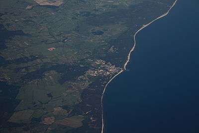
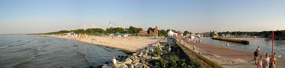
There are two beaches in Ustka. The Eastern Beach and the Western Beach, divided by the river Słupia. Since the eastern part of the town contains the centre, the Eastern Beach is more popular than the Western Beach. The Western Beach runs into the territory of the Navy Training Centre (CSSMW, Centrum Szkolenia Specjalistów Marynarki Wojennej), access to which was restricted beyond a certain point in the west. However, much more popular, developed and facilitated with numerous bars, restaurants, a concert hall, and a waterfront promenade (built in 1875), the Eastern Beach is more prone to "abrasia" (the erosion of the sea). The maintenance of the beach, which after the winter storm season becomes very narrow, is one the considerable expenses of Ustka authorities. The Eastern Beach is signified by high sand cliffs. The Western Beach is flat.
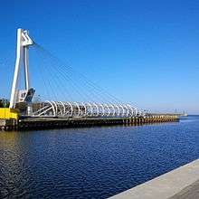
There is a new (built in 2013), swing pedestrian bridge over the river Slupia - open for 15 minutes every hour, that links both beaches every day. Road-rail bridge in Ustka is located outside the centre, in the western part of the town - close to the main railway station.
Near Ustka is a military exercise area from which Meteor-type sounding rockets were launched in the late 1960s and early 1970s.
Ustka is also a host of the annual International Contest of Fireworks, which takes place in the middle of July.
Demographics
Before the end of World War II most inhabitants of the town were Protestants. Since the war the population is composed predominantly of Roman Catholics.
| Year | Inhabitants |
|---|---|
| 1905 | 2,374 |
| 1933 | 4,014 |
| 1939 | 4,739 |
| 1960 | 6,100 |
| 1970 | 9,000 |
| 1975 | 12,400 |
| 1980 | 15,200 |
| 2001 | 17,100 |
International relations
Twin towns — Sister cities
Ustka is twinned with the following cities:
 Bielsko-Biała in Poland [5]
 Enkhuizen in Netherlands
 Kappeln in Germany
- Słupsk in Poland
Notes
- ↑ One more name, Ujście, is associated with the town, but the contributor who added it did not say where Ujście was posted, if it was.
References
- Notes
- ↑ Alicja Deck-Partyka, Poland, a Unique Country & Its People, Authorhouse - 2006, p. 135. Accessed 2008-29-04.
- ↑ Zofia Uszyńska, Poland, Travel Guide. Published by Agpol, 1960. Page 43. Accessed 2008-05-05.
- ↑ The book about today's Polish Baltic Sea Coast (Die Polnische Ostseeküste) describes the current town of Ustka and its location at the mouth of the river, Ujscie = Mündung Ujscie = Muendung,(at mouth of River) = mouth of river (water flow). Ujsc In Polish language means escape (such as a river) and the connection to water is reflected in other European languages such as uisce, usque (see Whisky) and the River Usk and others.
- ↑ Lighthouse at Stolpmünde built in 1871
- ↑ "Bielsko-Biała - Partner Cities". © 2008 Urzędu Miejskiego w Bielsku-Białej. Retrieved 2008-12-10.
External links
| Wikimedia Commons has media related to Ustka. |
![]() Media related to Historia Ustki at Wikimedia Commons
Media related to Historia Ustki at Wikimedia Commons
![]() Media related to Dziedzictwo Kultury at Wikimedia Commons
Media related to Dziedzictwo Kultury at Wikimedia Commons
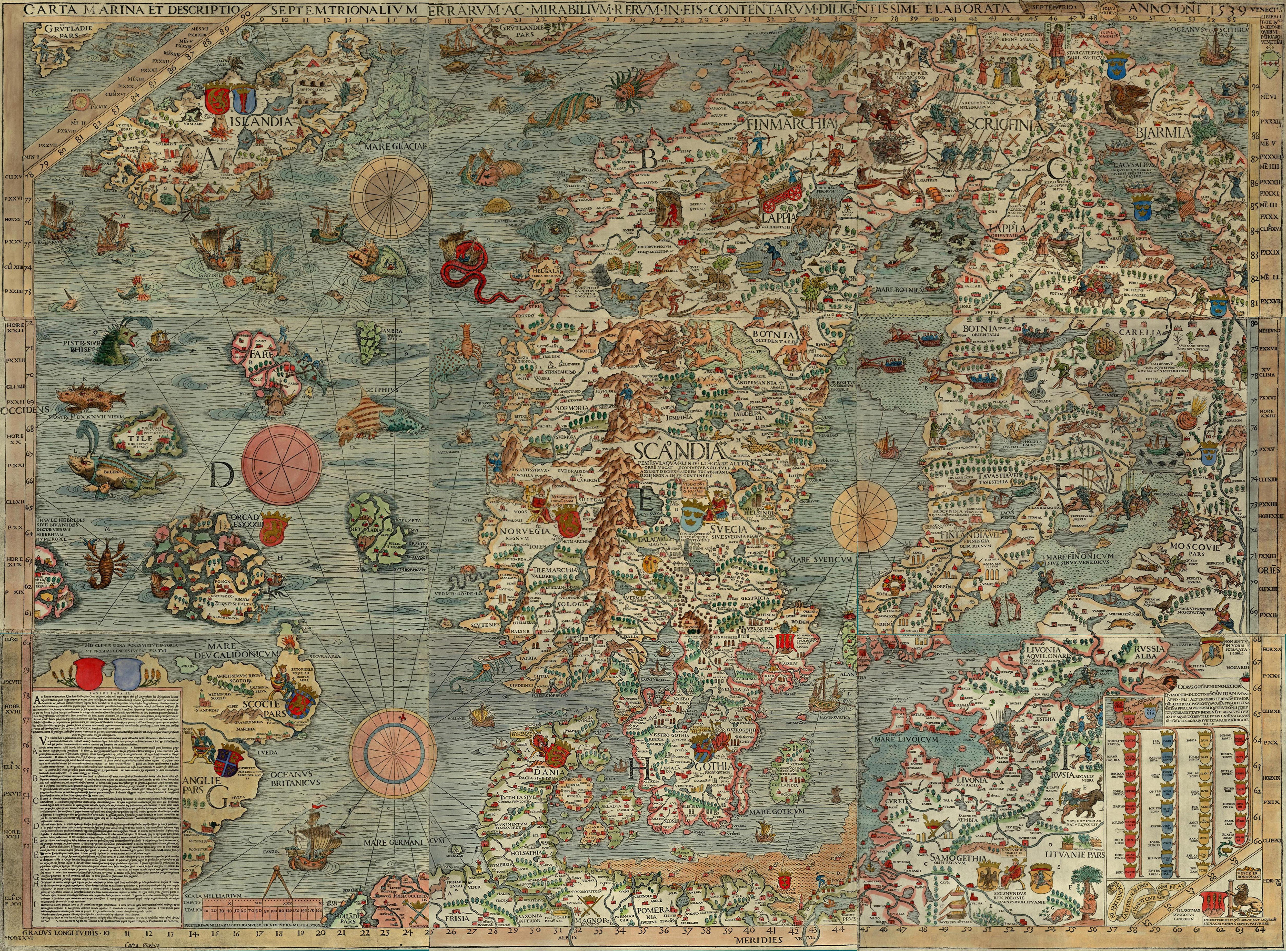
- Stolp in 1539 on Carta Marina by Olaus Magnus
- Stolpmünde on 1709 map
- Ustka website (Polish)
- China Daily article about mermaid statue of Ustka
- Ustka Old Town
- Stolpmünde: History until 1945 (German)
Coordinates: 54°35′N 16°51′E / 54.583°N 16.850°E
Seat (not part of the county): Słupsk | ||
| Urban gmina |  | |
| Urban-rural gmina | ||
| Rural gminas | ||
