Verdun, South Australia
| Verdun South Australia | |
|---|---|
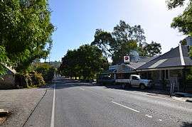 Onkaparinga Valley Road at Verdun | |
 Verdun | |
| Coordinates | 35°00′0″S 138°47′0″E / 35.00000°S 138.78333°ECoordinates: 35°00′0″S 138°47′0″E / 35.00000°S 138.78333°E |
| Population | 662 (2011 census)[1] |
| Postcode(s) | 5245 |
| LGA(s) | Adelaide Hills Council |
| State electorate(s) | Kavel |
| Federal Division(s) | Mayo |
Verdun is a small town in the Adelaide Hills, Australia, on the road from Hahndorf to Balhannah. At the 2011 Australian Census the town recorded a population of 662.[1]
Verdun is approximately 4 km from Hahndorf and 5 km from Bridgewater. There is one school, one pub and a general store.
Verdun originally had the German name Grunthal,[2] after being named by the Prussian settlers who established the town. The town was renamed in 1917 after one of the bloodiest battles of the First World War, the Battle of Verdun.
The Hills Christian Community School opened in February 1983 at the site of the former Verdun Primary School.[3]
See also
References
- 1 2 Australian Bureau of Statistics (31 October 2012). "Verdun (State Suburb)". 2011 Census QuickStats. Retrieved 7 July 2013.
- ↑ "Changing Of German Place Names In Australia". Year Book Australia, 1926. Australian Bureau of Statistics. Retrieved 7 July 2013.
- ↑ "About HCCS". The Hills Christian Community School. Retrieved 7 July 2013.
This article is issued from Wikipedia - version of the 10/27/2016. The text is available under the Creative Commons Attribution/Share Alike but additional terms may apply for the media files.