Villa de Cos
| Villa de Cos Municipality | |
|---|---|
| Municipality | |
|
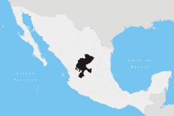
Villa de Cos Municipality Location in Mexico | |
| Coordinates: 23°17′42″N 102°20′24″W / 23.29500°N 102.34000°WCoordinates: 23°17′42″N 102°20′24″W / 23.29500°N 102.34000°W | |
| Country |
|
| State | Zacatecas |
| Area | |
| • Total | 6,405 km2 (2,473 sq mi) |
| Population (2010) | |
| • Total | 34,328 |
Villa de Cos Municipality is one of 58 municipalities of Zacatecas, Mexico. It is located in the center-east of the state, bordered by the municipalities of Mazapil, Francisco R. Murguia, Felipe Pescador, Fresnillo, Panuco, Guadalupe and Santo Domingo in the neighboring state of San Luis Potosí. It has an area of 6,405 km² occupying 8.53% of state territory. The municipal seat is located in the town of the same name. According to figures from INEGI, in 2010 it had a population of 34.328 inhabitants. Its main economic activity is picking chile and feedlot.
References
Zacatecas (capital) | ||
| Municipalities and (municipal seats) |
|  |
This article is issued from Wikipedia - version of the 7/27/2015. The text is available under the Creative Commons Attribution/Share Alike but additional terms may apply for the media files.