Wabash Township, Adams County, Indiana
| Wabash Township | |
|---|---|
| Township | |
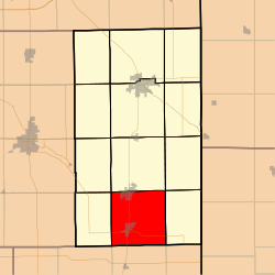 Location in Adams County | |
| Coordinates: 40°36′52″N 84°56′15″W / 40.61444°N 84.93750°WCoordinates: 40°36′52″N 84°56′15″W / 40.61444°N 84.93750°W | |
| Country | United States |
| State | Indiana |
| County | Adams |
| Government | |
| • Type | Indiana township |
| Area | |
| • Total | 36.57 sq mi (94.7 km2) |
| • Land | 36.13 sq mi (93.6 km2) |
| • Water | 0.44 sq mi (1.1 km2) 1.20% |
| Elevation | 823 ft (251 m) |
| Population (2010) | |
| • Total | 6,223 |
| • Density | 172.2/sq mi (66.5/km2) |
| ZIP codes | 46711, 46740, 47326 |
| GNIS feature ID | 0453962 |
Wabash Township is one of twelve townships in Adams County, Indiana, United States. As of the 2010 census, its population was 6,223.[1]
Geography
According to the 2010 census, the township has a total area of 36.57 square miles (94.7 km2), of which 36.13 square miles (93.6 km2) (or 98.80%) is land and 0.44 square miles (1.1 km2) (or 1.20%) is water.[1]
Cities, towns, villages
Unincorporated towns
Adjacent townships
- Monroe Township (north)
- Blue Creek Township (northeast)
- Jefferson Township (east)
- Bearcreek Township, Jay County (south)
- Jackson Township, Jay County (southwest)
- Hartford Township (west)
- French Township (northwest)
Cemeteries
The township contains these cemeteries: Bunker Hill Amish, Bunker Hill (Baker Family), Collins (Ceylon), Crawford (also known as Rawley or Prairie Burying), Cross/Kross Reformed (Hoffstetter), MRE (Mennonite Reformed Evangelical), Nussbaum Family (no longer exists), Riverside, Snow, Studebaker, and Westlawn (Pyle).
Major highways
Rivers
Lakes
- Rainbow Lake
Landmarks
- Lehman Park
School districts
- South Adams Schools
Political districts
- Indiana's 6th congressional district
- State House District 79
- State Senate District 19
References
- "Wabash Township, Adams County, Indiana". Geographic Names Information System. United States Geological Survey. Retrieved 2009-09-24.
- United States Census Bureau 2007 TIGER/Line Shapefiles
- United States National Atlas
- 1 2 "Geographic Identifiers: 2010 Demographic Profile Data (G001): Wabash township, Adams County, Indiana". U.S. Census Bureau, American Factfinder. Retrieved May 8, 2013.
External links
Municipalities and communities of Adams County, Indiana, United States | ||
|---|---|---|
| Cities | ||
| Towns | ||
| Townships | ||
| Unincorporated communities |
| |
This article is issued from Wikipedia - version of the 1/3/2014. The text is available under the Creative Commons Attribution/Share Alike but additional terms may apply for the media files.