Wade Hampton, South Carolina
| Wade Hampton, South Carolina | |
|---|---|
| CDP | |
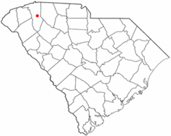 Location of Wade Hampton, South Carolina | |
| Coordinates: 34°52′59″N 82°20′0″W / 34.88306°N 82.33333°WCoordinates: 34°52′59″N 82°20′0″W / 34.88306°N 82.33333°W | |
| Country | United States |
| State | South Carolina |
| County | Greenville |
| Area | |
| • Total | 8.8 sq mi (22.9 km2) |
| • Land | 8.8 sq mi (22.7 km2) |
| • Water | 0.0 sq mi (0.1 km2) |
| Elevation | 1,030 ft (314 m) |
| Population (2000) | |
| • Total | 20,458 |
| • Density | 2,331.4/sq mi (900.2/km2) |
| Time zone | Eastern (EST) (UTC-5) |
| • Summer (DST) | EDT (UTC-4) |
| FIPS code | 45-73870[1] |
| GNIS feature ID | 1245371[2] |
Wade Hampton is a census-designated place (CDP) in Greenville County, South Carolina, United States. The population was 20,458 at the 2000 census. It is named for American Civil War general and South Carolina governor Wade Hampton.
Wade Hampton is part of the Greenville–Mauldin–Easley Metropolitan Statistical Area.
Geography
Wade Hampton is located at 34°52′59″N 82°20′0″W / 34.88306°N 82.33333°W (34.883084, -82.333227).[3]
According to the United States Census Bureau, the CDP has a total area of 8.8 square miles (22.8 km²), of which 8.8 square miles (22.7 km²) is land and 0.1 square mile (0.1 km²) (0.57%) is water.
Demographics
As of the census[1] of 2000, there were 20,458 people, 9,210 households, and 5,645 families residing in the CDP. The population density was 2,331.4 people per square mile (900.7/km²). There were 9,793 housing units at an average density of 1,116.0 per square mile (431.1/km²). The racial makeup of the CDP was 84.85% White, 8.08% African American, 0.18% Native American, 3.34% Asian, 0.06% Pacific Islander, 2.39% from other races, and 1.11% from two or more races. Hispanic or Latino of any race were 6.13% of the population.
There were 9,210 households out of which 22.9% had children under the age of 18 living with them, 49.4% were married couples living together, 9.0% had a female householder with no husband present, and 38.7% were non-families. 32.7% of all households were made up of individuals and 10.8% had someone living alone who was 65 years of age or older. The average household size was 2.21 and the average family size was 2.81.
In the CDP the population was spread out with 19.0% under the age of 18, 9.6% from 18 to 24, 28.9% from 25 to 44, 24.3% from 45 to 64, and 18.2% who were 65 years of age or older. The median age was 40 years. For every 100 females there were 93.8 males. For every 100 females age 18 and over, there were 90.9 males.
The median income for a household in the CDP was $40,487, and the median income for a family was $54,106. Males had a median income of $40,528 versus $27,613 for females. The per capita income for the CDP was $26,376. About 6.4% of families and 9.0% of the population were below the poverty line, including 10.9% of those under age 18 and 5.3% of those age 65 or over.
Education
The French Bilingual School of South Carolina is located in Wade Hampton.[4][5]
The Greenville Saturday School (グリーンビル日本語補習授業校 Gurīnbiru Nihongo Hoshū Jugyō Kō), a Japanese Saturday supplementary school, holds its classes at the French Bilingual School.[6]
References
- 1 2 "American FactFinder". United States Census Bureau. Retrieved 2008-01-31.
- ↑ "US Board on Geographic Names". United States Geological Survey. 2007-10-25. Retrieved 2008-01-31.
- ↑ "US Gazetteer files: 2010, 2000, and 1990". United States Census Bureau. 2011-02-12. Retrieved 2011-04-23.
- ↑ "FRENCH BILINGUAL SCHOOL OF SOUTH CAROLINA" (Archive) Association of French Schools in America. Retrieved on May 11, 2014. "Address: 2 Fisher road City: Greenville, SC State/Province: SC, 29615"
- ↑ "2010 CENSUS - CENSUS BLOCK MAP: Wade Hampton CDP, SC" (Archive). U.S. Census Bureau. Retrieved on May 11, 2014.
- ↑ "GSSへのDirection" (Archive). Greenville Saturday School. Retrieved on May 11, 2014.
Municipalities and communities of Greenville County, South Carolina, United States | ||
|---|---|---|
| Cities | 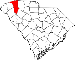 | |
| CDPs | ||
| Unincorporated communities | ||
| Footnotes | ‡This populated place also has portions in an adjacent county or counties | |