Greenville County, South Carolina
| Greenville County, South Carolina | |
|---|---|
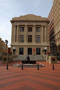 Former Greenville County Courthouse (now a bookstore and office space) | |
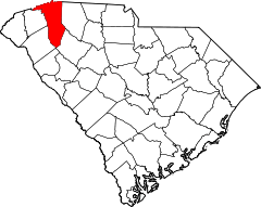 Location in the U.S. state of South Carolina | |
 South Carolina's location in the U.S. | |
| Founded | March 22, 1786 |
| Seat | Greenville |
| Largest city | Greenville |
| Area | |
| • Total | 795 sq mi (2,059 km2) |
| • Land | 785 sq mi (2,033 km2) |
| • Water | 9.7 sq mi (25 km2), 1.2% |
| Population (est.) | |
| • (2015) | 491,863 |
| • Density | 615/sq mi (237/km²) |
| Congressional district | 4th |
| Time zone | Eastern: UTC-5/-4 |
| Website |
www |
Greenville County is a county located in the state of South Carolina, in the United States. As of the 2010 census, the population was 451,225,[1] making it the most populous county in the state. Its county seat is Greenville.[2] The county is also home to the Greenville County School District, the largest school system in South Carolina. County government is headquartered at Greenville County Square.
Greenville County is included in the Greenville-Anderson-Mauldin, SC Metropolitan Statistical Area.
Geography
According to the U.S. Census Bureau, the county has a total area of 795 square miles (2,060 km2), of which 785 square miles (2,030 km2) is land and 9.7 square miles (25 km2) (1.2%) is water.[3]
Adjacent counties
- Henderson County, North Carolina - north
- Polk County, North Carolina - northeast
- Spartanburg County - east
- Laurens County - southeast
- Abbeville County - south
- Anderson County - southwest
- Pickens County - west
- Transylvania County, North Carolina - northwest
Demographics
| Historical population | |||
|---|---|---|---|
| Census | Pop. | %± | |
| 1790 | 6,503 | — | |
| 1800 | 11,504 | 76.9% | |
| 1810 | 13,133 | 14.2% | |
| 1820 | 14,530 | 10.6% | |
| 1830 | 16,476 | 13.4% | |
| 1840 | 17,839 | 8.3% | |
| 1850 | 20,156 | 13.0% | |
| 1860 | 21,892 | 8.6% | |
| 1870 | 22,262 | 1.7% | |
| 1880 | 37,496 | 68.4% | |
| 1890 | 44,310 | 18.2% | |
| 1900 | 53,490 | 20.7% | |
| 1910 | 68,377 | 27.8% | |
| 1920 | 88,498 | 29.4% | |
| 1930 | 117,009 | 32.2% | |
| 1940 | 136,580 | 16.7% | |
| 1950 | 168,152 | 23.1% | |
| 1960 | 209,776 | 24.8% | |
| 1970 | 240,546 | 14.7% | |
| 1980 | 287,913 | 19.7% | |
| 1990 | 320,167 | 11.2% | |
| 2000 | 379,616 | 18.6% | |
| 2010 | 451,225 | 18.9% | |
| Est. 2015 | 491,863 | [4] | 9.0% |
| U.S. Decennial Census[5] 1790-1960[6] 1900-1990[7] 1990-2000[8] 2010-2015[9] | |||
As of the 2010 United States Census, there were 451,225 people, 176,531 households, and 119,362 families residing in the county.[10] The population density was 574.7 inhabitants per square mile (221.9/km2). There were 195,462 housing units at an average density of 249.0 per square mile (96.1/km2).[11] The racial makeup of the county was 73.8% white, 18.1% black or African American, 2.0% Asian, 0.3% American Indian, 0.1% Pacific islander, 3.9% from other races, and 1.9% from two or more races. Those of Hispanic or Latino origin made up 8.1% of the population.[10] In terms of ancestry, 13.0% were American, 11.6% were German, 10.9% were English, and 10.7% were Irish.[12]
Of the 176,531 households, 33.7% had children under the age of 18 living with them, 49.7% were married couples living together, 13.5% had a female householder with no husband present, 32.4% were non-families, and 27.0% of all households were made up of individuals. The average household size was 2.49 and the average family size was 3.03. The median age was 37.2 years.[10]
The median income for a household in the county was $46,830 and the median income for a family was $59,043. Males had a median income of $45,752 versus $33,429 for females. The per capita income for the county was $25,931. About 10.8% of families and 14.1% of the population were below the poverty line, including 20.0% of those under age 18 and 9.1% of those age 65 or over.[13]
| Racial composition | 2010 | 2015 |
|---|---|---|
| White | 73.8% | 76.8% |
| Black | 18.1% | 18.5% |
| Asian | 2.0% | 2.2% |
| Native American | 0.3% | 0.5% |
| Native Hawaiian and other Pacific Islander | 0.1% | 0.1% |
| Two or more races | 1.9% | 1.8% |
| Other | 3.8% | 0.1% |
Economy
CommunityWorks Federal Credit Union was chartered in 2014 to serve the residents of Greenville County. It is sponsored by CommunityWorks, Inc., a non-profit community development financial institution, and receives assistance from the United Way of Greenville County and the Hollingsworth Fund.[15]
Communities
The 2010 Census lists six cities and 16 census designated places that are fully or partially within Greenville County.[16]
Cities
- Fountain Inn (partly in Laurens County)
- Greenville
- Greer (partly in Spartanburg County)
- Mauldin
- Simpsonville
- Travelers Rest
Census-designated places
Unincorporated communities
See also
References
- ↑ "State & County QuickFacts". United States Census Bureau. Retrieved March 17, 2015.
- ↑ "Find a County". National Association of Counties. Retrieved 2011-06-07.
- ↑ "2010 Census Gazetteer Files". United States Census Bureau. August 22, 2012. Retrieved March 17, 2015.
- ↑ "County Totals Dataset: Population, Population Change and Estimated Components of Population Change: April 1, 2010 to July 1, 2015". Retrieved July 2, 2016.
- ↑ "U.S. Decennial Census". United States Census Bureau. Retrieved March 17, 2015.
- ↑ "Historical Census Browser". University of Virginia Library. Retrieved March 17, 2015.
- ↑ Forstall, Richard L., ed. (March 27, 1995). "Population of Counties by Decennial Census: 1900 to 1990". United States Census Bureau. Retrieved March 17, 2015.
- ↑ "Census 2000 PHC-T-4. Ranking Tables for Counties: 1990 and 2000" (PDF). United States Census Bureau. April 2, 2001. Retrieved March 17, 2015.
- ↑ "Greenville County, South Carolina". US Census. US Census. Retrieved April 15, 2015.
- 1 2 3 "DP-1 Profile of General Population and Housing Characteristics: 2010 Demographic Profile Data". United States Census Bureau. Retrieved 2016-03-09.
- ↑ "Population, Housing Units, Area, and Density: 2010 - County". United States Census Bureau. Retrieved 2016-03-09.
- ↑ "DP02 SELECTED SOCIAL CHARACTERISTICS IN THE UNITED STATES – 2006-2010 American Community Survey 5-Year Estimates". United States Census Bureau. Retrieved 2016-03-09.
- ↑ "DP03 SELECTED ECONOMIC CHARACTERISTICS – 2006-2010 American Community Survey 5-Year Estimates". United States Census Bureau. Retrieved 2016-03-09.
- ↑ "Greenville County, South Carolina". Census Bureau. Census Bureau. Retrieved October 2, 2016.
- ↑ Birch, Ray (April 3, 2014). "CommunityWorks FCU Is First New CU Charter Of The Year". Credit Union Journal. Retrieved 3 April 2014.
- ↑ See http://factfinder2.census.gov for population numbers and for municipality and CDP lists in the 2010 Census.
External links
| Wikimedia Commons has media related to Greenville County, South Carolina. |
- Greenville Area Development Corporation (GADC)
-
 Geographic data related to Greenville County, South Carolina at OpenStreetMap

Municipalities and communities of Greenville County, South Carolina, United States | ||
|---|---|---|
| Cities | | |
| CDPs | ||
| Unincorporated communities | ||
| Footnotes | ‡This populated place also has portions in an adjacent county or counties | |
Columbia (capital) | |
| Regions | |
| Larger cities | |
| Smaller cities |
|
| Towns |
|
| CDPs | |
| Counties |
|
| Topics |
|
| Society | |
Coordinates: 34°53′N 82°22′W / 34.89°N 82.37°W