Walkinstown
| Walkinstown Baile Bhailcín | |
|---|---|
| Suburb of Dublin | |
|
The Walkinstown roundabout, leading into Walkinstown town | |
 Walkinstown Location in Ireland | |
| Coordinates: 53°19′32″N 6°20′35″W / 53.3256°N 6.34301°WCoordinates: 53°19′32″N 6°20′35″W / 53.3256°N 6.34301°W | |
| Country | Ireland |
| Province | Leinster |
| County | Dublin |
| Council | South Dublin County Council |
| Dáil Éireann | Dublin South-Central |
| European Parliament | Dublin |
| Population (2006) | |
| • Urban | 5,910 |
| Time zone | WET (UTC+0) |
| • Summer (DST) | IST (WEST) (UTC-1) |

Walkinstown (Irish: Baile Bhailcín) is a suburb of Dublin, Ireland, situated on the Southside of the city, approximately 6 kilometres south-west of Dublin city centre. The suburb borders Crumlin to the east, Drimnagh to the north, Greenhills to the south and Ballymount, Bluebell and Clondalkin to the west. Its postal code is Dublin 12.
Walkinstown is a working class/lower middle class suburb consisting primarily of privately owned residential housing with some social housing remaining in the Dublin City Council area between the Walkinstown and Longmile Roads and Ballymount Lower. It was built as an estate of starter homes after World War 2 with the council housing being developed as social rented homes later in the early to mid fifties.
Light industry, warehousing, car dealerships and commercial outlet stores are concentrated along the Long Mile Road in the western sector of the suburb. The Central Statistics Office census of 2006 recorded a populated of 5910[1] for the area. The area is very well served with a library, residents' association, sports ground, community centre, schools, pubs, church and retail facilities.
Name and History
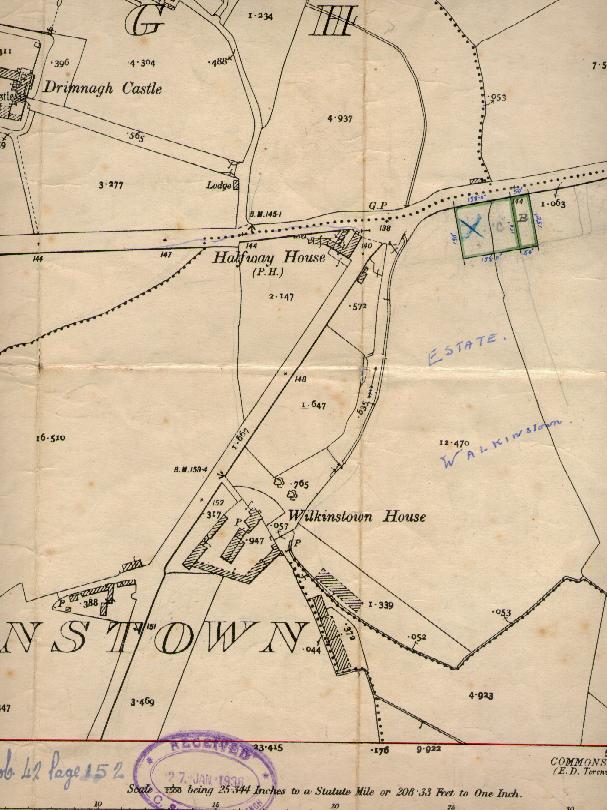
The name of the area is a corruption of Wilkinstown - named after Wilkins, a tenant farmer who lived in the area in the 15th century.The irish name for the area is 'Baile Bhailcín'.
Walkinstown as a suburb is a 20th-century creation. The area was a dairy farm until house building began in the 1930s. Building ended in the area in the 1970s when most of the available land was built upon. The 1950s saw the building of the local Catholic church as well as primary and second schools for boys and girl.
Location and extent
There is some ambiguity as to the full extent of the suburb, with some claiming Walkinstown includes Greenhills, as well as one of three parts of Ballymount.
Greenhills was previously linked to Walkinstown in the Catholic Church structure to make up the Parish of Walkinstown and Greenhills, at a time when Greenhills did not have its own local church. This combined parish ceased to exist when Greenhills acquired its own parish church in 1971. Greenhills is generally regarded now as a separate and distinct suburb, with its own identity and full range of services.
The distinction between Ballymount and Walkinstown is not so well defined. Given that Ballymount has a less clear identity, many consider it to form part of Walkinstown. The area itself is primarily given over to light industry with much less residential housing than its nearest neighbour, Walkinstown. Most residential housing which exists directly borders on the Ballymount Road which itself is often listed as Walkinstown. Residents of Ballymount do not have their own services and so rely on Walkinstown for schools, church and commercial centres.
Amenities
There is a branch of Dublin City Public Libraries and Archive - the Walkinstown Public Library - on Percy French Road. The local An Post post office is in SuperValu on the Walkinstown Road. The local branch of the Irish League of Credit Unions, Walkinstown Credit Union, is located on Walkinstown Green.
The local Catholic Church, Our Lady of the Assumption, is one of the largest buildings in the suburb and is situated on Kilnamanagh Road, near the Long Mile Road. It forms part of a major concentration of religious and educational services, with a girls school (Our Lady of the Assumption) adjacent to the Church, whilst a boys school, Drimnagh Castle CBS, is situated opposite the girls school on the other side of the Long Mile Road. Both theses schools provide primary and secondary education.
Walkinstown Park is a Dublin City Council run park, on the Walkinstown Avenue oppisite Lidl. The park has three football pitches and two GAA pitches. It also has a tennis court and a stream that runs at the rear of the park.
The premises of the Walkinstown Association, which provides services to people with intellectual disabilities, is situated on the Long Mile Road, adjacent to the Halfway House public house.
The 94th Dublin Scout Den is situated on Bunting Road.
Walkinstown is served by six "and a half" pubs, located in two hubs. The first hub is located at the intersection of the Drimnagh, Walkinstown and Long Mile roads, while the second is situated at the Walkinstown Roundabout. The six pubs are:
- (1) the Halfway House, located on a triangular site bordered by the Walkinstown and Long Mile Roads, with (2) the Long Mile Inn directly across the road
- (3) The Black Forge and (4) The Eleanora are located a short distance away on the Drimnagh Road
- (5) the Cherrytree and (6) the Kestrel House are located on opposite sides of the Walkinstown Roundabout
The "half a pub" refers to The Submarine Bar, which although almost entirely located in Crumlin has its main entrance on Cromwellsfort Road in Walkinstown.
There is no local Garda station. The area is served equally by neighbouring Crumlin's two Garda stations - the Crumlin Village and Sundrive Road stations. The three hospitals which primarily serve the local community are Tallaght Hospital, Our Lady's Children's Hospital, Crumlin and St. James' Hospital.
Shopping
SuperValu on the Walkinstown Road. The Ashleaf Shopping Centre, located on Cromwellsfort Road, is the nearest shopping centre and has as anchor tenant Dunnes Stores, providing both supermarket and clothing retail services. Lidl is located on Walkinstown Avenue opposite Walkinstown Park. Aldi is located on the Long Mile Road.
Small commercial enterprises such as newsagents, pharmacies and fast food outlets as well as local branches of the major banks are concentrated in a similar fashion to the area's pubs, at the intersection of the Drimnagh, Walkinstown and Long Mile roads as well as around the Walkinstown Roundabout. There is also a Subway {fast food outlet}, Eddie Rockets and a Polish food store located at the rear of LIDL on Walkinstown Avenue. Walkinstown Medical Centre is on the corner of Thomas Moore Road with Prestige Properties Auctioneers next door.
Walkinstown Mall is located across from SuperValu on the Walkinstown Road. Located at the Mall is a Chinese take away, Papa Johns, Super Macs, a Funeral Home, Barber/Hairdresser, Eastern European food store, Employment Agency and a beauty parlour. Walkinstown Roundabout is one of the busiest in the city. Its construction was held up for many years due to protracted negotiations to purchase a small white washed cottage on the then Walkinstown Cross (scene of many bad motor crashes). The resident was eventually rehoused in a new bungalow at the top of Walkinstown Avenue. This cottage was formally in the centre of the new roundabout.
Local landmarks
There are a few local historic landmarks within the area of Walkinstown. One of the oldest buildings in the immediate vicinity is Drimnagh Castle, located on the northern side of the Long Mile Road. This castle dates from 1216 and is the only castle in Ireland with a flooded moat. The Halfway House pub is the oldest public house in the area, predating all of the housing developments that went to make up the suburb.[2] This pub, which used to be a Coachhouse, situated halfway between Dublin and Tallaght, retains the outward appearance of the country pub, although the interior was recently modernised. The most distinctive buildings of the Walkinstown area are that of the local Catholic church and schools, built in a sturdy style of the 1950s with red brick and green copper roofing and impressive stained glass windows, made by local craftsmen.
The layout of the suburb is such that "nests" of smaller roads run off the main roads, usually with green open spaces as focal points. The dominant style of the area is that of a mid-20th century Dublin housing development. One of the key features of the area is the Walkinstown Roundabout, also known as Walkinstown Cross, one of the largest, and most accident-prone roundabouts in the Dublin area. This major junction serves seven major local roads - Walkinstown Road towards Drimnagh, Bunting Road towards Crumlin, Cromwellsfort Road towards Kimmage and Crumlin, and St Peter's Road towards Greenhills and Templeogue, Greenhills Road towards Tallaght, Ballymount Road towards Ballymount and the M50 and Walkinstown Avenue towards Ballyfermot,
An area of Walkinstown north of Cromwellsfort Road is known as the Musical Roads. Roads in this area are named after prominent figures of Irish music - examples include the tenor Count John McCormack and composers Michael William Balfe, Percy French and Edward Bunting.
The SuperValu supermarket on Walkinstown Road was once the site of Walkinstown House, a distinctive country house and the family home of the Flanagan family, including the infamous "The Bird Flanagan", a well-known Dublin character and infamous practical joker of the early 20th century. It is said that The Long Mile Road was named after a mile long horse race along this route won by the Bird Flanagan. However it was later argued that it was a long mile.[3]
Administration
Walkinstown is in the extreme south-west of the Dublin City Council area and in local government elections is part of the Ballyfermot-Drimnagh Ward. Since the last local elections in 2014, the local elected representatives on Dublin City Council are:
- Paul Hand (Independent)
- Daithí Doolan (Sinn Féin)
- Vincent Jackson (Independent)
- Greg Kelly (Sinn Féin)
- Bríd Smith (People Before Profit)
- Daithí de Róiste (Fianna Fáil)
Walkinstown is part of the Dublin South-Central Dáil constituency. The elected TD's for the current 32nd Dáil Éireann are:
Sport
The first local GAA club was set up in the 1950s in part to help give the new suburb of Walkinstown an identity, in addition to providing a sports outlet for the newly arrived residents. That club has since morphed, changed name and amalgamated with others to form the current St James' Gaels GAA club which is still charged with the promotion of Gaelic Games in the Walkinstown area.
Walkinstown Athletic FC is the local soccer team. W.S.A.F. - Walkinstown Sports and Athletic Association - meet at Moeran Community Hall on Summerville Drive. Mooney's Field, the local name given to the largest green open space in the Walkinstown area (situated on Bunting Road), is used for many field sports. The nearest municipal swimming pool is located in Crumlin village.
Walkinstown United Football Club is the leading football team based in Walkinstown, Dublin 12. The home ground is Walkinstown Park, which is located in the heart of Walkinstown. Established in 1978, the club has had much success with honours such as league promotion and league cup wins.
Transportation
Walkinstown is well served by Dublin Bus both in terms of number of routes and frequency. The following routes service the suburb:
9, 17, 18, 27, 77A, 56A, 122, 123, 150, 151
Route numbers 18, 27, 77A, 56A, 123 and 151 all pass by, or very near to, the Halfway House pub. The 9, 17 & 150 pass the Ashleaf Shopping Centre/Submarine Bar while the 122 has its terminus at Our Lady's Hospital (Crumlin), approximately 5 minutes walk east of the Halfway House pub. Typical bus journey time to the city centre is 25 minutes, and a little longer than this during peak periods.
The Dublin Bus Nitelink 77N service provides a one-way link from Dublin city centre to Walkinstown until late at night after regular bus services finish at 23:30. This route departs from a bus stop on College Green opposite Doyle's pub in the city centre.
Although the Luas does not serve Walkinstown, the route of the Red Line takes it to within walking distance of the suburb. The nearest stops are Bluebell and Kylemore, approximately 10 minutes north of the intersection of the Walkinstown and Drimnagh roads.
Famous Names
- Dean Delany - Goalkeeper with Shelbourne F.C.
- Eamonn Coughlan - 4-time Olympian
- Kevin Moran - GAA and soccer star
- Eamonn Campbell of The Dubliners lives in Walkinstown
- Gabriel Byrne - Film actor
- Gerry Ryan - Soccer player
See also
List of towns and villages in Ireland
External links
- Walkinstown Association
- Walkinstown United Football Club
- Walkinstown Public Library
- Walkinstown Post Office
- Drimnagh Castle Boys Secondary School
- Assumption Girls National School Walkinstown
- 94th Walkinstown Scouts
- Church of the Assumption (Catholic) Walkinstown
- Walkinstown Social Services Centre
- Dublin City Council
- Citizen's Information Bureau