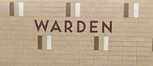
Warden (TTC)
Warden | |||||||||||
|---|---|---|---|---|---|---|---|---|---|---|---|
 | |||||||||||
| Location |
701 Warden Avenue, Toronto, Ontario, Canada | ||||||||||
| Coordinates | 43°42′41″N 79°16′47″W / 43.71139°N 79.27972°WCoordinates: 43°42′41″N 79°16′47″W / 43.71139°N 79.27972°W | ||||||||||
| Platforms | centre platform | ||||||||||
| Tracks | 2 | ||||||||||
| Connections |
| ||||||||||
| Construction | |||||||||||
| Structure type | elevated | ||||||||||
| Parking | 1,071 spaces | ||||||||||
| Disabled access | No | ||||||||||
| History | |||||||||||
| Opened | 10 May 1968 | ||||||||||
| Traffic | |||||||||||
| Passengers (2014[1]) | 32,110 | ||||||||||
| Services | |||||||||||
| |||||||||||
Warden is a station on the Bloor–Danforth line in Toronto, Ontario, Canada. It is located at the southeast corner of St. Clair Avenue East and Warden Avenue.
The main pedestrian street entrance is on the east side of Warden, with another entrance from St. Clair along a walkway on the west side of the elevated tracks. Vehicle entry to the passenger pick up and drop off entrance is on the south side of St. Clair, east of Warden, exiting on to Warden south of St. Clair.
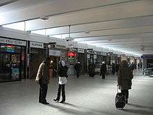
The station is on four levels: the subway platform is on the upper floor, the bus concourse to the connecting routes is below it, the two collector entrances and the concourse are found above street level, and the two entrances and the bus platforms are on the lower floor.
1,071 parking spaces are located at this station for commuter use, with 920 in the North Lot and 151 in the South Lot.
History
Warden Station was opened in 1968 in what was then the Borough of Scarborough, and served as the Bloor-Danforth line's eastern terminus for 12 years until the extension to Kennedy was completed in 1980.
Until 1973, the buses and the subway trains serving the station were in separate fare zones and so the turnstiles and collector booths were placed between the bus bays and the subway platforms. When the zones were abolished, the layout was reconfigured to bring the buses inside the station's fare-paid area; one collector booth, left isolated inside the fare-paid zone, became an information booth.
Subway infrastructure in the vicinity

After exiting the station eastbound towards Kennedy Station, the track returns to an underground tunnel at the Chestnut Portal, where it continues on its diagonal alignment under the former Canadian National Railway (CNR) spur line.
West of the station a small siding and storage shed are on the south side of the above ground tracks, which continue along the track bed of the former CNR line, all the way to Victoria Park Station.
Nearby landmarks
Nearby landmarks include the Providence Healthcare, Warden Woods Park, Warden Hilltop Community Centre and Pine Hills Cemetery. It is near much vacant industrial land (including the former site of Centennial College and Warden Woods Mall/Power Centre) where major redevelopment is expected over the coming years, including numerous new housing developments on the former Power Centre property.[2] It is also near the Toronto District School Board high school W.A. Porter C.I., which brings about 700 students in the station each year.
Surface connections
The layout of the bus terminal is similar to Islington and previously, Victoria Park as its design has its individually separated bus bays.
- Bay 1
- 17A Birchmount to Highway 7 (Extra fare required north of Steeles Avenue)
- 17B to Steeles Avenue via Wintermute Blvd
- 17C to Steeles Avenue
- Bay 2
- 9 Bellamy to Scarborough Centre Station
- Bay 3
- 102A Markham Road to Progress Avenue/Centennial College
- 102B to Steeles Avenue
- 102C to Steeles Avenue via Dynamic Drive
- 102D to Major Mackenzie Drive (Extra fare required north of Steeles Avenue)
- Bay 4
- 16 McCowan to Scarborough Centre Station
- Bay 5
- 69B Warden South to Kingston Road via Birchmount Road
- Bay 6
- 69A Warden South to Kingston Road via Warden Avenue
- 135 Gerrard to Main Street Station
- Bay 7
- 68A Warden to Steeles Avenue
- 68B to Major Mackenzie Drive (Extra fare required north of Steeles Avenue)
- Bay 8
- 70C O'Connor to Coxwell Station
- Bay 9
- Unloading/Vacant
References
- ↑ "Subway ridership, 2014" (PDF). Toronto Transit Commission. Retrieved September 12, 2015.
This table shows the typical number of customer-trips made on each subway on an average weekday and the typical number of customers travelling to and from each station platform on an average weekday.
- ↑ http://www.city.toronto.on.ca/planning/warden-vicpark.htm
External links
![]() Media related to Warden Station at Wikimedia Commons
Media related to Warden Station at Wikimedia Commons