Warriewood, New South Wales
| Warriewood Sydney, New South Wales | |||||||||||||
|---|---|---|---|---|---|---|---|---|---|---|---|---|---|
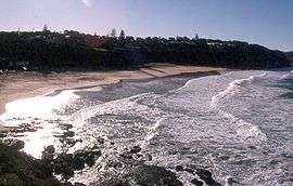 Warriewood Beach | |||||||||||||
|
Warriewood | |||||||||||||
| Coordinates | 33°41′39″S 151°18′03″E / 33.69404°S 151.30093°ECoordinates: 33°41′39″S 151°18′03″E / 33.69404°S 151.30093°E | ||||||||||||
| Population | 4,994 (2006 census)[1] | ||||||||||||
| Postcode(s) | 2102 | ||||||||||||
| Location | 26 km (16 mi) north of Sydney CBD | ||||||||||||
| LGA(s) | Northern Beaches Council | ||||||||||||
| State electorate(s) | Pittwater | ||||||||||||
| Federal Division(s) | Mackellar | ||||||||||||
| |||||||||||||
Warriewood is a suburb in northern Sydney, in the state of New South Wales, Australia. Warriewood is located 26 kilometres north of the Sydney central business district, in the local government area of Northern Beaches Council. Warriewood is part of the Northern Beaches region.
History
Warriewood takes its name from the Warriewood Estate that was subdivided in 1906 by Henry F. Halloran, who had purchased it from the McPherson family.[2] Warriewood is in the federal Division of Mackellar.
Commercial areas
Warriewood features Warriewood Square a medium-sized shopping mall with Kmart, Coles, Woolworths and an Aldi Supermarket (opening 2016). In 2015 there is a redevelopment for Warriewood Square expecting to be completed by 2016. Warriewood also has a cinema complex, a mini putt-putt golf and a swimming beach. Warriewood is also the location of a Catholic high school, Mater Maria Catholic College.
Housing
Warriewood Valley was identified by the NSW State Government as a potential land release area. It was subsequently rezoned to allow intensification of residential dwellings and infrastructure. The rezoning and development of Warriewood valley has also resulted in the cleaning up of the water bodies and wetlands and water management techniques were applies to deal with the flooding.[3]
References
- ↑ Australian Bureau of Statistics, 2006
- ↑ The Book of Sydney Suburbs, Compiled by Frances Pollon, Angus & Robertson Publishers, 1990, Published in Australia ISBN 0-207-14495-8, page 263
- ↑ Pittwater Council: Warriewood Valley
External links
- Virginia Macleod - Mona Vale Library (2008). "Warriewood". Dictionary of Sydney. Retrieved 29 September 2015. [CC-By-SA]