Waterloo, Victoria
| Waterloo Victoria | |
|---|---|
 Waterloo | |
| Coordinates | 37°22′21″S 143°24′52″E / 37.37250°S 143.41444°ECoordinates: 37°22′21″S 143°24′52″E / 37.37250°S 143.41444°E |
| Postcode(s) | 3373 |
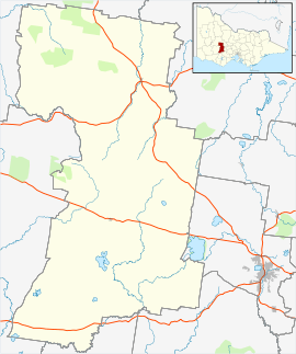
| Location |
|
| LGA(s) | Pyrenees Shire |
| State electorate(s) | Ripon |
| Federal Division(s) | Wannon |
Waterloo is a locality consisting of a collection of farms and houses approximately 9 kilometres (5.6 mi) north of the town of Beaufort, Victoria and 162 kilometres (101 mi) west north west of the state capital of Melbourne.
It was originally settled during the Victorian gold rush as part of the Baxter lead alluvial Gold Mining Precinct, Waterloo Post Office opening on 1 November 1860 and closing in 1965.[1]
The locality is the birthplace of Ernest Chinnery (5 November 1887- 17 December 1972), an Australian anthropologist and public servant who worked extensively in Papua New Guinea and visited communities along the Sepik river.
During World War I many men from Waterloo served in the 57th Battalion, 2nd Reinforcement of the Australian Army.
References
- ↑ Premier Postal History, Post Office List, retrieved 11 April 2008
This article is issued from Wikipedia - version of the 6/2/2015. The text is available under the Creative Commons Attribution/Share Alike but additional terms may apply for the media files.