Wesley Chapel, Florida
| Wesley Chapel | |
|---|---|
| CDP | |
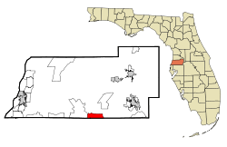 Location in Pasco County and the state of Florida | |
| Coordinates: 28°10′43″N 82°21′2″W / 28.17861°N 82.35056°WCoordinates: 28°10′43″N 82°21′2″W / 28.17861°N 82.35056°W | |
| Country | United States |
| State | Florida |
| County | Pasco |
| Area | |
| • Total | 6.1 sq mi (15.8 km2) |
| • Land | 6.1 sq mi (15.7 km2) |
| • Water | 0 sq mi (0.1 km2) |
| Elevation | 108 ft (33 m) |
| Population (2010) | |
| • Total | 44,092 |
| • Density | 933/sq mi (360.2/km2) |
| Time zone | Eastern (EST) (UTC-5) |
| • Summer (DST) | EDT (UTC-4) |
| ZIP codes | 33543-33544-33545 |
| Area code(s) | 813 |
| FIPS code | 12-75875[1] |
| GNIS feature ID | 0294231[2] |
Wesley Chapel is a census-designated place (CDP) in Pasco County, Florida, United States. Wesley Chapel is considered part of the Tampa Bay Area metro. The population was 44,092 at the 2010 census. In 2003, some residents of Wesley Chapel started a movement to incorporate the community (including areas not in the official CDP). This "city," which would have been the largest and most populous in Pasco County, never materialized.
Geography
Wesley Chapel is located at 28°10′43″N 82°21′2″W / 28.17861°N 82.35056°W (28.178688, -82.350676).[3]
According to the United States Census Bureau, the CDP has a total area of 6.1 square miles (16 km2), of which 6.1 square miles (16 km2) is land and 0.04 square miles (0.10 km2) (0.49%) is water.
Residents choose the area because of its proximity to Interstate 75 and Interstate 275, 25 miles north of Downtown Tampa, and other major locales. Adjacent to its south is the region of New Tampa, part of incorporated Tampa.
Demographics
As of the census[1] of 2010, there were 44,092 people, 15,745 households, and 11,841 families residing in the CDP. There were 17,764 housing units . The racial makeup of the CDP was 74.97% White, 11.39% African American, 0.25% Native American, 5.72% Asian, 0.11% Pacific Islander, 3.97% from other races, and 3.57% from two or more races. Hispanic or Latino of any race were 20.12% of the population.
There were 15,745 households out of which 40.19% had children under the age of 18 living with them, 58.8% were married couples living together, 10.75% had a female householder with no husband present, and 24.8% were non-families. 18.58% of all households were made up of individuals and 3.13% had someone living alone who was 65 years of age or older. The average household size was 2.80 and the average family size was 3.22.
In the CDP the population was spread out with 28.27% under the age of 18, 4.69% from 20 to 24, 32.58% from 25 to 44, 23.36% from 45 to 64, and 8.86% who were 65 years of age or older. The median age was 35.2 years.
Growth
Originally called Double Branch for the area's twin creeks, the community was named for the Methodist chapel that stood on the northwest corner of SR 54 and Boyette Road. A popular nickname for the area was "Gatorville."
Since 2000, Wesley Chapel has grown rapidly. Newcomers from in and out of state have populated new luxury communities such as the Enclave at Wiregrass Apartments, Preserve at Quail Woods by Southern Crafted Homes, Citrus Trace, Saddlewood, Brooksville, Bridgeview, Watergrass, Villages of Wesley Chapel, Seven Oaks, Country Walk, Meadow Pointe, Chapel Pines, Bridgewater, Northwood, Saddlebrook and Lexington Oaks. Several townhome developments have been built, Saddle Creek and Santa Fe. A new retirement community is planned by Del Webb.
The area has two middle schools and two high schools, half of which are brand new. Two of three planned malls have now opened, including the Shops at Wiregrass and a big box mall called The Grove on the northern perimeter. Wiregrass is known for its well-reviewed cafes.[4] Development plans for Cypress Creek Town Center are underway. Two new schools have been built, Dr. John Long Middle School and Wiregrass Ranch High School (which was built to relieve overcrowding at Wesley Chapel High School). The newest of the two high Schools and middle schools is located in a community called Meadow Pointe.
Wesley Chapel has been a major catalyst in the rapid growth of Pasco County, 38th fastest-growing county in the nation.[5] and retains much in the way of wildlife.[6][7][8] Also as of July 2007, a new county park opened at the southwest corner of Boyette and Overpass roads.[9] State Road 56 is currently slated to extend east from its current terminus at Bruce B. Downs Boulevard to a terminus at US 301 in Zephyrhills, of which the first phase has begun March 2008.[10][11] Wesley Chapel was also listed as one of the "8 boomtowns of 2008" by the Gadberry Group's annual list.[12] Wesley Chapel has a new hospital called Florida Hospital at Wesley Chapel,[13] and Pasco-Hernando State College's latest campus, Porter Campus at Wiregrass Ranch.[14]
External links
| Wikimedia Commons has media related to Wesley Chapel, Florida. |
References
- 1 2 "American FactFinder". United States Census Bureau. Retrieved 2008-01-31.
- ↑ "US Board on Geographic Names". United States Geological Survey. 2007-10-25. Retrieved 2008-01-31.
- ↑ "US Gazetteer files: 2010, 2000, and 1990". United States Census Bureau. 2011-02-12. Retrieved 2011-04-23.
- ↑ "Neighborhood Dining Guide: Mall madness". Creative Loafing Tampa.
- ↑ "100 fastest growing counties - Mar. 16, 2006". cnn.com.
- ↑ "Pasco: An inspirational beginning for funky decor store". sptimes.com.
- ↑ "Northoftampa: Boutiques in the 'burbs". sptimes.com.
- ↑ "Plato's Closet, featuring trendy secondhand clothes, will open in Shoppes at New Tampa". Tampa Bay Times.
- ↑ "Pasco: Wesley Chapel finally has park of its own". sptimes.com.
- ↑ "Citrus: State Road 56 extension to start by spring". sptimes.com.
- ↑ http://www2.tbo.com/content/2008/mar/18/pa-sr-56-gets-scooped-for-extension/
- ↑ http://www2.tbo.com/content/2009/jan/09/wesley-chapel-makes-list-8-us-boom-towns/news-pasco/
- ↑ "Florida Hospital Wesley Chapel opens its doors". Florida Hospital Wesley Chapel. October 10, 2012. Retrieved January 29, 2016.
- ↑ "New PHCC Porter Campus opens to rave reviews". Tampa Bay Times.
Municipalities and communities of Pasco County, Florida, United States | ||
|---|---|---|
| Cities | 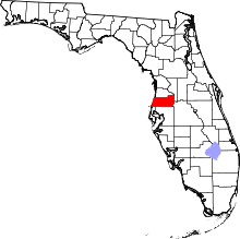 | |
| Town | ||
| CDPs |
| |
| Unincorporated communities | ||
| Footnotes | ‡This populated place also has portions in an adjacent county or counties | |