West Green, London

Coordinates: 51°35′11″N 0°05′25″W / 51.5864°N 0.0902°W
West Green is an area of north London, England in the United Kingdom and part of the London Borough of Haringey. It is an inner-suburban area located 5.7 miles (9.22 km) north of Charing Cross.
The area is mainly residential and includes both Chestnuts and Downhills parks. Its area is roughly defined by Downhills Park in the North and Northeast, by Cornwall Road to the East, a line running between Cranleigh and Stanley Roads to the South, Harringay Road and Stanmore Road to the West and Northwest.
History
West Green developed as a small village in the Middle Ages with settlement first recorded in 1393. By the start of the seventeenth century the eight buildings that then stood in West Green formed the only hamlet in the central area of the manor of Tottenham. Although it had not grown by 1800, by 1840 it contained 18 houses. This made it bigger than Wood Green at that time. Development really took off during the period after the 1860s, particularly after the arrival of the Tottenham & Hampstead Junction Railway in 1878. Nineteenth century local author, Charlotte Riddell described the changes vividly in her 1874 book Above Suspicion:
| “ | Sixteen years ago no more rural village could have been found within five miles of the General Post Office than West Green. It was as utterly in the country as though situated a hundred miles from London, and by a natural consequence it was country in its ways, habits, and manners. The various lanes leading to it from Stamford Hill, Tottenham, Hornsey, and Southgate were rural, which they certainly are not now…As for Hanger Lane, no one had yet dreamed of the evil days to come, when mushroom villas should be built upon the ground that not long before was regarded as an irreclaimable morass—when at first a tavern and then a church (the two invariable pioneers of that which, for some unknown reason, we call civilisation) appeared on the scene, and brought London following at their heels . . . when, in a word, Hanger Lane should be improved off the face of the earth and in the interest of speculative builders . . called, as it is at present, St. Ann’s Road, it has only taken sixteen years to change West Green from an extremely pretty village to an eminently undesirable suburb. | ” |
By 1890 the urbanisation of the area was complete.[3]
See Also:
Education
- For further details of education in West Green, London see the London Borough of Haringey article.
Park View is a secondary school located in the area. The school is situated next to Downhills Park.
Transport and locale
Nearest places
Nearest tube station
Nearest railway stations
Bus routes
Routes 41, 67, 230, 341 and W4 serve the area.
References
- ↑ "Haringey Ward population 2011". Neighbourhood Statistics. Office for National Statistics. Retrieved 23 October 2016.
- ↑ Riddell, Mrs J.H. (1874). Above Suspicion. Tinsley Brothers.
- ↑ 'Tottenham: Growth before 1850', A History of the County of Middlesex, Volume 5: 1976, pp. 313-17
External links
| Districts | 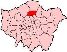 | |
|---|---|---|
| Attractions | ||
| Parks and open spaces |
| |
| Constituencies | ||
| Tube and railway stations | ||
| Other topics | ||