Wetumka, Oklahoma
| Wetumka | |
|---|---|
| City | |
|
Location of Wetumka, Oklahoma | |
 Wetumka Location of Wetumka, Oklahoma | |
| Coordinates: 35°14′20″N 96°14′23″W / 35.23889°N 96.23972°WCoordinates: 35°14′20″N 96°14′23″W / 35.23889°N 96.23972°W | |
| Country | United States |
| State | Oklahoma |
| County | Hughes |
| Area | |
| • Total | 1.9 sq mi (5.0 km2) |
| • Land | 1.9 sq mi (4.9 km2) |
| • Water | 0.0 sq mi (0.0 km2) |
| Elevation | 764 ft (233 m) |
| Population (2010) | |
| • Total | 1,282 |
| • Density | 760.8/sq mi (293.7/km2) |
| Time zone | Central (CST) (UTC-6) |
| • Summer (DST) | CDT (UTC-5) |
| ZIP code | 74883 |
| Area code(s) | 405 |
| FIPS code | 40-80500[1] |
| GNIS feature ID | 1099652[2] |
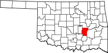
Wetumka is a city in northern Hughes County, Oklahoma, United States. The population was 1,282 at the 2010 census, a decline of 11.7 percent from 1,451 at the 2000 census.[3] The town was named for a Creek town of Wetumpka in Alabama, which the Creeks were forced to leave during the Indian Removal. Wetumka is a Muscogee Creek word meaning "tumbling water." [4] It is the headquarters for two federally recognized tribes, the Alabama-Quassarte Tribal Town and the Kialegee Tribal Town. It is the home of the Sucker Day, held every year on the last Saturday in September.[4]
Geography
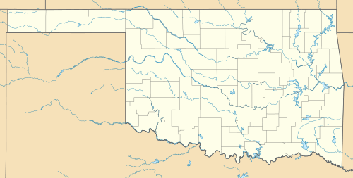
Wetumka is located at 35°14′20″N 96°14′23″W / 35.23889°N 96.23972°W (35.238849, -96.239851).[5] It is approximately 15 miles (24 km) northeast of Holdenville, the county seat.[4]
According to the United States Census Bureau, the city has a total area of 1.9 square miles (4.9 km2), of which, 1.9 square miles (4.9 km2) of it is land and 20% is water.
Demographics
| Historical population | |||
|---|---|---|---|
| Census | Pop. | %± | |
| 1910 | 231 | — | |
| 1920 | 1,422 | 515.6% | |
| 1930 | 2,153 | 51.4% | |
| 1940 | 2,340 | 8.7% | |
| 1950 | 2,025 | −13.5% | |
| 1960 | 1,798 | −11.2% | |
| 1970 | 1,687 | −6.2% | |
| 1980 | 1,725 | 2.3% | |
| 1990 | 1,427 | −17.3% | |
| 2000 | 1,451 | 1.7% | |
| 2010 | 1,282 | −11.6% | |
| Est. 2015 | 1,245 | [6] | −2.9% |
| U.S. Decennial Census | |||
As of the census[1] of 2000, there were 1,451 people, 591 households, and 346 families residing in the city. The population density was 760.8 people per square mile (293.3/km²). There were 700 housing units at an average density of 367.0 per square mile (141.5/km²). The racial makeup of the city was 58.37% White, 5.65% African American, 31.63% Native American, 0.07% Pacific Islander, 0.21% from other races, and 4.07% from two or more races. Hispanic or Latino of any race were 2.55% of the population.
There were 591 households out of which 26.1% had children under the age of 18 living with them, 37.4% were married couples living together, 16.4% had a female householder with no husband present, and 41.3% were non-families. 38.6% of all households were made up of individuals and 22.7% had someone living alone who was 65 years of age or older. The average household size was 2.31 and the average family size was 3.06.
In the city the population was spread out with 26.9% under the age of 18, 8.1% from 18 to 24, 23.7% from 25 to 44, 22.5% from 45 to 64, and 18.8% who were 65 years of age or older. The median age was 39 years. For every 100 females there were 86.7 males. For every 100 females age 18 and over, there were 78.3 males.
The median income for a household in the city was $17,000.00, and the median income for a family was $21,645. Males had a median income of $18,194 versus $14,091 for females. The per capita income for the city was $9,455. About 31.3% of families and 39.6% of the population were below the poverty line, including 48.4% of those under age 18 and 29.8% of those age 65 or over.
Education
The first school in Wetumka was the Levering Manual Labor Mission School, which opened on September 1, 1881. It was operated by the Home Mission Board of the Southern Baptist Convention, partly funded by the Creek Nation and educated Creek children. The town had a public school system by 1902 The Wes Watkins Technology Center is located in Wetumka. Opened in 1992, it offers vocational training.[4]
Activities
Wetumka was conned by a man named F. Bam Morrison in 1950, and the town laughs about it each year through a celebration called Sucker Day.[7][8]
Notable people
- John Herrington, Astronaut
References
- 1 2 "American FactFinder". United States Census Bureau. Retrieved 2008-01-31.
- ↑ "US Board on Geographic Names". United States Geological Survey. 2007-10-25. Retrieved 2008-01-31.
- ↑ CensusViewer:Wetumka, Oklahoma Population
- 1 2 3 4 Linda D. Wilson, "Wetumka". Encyc lopedia of Oklahoma History and Culture. Accessed January 17, 2013
- ↑ "US Gazetteer files: 2010, 2000, and 1990". United States Census Bureau. 2011-02-12. Retrieved 2011-04-23.
- ↑ "Annual Estimates of the Resident Population for Incorporated Places: April 1, 2010 to July 1, 2015". Retrieved July 2, 2016.
- ↑
- ↑ "Sucker Day Festival - September 24, 2016," TravelOK.com, Oklahoma Tourism and Recreation Department, Accessed October 30, 2015.
