White Meadow Lake, New Jersey
| White Meadow Lake, New Jersey | |
|---|---|
| Census-designated place | |
|
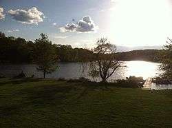
White Meadow Lake at sunset, taken From clubhouse deck | |
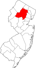
 Map of White Meadow Lake highlighted within Morris County. Inset: Location of Morris County in New Jersey. | |
| Coordinates: 40°55′43″N 74°31′00″W / 40.928477°N 74.516762°WCoordinates: 40°55′43″N 74°31′00″W / 40.928477°N 74.516762°W | |
| Country |
|
| State |
|
| County | Morris |
| Township | Rockaway |
| Area[1] | |
| • Total | 4.318 sq mi (11.184 km2) |
| • Land | 3.847 sq mi (9.964 km2) |
| • Water | 0.471 sq mi (1.221 km2) 10.92% |
| Elevation[2] | 755 ft (230 m) |
| Population (2010 Census)[3] | |
| • Total | 8,836 |
| • Density | 2,296.9/sq mi (886.8/km2) |
| Time zone | EST (UTC-5) |
| • Summer (DST) | EDT (UTC-4) |
| Area code(s) | 862/973 |
| FIPS code | 3480750[4] |
| GNIS feature ID | 02390507[5] |
| Website | www.whitemeadowlake.org |
White Meadow Lake is an unincorporated community and census-designated place (CDP) located within Rockaway Township, in Morris County, New Jersey, United States.[6][7][8][9] As of the 2010 United States Census, the CDP's population was 8,836.[3]
Geography
According to the United States Census Bureau, the CDP had a total area of 4.318 square miles (11.184 km2), including 3.847 square miles (9.964 km2) of land and 0.471 square miles (1.221 km2) of water (10.92%).[1][10]
Demographics
| Historical population | |||
|---|---|---|---|
| Census | Pop. | %± | |
| 1970 | 8,499 | — | |
| 1980 | 8,429 | −0.8% | |
| 1990 | 8,002 | −5.1% | |
| 2000 | 9,052 | 13.1% | |
| 2010 | 8,836 | −2.4% | |
| Population sources: 1970-1980[11] 1990-2010[8] 2000[12] 2010[3] | |||
Census 2010
The 2010 United States Census counted 8,836 people, 3,061 households, and 2,531 families residing in the CDP. The population density was 2,296.9 per square mile (886.8/km2). The CDP contained 3,152 housing units at an average density of 819.3 per square mile (316.3/km2). The racial makeup of the CDP was 89.08% (7,871) White, 1.69% (149) Black or African American, 0.03% (3) Native American, 5.89% (520) Asian, 0.05% (4) Pacific Islander, 1.45% (128) from other races, and 1.82% (161) from two or more races. Hispanics or Latinos of any race were 9.19% (812) of the population.[3]
Out of a total of 3,061 households, 41.0% had children under the age of 18 living with them, 71.3% were married couples living together, 8.4% had a female householder with no husband present, and 17.3% were non-families. 13.6% of all households were made up of individuals, and 5.2% had someone living alone who was 65 years of age or older. The average household size was 2.89 and the average family size was 3.18.[3]
In the CDP, 25.9% of the population were under the age of 18, 6.3% from 18 to 24, 25.8% from 25 to 44, 31.9% from 45 to 64, and 10.0% who were 65 years of age or older. The median age was 40.4 years. For every 100 females the census counted 96.5 males, but for 100 females at least 18 years old, it was 93.6 males.[3]
Census 2000
As of the 2000 Census,[4] there were 9,052 people, 3,046 households, and 2,562 families residing in the CDP. The population density was 2,210.6 inhabitants per square mile (853.5/km2). There were 3,119 housing units at an average density of 761.7 per square mile (294.1/km2). The racial makeup of the CDP was 91.6% White, 1.61% African American, 0.1% Native American, 4.7% Asian, 0.9% from other races, and 1.1% from two or more races. Hispanic or Latino of any race were 4.7% of the population.[12]
There were 3,046 households out of which 45.4% had children under the age of 18 living with them, 75% were married couples living together, 7.1% had a female householder with no husband present, and 15.9% were non-families. 11.9% of all households were made up of individuals and 3.9% had someone living alone who was 65 years of age or older. The average household size was 2.97 and the average family size was 3.25.[12]
In the CDP, the population was spread out with 28.7% under the age of 18, 5.3% from 18 to 24, 33.3% from 25 to 44, 24.8% from 45 to 64, and 8.0% who were 65 years of age or older. The median age was 36 years. For every 100 females there were 98.0 males. For every 100 females age 18 and over, there were 95.1 males.[12]
The median income for a household in the CDP was $83,708, and the median income for a family was $89,345. Males had a median income of $57,400 versus $41,057 for females. The per capita income for the CDP was $32,596. About 1.2% of families and 2.3% of the population were below the poverty line, including 3.1% of those under age 18 and 1.5% of those age 65 or over.[12]
Community
All homeowners in White Meadow Lake are members of the White Meadow Lake Property Owners Association, Inc., which owns and maintains the lake itself and its beaches, boat docks, club house and other facilities.
Two places of worship are located within White Meadow Lake, both Jewish: the White Meadow Temple, a Conservative congregation, and a Chabad center.
Copeland Middle School, part of the Rockaway Township Public Schools, is located in White Meadow Lake as is Stonybrook Elementary School. Elementary students in White Meadow Lake will attend either Stonybrook or Dwyer Elementary School. High School students from White Meadow Lake attend Morris Hills High School in Rockaway Borough.
References
- 1 2 Gazetteer of New Jersey Places, United States Census Bureau. Accessed July 21, 2016.
- ↑ U.S. Geological Survey Geographic Names Information System: White Meadow Lake Census Designated Place, Geographic Names Information System. Accessed December 23, 2012.
- 1 2 3 4 5 6 DP-1 - Profile of General Population and Housing Characteristics: 2010 Demographic Profile Data for White Meadow Lake CDP, New Jersey, United States Census Bureau. Accessed December 23, 2012.
- 1 2 American FactFinder, United States Census Bureau. Accessed September 4, 2014.
- ↑ US Board on Geographic Names, United States Geological Survey. Accessed September 4, 2014.
- ↑ GCT-PH1 - Population, Housing Units, Area, and Density: 2010 - County -- County Subdivision and Place from the 2010 Census Summary File 1 for Morris County, New Jersey, United States Census Bureau. Accessed December 23, 2012.
- ↑ 2006-2010 American Community Survey Geography for New Jersey, United States Census Bureau. Accessed December 23, 2012.
- 1 2 New Jersey: 2010 - Population and Housing Unit Counts - 2010 Census of Population and Housing (CPH-2-32), United States Census Bureau, August 2012. Accessed December 23, 2012.
- ↑ Locality Search, State of New Jersey. Accessed April 19, 2015.
- ↑ US Gazetteer files: 2010, 2000, and 1990, United States Census Bureau. Accessed September 4, 2014.
- ↑ Staff. 1980 Census of Population: Number of Inhabitants United States Summary, p. 1-141. United States Census Bureau, June 1983. Accessed January 12, 2012.
- 1 2 3 4 5 DP-1 - Profile of General Demographic Characteristics: 2000 from the Census 2000 Summary File 1 (SF 1) 100-Percent Data for White Meadow Lake CDP, New Jersey, United States Census Bureau. Accessed December 23, 2012.
External links
- White Meadow Lake official website
- Hub Lakes Sports League official website
- Rockaway Township, Morris County, New Jersey official website