Whitemarsh Island, Georgia
| Whitemarsh Island, Georgia | |
|---|---|
| Census-designated place | |
 Location in Chatham County and the state of Georgia | |
| Coordinates: 32°2′22″N 81°0′28″W / 32.03944°N 81.00778°WCoordinates: 32°2′22″N 81°0′28″W / 32.03944°N 81.00778°W | |
| Country | United States |
| State | Georgia |
| County | Chatham |
| Area | |
| • Total | 6.6 sq mi (17.2 km2) |
| • Land | 5.6 sq mi (14.6 km2) |
| • Water | 1.0 sq mi (2.6 km2) |
| Elevation | 13 ft (4 m) |
| Population (2010) | |
| • Total | 6,792 |
| • Density | 1,202/sq mi (464.2/km2) |
| Time zone | Eastern (EST) (UTC-5) |
| • Summer (DST) | EDT (UTC-4) |
| FIPS code | 13-82636[1] |
| GNIS feature ID | 1867247[2] |
Whitemarsh Island (pronounced "WIT-marsh") is a census-designated place (CDP) in Chatham County, Georgia, United States. The population was 6,792 at the 2010 census.[3] It is part of the Savannah Metropolitan Statistical Area. The communities of Whitemarsh Island are a relatively affluent suburb of Savannah.
Neighborhoods
Long Point Plantation is located on Whitemarsh Island, just east of the intersection of US HWY 80 and Johnny Mercer Boulevard. It is convenient to both the downtown business district, the beach, shopping and entertainment. Approximately 300 professional families reside in Long Point Plantation. Amenities include a pool, tennis courts and a 24/7 manned gate as well as a community dock, all are included for an annual association fee. A good selection of is currently available. Homes range from 2200 to over 5000 square feet and are typically situated on lots of approximately one half acre often with a lagoon, marsh or water view. Long Point Plantation is a popular family neighborhood with good schools, neighborhood shopping and recreation nearby. It can be reached by driving east on US 80 or from the Islands Expressway.
- Ranked #92 America's Best and Worst Cities for Crime (Mid-Size Metro Areas)
- Ranked #98 Most Popular Cities for the Holidays,
- Ranked #156 2005 Best Places to Live
- Ranked #235 Best Green Cities
Geography
The Whitemarsh Island CDP is located at 32°2′22″N 81°0′28″W / 32.03944°N 81.00778°W (32.039482, -81.007850),[4] occupying the island of the same name. It is bordered to the north by Richardson Creek, to the east by Turner Creek, and to the south and west by the Wilmington River, all of which are tidal water bodies. U.S. Route 80 crosses the island, leading west into Savannah and east to Tybee Island on the Atlantic shore. The Islands Expressway runs northwest from Whitemarsh Island 6.5 miles (10.5 km) to downtown Savannah.
According to the United States Census Bureau, the Whitemarsh Island CDP has a total area of 6.6 square miles (17.2 km2), of which 5.6 square miles (14.6 km2) is land and 1.0 square mile (2.6 km2), or 15.10%, is water.[3]
Demographics
| Historical population | |||
|---|---|---|---|
| Census | Pop. | %± | |
| 1990 | 2,824 | — | |
| 2000 | 5,824 | 106.2% | |
| 2010 | 6,792 | 16.6% | |
| source:[5][3] | |||
As of the census[1] of 2000, there were 5,824 people, 2,302 households, and 1,609 families residing in the CDP. The population density was 987.5 people per square mile (381.1/km²). There were 2,427 housing units at an average density of 411.5 per square mile (158.8/km²). The racial makeup of the CDP was 82.19% White, 9.24% African American, 0.26% Native American, 5.75% Asian, 0.12% Pacific Islander, 1.01% from other races, and 1.43% from two or more races. Hispanic or Latino of any race were 2.40% of the population.
There were 2,302 households out of which 34.8% had children under the age of 18 living with them, 59.1% were married couples living together, 7.7% had a female householder with no husband present, and 30.1% were non-families. 22.6% of all households were made up of individuals and 4.2% had someone living alone who was 65 years of age or older. The average household size was 2.53 and the average family size was 2.99.
In the CDP the population was spread out with 25.0% under the age of 18, 7.8% from 18 to 24, 34.8% from 25 to 44, 23.9% from 45 to 64, and 8.5% who were 65 years of age or older. The median age was 36 years. For every 100 females there were 96.2 males. For every 100 females age 18 and over, there were 95.9 males.
The median income for a household in the CDP was $58,087, and the median income for a family was $73,704. Males had a median income of $47,083 versus $32,055 for females. The per capita income for the CDP was $31,529. About 1.2% of families and 5.0% of the population were below the poverty line, including 2.1% of those under age 18 and 4.0% of those age 65 or over.
Housing costs on Whitemarsh Island range from $150,000 to upwards of $2,900,000.
References
- 1 2 "American FactFinder". United States Census Bureau. Retrieved 2008-01-31.
- ↑ "US Board on Geographic Names". United States Geological Survey. 2007-10-25. Retrieved 2008-01-31.
- 1 2 3 "Geographic Identifiers: 2010 Demographic Profile Data (G001): Whitemarsh Island CDP, Georgia". U.S. Census Bureau, American Factfinder. Retrieved July 24, 2014.
- ↑ "US Gazetteer files: 2010, 2000, and 1990". United States Census Bureau. 2011-02-12. Retrieved 2011-04-23.
- ↑ "CENSUS OF POPULATION AND HOUSING (1790-2000)". U.S. Census Bureau. Retrieved 2010-07-31.
Municipalities and communities of Chatham County, Georgia, United States | ||
|---|---|---|
| Cities | 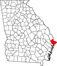 | |
| Towns | ||
| CDPs | ||
| Unincorporated communities | ||