Why, Arizona


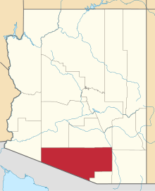
Why (O'odham: Ban Hi:nk) is a tiny unincorporated rural community in Pima County, Arizona, United States. It lies near the western border of the Tohono O'Odham Indian Reservation and due north of Organ Pipe Cactus National Monument in Southern Arizona. It is approximately thirty miles north of the Mexican border where Lukeville, Arizona, and Sonoita, Sonora, Mexico, border each other, and ten miles south of Ajo, Arizona.
The population in Why at the 2000 census was approximately 116.
History
The town derives its name from the fact that the two major highways, State Routes 85 and 86, originally intersected in a Y-intersection. At the time of its naming, Arizona law required all city names to have at least three letters, so the town's founders named the town "Why" as opposed to simply calling it "Y." The Arizona Department of Transportation (ADOT) later removed the old Y-intersection for traffic safety reasons and built the two highways in a conventional T-intersection south of the original intersection.
It has frequently been noted on lists of unusual place names.[1][2]
References
- ↑ Parker, Quentin (2010). Welcome to Horneytown, North Carolina, Population: 15: An insider's guide to 201 of the world's weirdest and wildest places. Adams Media. pp. xii.
- ↑ Hargis, Toni (January 13, 2014). "No, Arkansas Doesn't Sound the Way It Looks: A Guide to Pronouncing U.S. Place Names". BBC America. Retrieved 14 July 2014.
^ This is the sum of the populations of Blocks 1131-1153, Census Tract 49, Pima County, Arizona according to US Census Factfinder.
External links
- Mapquest Map
- Google Maps
- Aerial Photos Google Earth
- Weather www.wunderground.com
Coordinates: 32°16′07″N 112°44′20″W / 32.26861°N 112.73889°W