Topawa, Arizona
| Topawa, Arizona O'odham: Ḍo Bawui | |
|---|---|
| Unincorporated community | |
 Topawa, Arizona  Topawa, Arizona | |
| Coordinates: 31°48′50″N 111°49′32″W / 31.81389°N 111.82556°WCoordinates: 31°48′50″N 111°49′32″W / 31.81389°N 111.82556°W | |
| Country | United States |
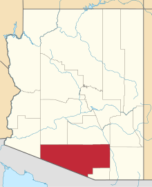
| State | Arizona |
| County | Pima |
| Elevation | 2,467 ft (752 m) |
| Time zone | Mountain (MST) (UTC-7) |
| ZIP code | 85639 |
| Area code(s) | 520 |
| GNIS feature ID | 12621[1] |
Topawa (O'odham: Ḍo Bawui) is an unincorporated community in Pima County, Arizona, United States. Topawa is located on the Tohono O'odham Indian Reservation 7.5 miles (12.1 km) south-southeast of Sells. Topawa has a post office with ZIP code 85639.[2]
References
This article is issued from Wikipedia - version of the 8/7/2016. The text is available under the Creative Commons Attribution/Share Alike but additional terms may apply for the media files.