Winnipeg Route 85
 | |
|---|---|
|
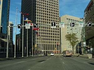
Corner of Portage and Main as seen from eastbound Route 85 | |
| Other name(s) | Portage Ave |
| Part of |
PTH 1 (TCH) (Trans-Canada Highway) Yellowhead Highway |
| Maintained by | City of Winnipeg |
| Length | 14 km (9 mi) |
| Location | Winnipeg, Manitoba |
| West end |
PTH 100 (TCH) south / PTH 101 north (Perimeter Hwy) PTH 1 (TCH) west (Portage Ave) |
| Major junctions |
Route 96 south (Moray St) Route 90 (Century St) Route 70 north (Maryland St) Route 70 south (Sherbrook St) PTH 1 (TCH) east / Broadway Route 62 (Colony St / Memorial Blvd) Route 42 south (Donald St) Route 42 north (Smith St) Route 57 west (Notre Dame St) |
| East end | Route 52 (Main St) / Route 57 |
| Other | |
| Known for | Junction of Portage and Main |

Route 85, also known as Portage Avenue, is a major arterial route in the Canadian city of Winnipeg, Manitoba. It is one of the city's oldest and most important roads and is part of both the Trans-Canada and Yellowhead Highways.
Route description
Route 85 begins in the heart of downtown Winnipeg, at the corner of Portage and Main (Route 52), and runs southwest through the downtown to Broadway. From Broadway to the west Perimeter Highway (PTH 100/101), it runs concurrently with the Trans-Canada Highway (PTH 1). Route 85 ends at the Perimeter Highway interchange, however, Portage Avenue continues 1.5 kilometers west to the official city limit, after which PTH 1 continues west into Headingley. Portage Avenue is also the first leg of the Yellowhead Highway from Winnipeg to Edmonton, which branches off PTH 1 on to PTH 16 near Portage la Prairie.
Route 85 is a six-lane road for its entire length and passes by major destinations such as Winnipeg Square, the MTS Centre, Portage Place, Polo Park Shopping Centre, and Assiniboia Downs. It is also the main link (via Route 90) between the city's downtown and airport.[1]
Portage Avenue East, which extends a short distance east from Portage and Main to Shaw Park, is not part of Route 85.
History
The origin of the route stems from its use as a part of an old Red River ox cart trail.[2][3]
The (red river) carts left deep ruts in the soft prairie turf, so deep that the wagons tended to spread out, the right wheel of one cart travelling in the wake of the left wheel of the cart ahead; thus, the prairie trails could be as much as twenty carts wide, a phenomenon that helps explain the many broad streets in Winnipeg. Portage Avenue is the widest thoroughfare in Canada and was known as Queen Street during the period from 1891 to 1893 as part of a failed scheme to introduce a numbering scheme to Winnipeg's streets. It is actually part of the old trail that led west to Portage la Prairie and then on to Edmonton.
Major intersections
Major intersections for Route 85 starting from Main Street and heading west to the Perimeter Highway.
| km | District | Intersecting Road | Notes |
|---|---|---|---|
| 0 | Downtown | see Portage and Main begin Yellowhead Highway begins | |
| 100m | |||
| 200m | Garry St south | ||
| 300m | Burton Cummings Theatre access | ||
| 400m | MTS Centre and Cityplace access | ||
| 500m | Hargave St north | ||
| 600m | Carlton St south | Convention Centre access | |
| 800m | Kennedy St south | ||
| 900m | Vaughan St north | Portage Place access | |
| 1 | Manitoba Legislative Building and Winnipeg Art Gallery access | ||
| 1.2 | West End | Balmoral St | University of Winnipeg |
| 1.6 | Furby St | ||
| 1.75 | |||
| 1.8 | |||
| 2 | begin | ||
| 2.3 | Arlington St | Vimy Ridge Memorial Park | |
| 3 | Dominion St | RCMP Division 'D' headquarters | |
| 3.5 | Wall St north | ||
| 4 | Valour Rd north | ||
| 4.5 | Empress St north | Polo Park access | |
| 4.9 | St. James St | ||
| 5 | St. James-Assiniboia | Winnipeg airport access (north) | |
| 7 | Overdale St north | Assiniboine Park access (pedestrians and cyclists only) | |
| 9.3 | |||
| 10.7 | Grace Hospital access | ||
| 11.6 | Westwood St south | ||
| 13.3 | Buchanan Blvd north | ||
| 14 | |||
See also
References
- ↑ Vanderhart, Tessa. "Best intersection in Canada? Portage and Main nominated as one of Canada's Greatest Places". Winnipeg Sun. Retrieved October 26, 2014.
- ↑ "Things you might not know about Portage and Main". CBC News. Retrieved October 26, 2014.
- ↑ George F. Reynolds (October 26, 2014). "The Man Who Created the Corner of Portage and Main". Manitoba Historical Society. Retrieved October 26, 2014.