World Geodetic System
| Geodesy | ||||||||||||||||
|---|---|---|---|---|---|---|---|---|---|---|---|---|---|---|---|---|
 | ||||||||||||||||
| Fundamentals | ||||||||||||||||
| Concepts | ||||||||||||||||
| Technologies | ||||||||||||||||
| Standards | ||||||||||||||||
|
||||||||||||||||
| History | ||||||||||||||||
The World Geodetic System (WGS) is a standard for use in cartography, geodesy, and navigation including GPS. It comprises a standard coordinate system for the Earth, a standard spheroidal reference surface (the datum or reference ellipsoid) for raw altitude data, and a gravitational equipotential surface (the geoid) that defines the nominal sea level.
The latest revision is WGS 84 (aka WGS 1984, EPSG:4326), established in 1984 and last revised in 2004.[1] Earlier schemes included WGS 72, WGS 66, and WGS 60. WGS 84 is the reference coordinate system used by the Global Positioning System.
Main parameters
The coordinate origin of WGS 84 is meant to be located at the Earth's center of mass; the error is believed to be less than 2 cm.[2]
The WGS 84 meridian of zero longitude is the IERS Reference Meridian,[3] 5.31 arc seconds or 102.5 metres (336.3 ft) east of the Greenwich meridian at the latitude of the Royal Observatory.[4][5]
The WGS 84 datum surface is an oblate spheroid (ellipsoid) with major (equatorial) radius a = 6378137 m at the equator and flattening f = 1/298.257223563.[6] The polar semi-minor axis b then equals a times (1 − f), or 6356752.3142 m.[6]
Currently, WGS 84 uses the EGM96 (Earth Gravitational Model 1996) geoid, revised in 2004. This geoid defines the nominal sea level surface by means of a spherical harmonics series of degree 360 (which provides about 100 km latitudinal resolution near the Equator).[7] The deviations of the EGM96 geoid from the WGS 84 reference ellipsoid range from about −105 m to about +85 m.[8] EGM96 differs from the original WGS 84 geoid, referred to as EGM84.
History
Efforts to supplement the various national surveying systems began in the 19th century with F.R. Helmert's famous book Mathematische und Physikalische Theorien der Physikalischen Geodäsie (Mathematical and Physical Theories of Physical Geodesy). Austria and Germany founded the Zentralbüro für die Internationale Erdmessung (Central Bureau of International Geodesy), and a series of global ellipsoids of the Earth were derived (e.g., Helmert 1906, Hayford 1910/ 1924).
A unified geodetic system for the whole world became essential in the 1950s for several reasons:
- International space science and the beginning of astronautics.
- The lack of inter-continental geodetic information.
- The inability of the large geodetic systems, such as European Datum (ED50), North American Datum (NAD), and Tokyo Datum (TD), to provide a worldwide geo-data basis
- Need for global maps for navigation, aviation, and geography.
- Western Cold War preparedness necessitated a standardised, NATO-wide geospatial reference system, in accordance with the NATO Standardisation Agreement
In the late 1950s, the United States Department of Defense, together with scientists of other institutions and countries, began to develop the needed world system to which geodetic data could be referred and compatibility established between the coordinates of widely separated sites of interest. Efforts of the U.S. Army, Navy and Air Force were combined leading to the DoD World Geodetic System 1960 (WGS 60). The term datum as used here refers to a smooth surface somewhat arbitrarily defined as zero elevation, consistent with a set of surveyor's measures of distances between various stations, and differences in elevation, all reduced to a grid of latitudes, longitudes, and elevations. Heritage surveying methods found elevation differences from a local horizontal determined by the spirit level, plumb line, or an equivalent device that depends on the local gravity field (see physical geodesy). As a result, the elevations in the data are referenced to the geoid, a surface that is not readily found using satellite geodesy. The latter observational method is more suitable for global mapping. Therefore, a motivation, and a substantial problem in the WGS and similar work is to patch together data that were not only made separately, for different regions, but to re-reference the elevations to an ellipsoid model rather than to the geoid.
In accomplishing WGS 60, a combination of available surface gravity data, astro-geodetic data and results from HIRAN [9] and Canadian SHORAN surveys were used to define a best-fitting ellipsoid and an earth-centered orientation for each of initially selected datum. (Every datum is relatively oriented with respect to different portions of the geoid by the astro-geodetic methods already described.) The sole contribution of satellite data to the development of WGS 60 was a value for the ellipsoid flattening which was obtained from the nodal motion of a satellite.
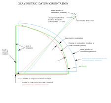
Prior to WGS 60, the U.S. Army and U.S. Air Force had each developed a world system by using different approaches to the gravimetric datum orientation method. To determine their gravimetric orientation parameters, the Air Force used the mean of the differences between the gravimetric and astro-geodetic deflections and geoid heights (undulations) at specifically selected stations in the areas of the major datums. The Army performed an adjustment to minimize the difference between astro-geodetic and gravimetric geoids. By matching the relative astro-geodetic geoids of the selected datums with an earth-centered gravimetric geoid, the selected datums were reduced to an earth-centered orientation. Since the Army and Air Force systems agreed remarkably well for the NAD, ED and TD areas, they were consolidated and became WGS 60.
The United States Department of Defense World Geodetic System 1966
Improvements to the global system included the Astrogeoid of Irene Fischer and the astronautic Mercury datum. In January 1966, a World Geodetic System Committee composed of representatives from the United States Army, Navy and Air Force was charged with developing an improved WGS, needed to satisfy mapping, charting and geodetic requirements. Additional surface gravity observations, results from the extension of triangulation and trilateration networks, and large amounts of Doppler and optical satellite data had become available since the development of WGS 60. Using the additional data and improved techniques, WGS 66 was produced which served DoD needs for about five years after its implementation in 1967. The defining parameters of the WGS 66 Ellipsoid were the flattening (1/298.25 determined from satellite data) and the semimajor axis (6,378,145 meters determined from a combination of Doppler satellite and astro-geodetic data). A worldwide 5° × 5° mean free air gravity anomaly field provided the basic data for producing the WGS 66 gravimetric geoid. Also, a geoid referenced to the WGS 66 Ellipsoid was derived from available astrogeodetic data to provide a detailed representation of limited land areas.
The United States Department of Defense World Geodetic System 1972
After an extensive effort extending over a period of approximately three years, the Department of Defense World Geodetic System 1972 was completed. Selected satellite, surface gravity and astrogeodetic data available through 1972 from both DoD and non-DoD sources were used in a Unified WGS Solution (a large scale least squares adjustment). The results of the adjustment consisted of corrections to initial station coordinates and coefficients of the gravitational field.
The largest collection of data ever used for WGS purposes was assembled, processed and applied in the development of WGS 72. Both optical and electronic satellite data were used. The electronic satellite data consisted, in part, of Doppler data provided by the U.S. Navy and cooperating non-DoD satellite tracking stations established in support of the Navy's Navigational Satellite System (NNSS). Doppler data was also available from the numerous sites established by GEOCEIVERS during 1971 and 1972. Doppler data was the primary data source for WGS 72 (Figure 38). Additional electronic satellite data was provided by the SECOR (Sequential Collation of Range) Equatorial Network completed by the U.S. Army in 1970. Optical satellite data from the Worldwide Geometric Satellite Triangulation Program was provided by the BC-4 camera system (Figure 39). Data from the Smithsonian Astrophysical Observatory was also used which included camera (Baker–Nunn) and some laser ranging.


The surface gravity field used in the Unified WGS Solution consisted of a set of 410 10° × 10° equal area mean free air gravity anomalies determined solely from terrestrial data. This gravity field includes mean anomaly values compiled directly from observed gravity data wherever the latter was available in sufficient quantity. The value for areas of sparse or no observational data were developed from geophysically compatible gravity approximations using gravity-geophysical correlation techniques. Approximately 45 percent of the 410 mean free air gravity anomaly values were determined directly from observed gravity data.
The astrogeodetic data in its basic form consists of deflection of the vertical components referred to the various national geodetic datums. These deflection values were integrated into astrogeodetic geoid charts referred to these national datums. The geoid heights contributed to the Unified WGS Solution by providing additional and more detailed data for land areas. Conventional ground survey data was included in the solution to enforce a consistent adjustment of the coordinates of neighboring observation sites of the BC-4, SECOR, Doppler and Baker–Nunn systems. Also, eight geodimeter long line precise traverses were included for the purpose of controlling the scale of the solution.
The Unified WGS Solution, as stated above, was a solution for geodetic positions and associated parameters of the gravitational field based on an optimum combination of available data. The WGS 72 ellipsoid parameters, datum shifts and other associated constants were derived separately. For the unified solution, a normal equation matrix was formed based on each of the mentioned data sets. Then, the individual normal equation matrices were combined and the resultant matrix solved to obtain the positions and the parameters.
The value for the semimajor axis (a) of the WGS 72 Ellipsoid is 6 378 135 meters. The adoption of an a-value 10 meters smaller than that for the WGS 66 Ellipsoid was based on several calculations and indicators including a combination of satellite and surface gravity data for position and gravitational field determinations. Sets of satellite derived station coordinates and gravimetric deflection of the vertical and geoid height data were used to determine local-to-geocentric datum shifts, datum rotation parameters, a datum scale parameter and a value for the semimajor axis of the WGS Ellipsoid. Eight solutions were made with the various sets of input data, both from an investigative point of view and also because of the limited number of unknowns which could be solved for in any individual solution due to computer limitations. Selected Doppler satellite tracking and astro-geodetic datum orientation stations were included in the various solutions. Based on these results and other related studies accomplished by the Committee, an a-value of 6 378 135 meters and a flattening of 1/298.26 were adopted.
In the development of local-to WGS 72 datum shifts, results from different geodetic disciplines were investigated, analyzed and compared. Those shifts adopted were based primarily on a large number of Doppler TRANET and GEOCEIVER station coordinates which were available worldwide. These coordinates had been determined using the Doppler point positioning method.
A new World Geodetic System: WGS 84
.svg.png)
In the early 1980s the need for a new world geodetic system was generally recognized by the geodetic community and also within the US Department of Defense. WGS 72 no longer provided sufficient data, information, geographic coverage, or product accuracy for all then-current and anticipated applications. The means for producing a new WGS were available in the form of improved data, increased data coverage, new data types and improved techniques. GRS 80 parameters together with available Doppler, satellite laser ranging and Very Long Baseline Interferometry (VLBI) observations constituted significant new information. An outstanding new source of data had become available from satellite radar altimetry. Also available was an advanced least squares method called collocation which allowed for a consistent combination solution from different types of measurements all relative to the Earth's gravity field, i.e. geoid, gravity anomalies, deflections, dynamic Doppler, etc.
The new World Geodetic System was called WGS 84. It is currently the reference system being used by the Global Positioning System. It is geocentric and globally consistent within ±1 m. Current geodetic realizations of the geocentric reference system family International Terrestrial Reference System (ITRS) maintained by the IERS are geocentric, and internally consistent, at the few-cm level, while still being metre-level consistent with WGS 84.
The WGS 84 originally used the GRS 80 reference ellipsoid, but has undergone some minor refinements in later editions since its initial publication. Most of these refinements are important for high-precision orbital calculations for satellites but have little practical effect on typical topographical uses. The following table lists the primary ellipsoid parameters.
| Ellipsoid reference | Semi-major axis a | Semi-minor axis b | Inverse flattening (1/f) |
|---|---|---|---|
| GRS 80 | 6 378 137.0 m | ≈ 6 356 752.314 140 m | 298.257 222 100 882 711... |
| WGS 84 | 6 378 137.0 m | ≈ 6 356 752.314 245 m | 298.257 223 563 |
The very small difference in the flattening thus results in a tiny difference of 0.105 mm in the semi polar axis.
Longitudes on WGS 84
WGS 84 uses the IERS Reference Meridian as defined by the Bureau International de l'Heure,[3] which was defined by compilation of star observations in different countries. The mean of this data caused a shift of about 100 metres east away from the Airy transit circle at the Royal Observatory, Greenwich.[5]
The longitude positions on WGS 84 agree with those on the older North American Datum 1927 at roughly 85° longitude west, in the east-central United States.
Updates and new standards
The latest major revision of WGS 84 is also referred to as "Earth Gravitational Model 1996" (EGM96), first published in 1996, with revisions as recent as 2004. This model has the same reference ellipsoid as WGS 84, but has a higher-fidelity geoid (roughly 100 km resolution versus 200 km for the original WGS 84).
Many of the original authors of WGS 84 contributed to a new higher-fidelity model, called EGM2008.[10] This new model will have a geoid with a resolution approaching 10 km, requiring over 4.6 million terms in the spherical expansion (versus 130,317 in EGM96 and 32,757 in WGS 84).
See also
- TRANSIT system
- NAD83
- ETRS89
- EGM96
- Geo (microformat) – for marking up WGS84 coordinates in (X)HTML
- Degree Confluence Project
- Geotagging
- Point of Interest
References
- ↑ "World Geodetic System website of the NGA (archived April 2012)". National Geospatial-Intelligence Agency. Archived from the original on April 2, 2012.
- ↑ "The EGM96 Geoid Undulation with Respect to the WGS84 Ellipsoid". NASA.
- 1 2 European Organisation for the Safety of Air Navigation and IfEN: WGS 84 Implementation Manual, p. 13. 1998
- ↑ History of the Prime Meridian – Past and Present
- 1 2 National Maritime Museum: "The Longitude of Greenwich"
- 1 2 National Imagery and Mapping Agency Technical Report TR 8350.2 Third Edition, Amendment 1, 1 Jan 2000, "Department of Defense World Geodetic System 1984"
- ↑ NGA/NASA EGM96, N=M=360 Earth Gravitational Model
- ↑ EGM96 15' × 15' Geoid Undulation Plot
- ↑ http://www.history.noaa.gov/stories_tales/ak7.html
- ↑ Earth Gravitational Model 2008 (EGM2008) – WGS 84 Version
External links
- Geodesy for the Layman, Chapter VIII, "The World Geodetic System"
- NIMA Technical Report TR8350.2 Department of Defense World Geodetic System 1984, Its Definition and Relationships With Local Geodetic Systems, Third Edition, National Geospatial-Intelligence Agency. This is the official publication of the standard, including addenda. Note this report actually documents the EGM 96 model (a revision of WGS 84). The original WGS 84 is documented in versions prior to 1996.
- Main NGA (was NIMA) page on Earth gravity models
- Description of the difference between the geoid and the ellipsoid from the US NOAA National Geodetic Survey GEOID page
- NASA GSFC Earth gravity page
- GeographicLib provides a utility GeoidEval (with source code) to evaluate the geoid height for the EGM84, EGM96, and EGM2008 earth gravity models. Here is an online version of GeoidEval.
- Spatial reference for EPSG:4326
![]() This article incorporates public domain material from websites or documents of the National Geodetic Survey.
This article incorporates public domain material from websites or documents of the National Geodetic Survey.