Worsthorne
| Worsthorne | |
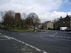 Church Square, Worsthorne |
|
 Worsthorne |
|
| OS grid reference | SD875325 |
|---|---|
| Civil parish | Worsthorne-with-Hurstwood |
| District | Burnley |
| Shire county | Lancashire |
| Region | North West |
| Country | England |
| Sovereign state | United Kingdom |
| Post town | BURNLEY |
| Postcode district | BB10 |
| Dialling code | 01282 |
| Police | Lancashire |
| Fire | Lancashire |
| Ambulance | North West |
| EU Parliament | North West England |
| UK Parliament | Burnley |
| Website | worsthorne |
|
|
Coordinates: 53°47′13″N 2°11′28″W / 53.787°N 2.191°W
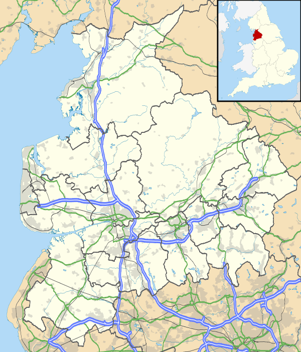
Worsthorne is a rural village on the eastern outskirts of Burnley in Lancashire, England. It is in the civil parish of Worsthorne-with-Hurstwood and the borough of Burnley. The village was known as Worthesthorn in 1202, which means "thorn tree of a man named 'Weorth'."[1]
The village has a small village green, overlooked by the church and Bay Horse public house.[2] Buildings in the village include cottages dating from the 16th and 17th centuries, and housing for millworkers dating from the Industrial Revolution. Relatively high property prices in the village reflect the fact that it is perceived to be a desirable place to live, with low crime and good education.[3]
History
Jan2006.jpg)
The history of human habitation in the area goes back to the late stone, bronze and Iron Ages. Earthworks and two prehistoric stone circles are shown on Ordnance Survey maps, one at grid reference SD885327 on the moors to the east of the village; both are in a poor state of repair. A flint dagger 15 cm in length found on the moor is now in Towneley Museum.[4]
Governance
Worsthorne forms part of the Worsthorne with Cliviger ward, which is currently represented on Burnley Borough Council by three Conservative councillors. In 2002 the ward elected a British National Party (BNP) councillor, which generated considerable media comment at the time; the seat returned to the Conservative Party when it was next contested.[5]
Landmarks
Oct2005.jpg)
Feb2007.jpg)
The village had a close association with the Thursby family, benefactors of the Burnley area,[1] and has a number of listed buildings. These include Jackson's House in the centre of the village, which was built in about 1600, and the Church of St. John the Evangelist which dates from 1833-1839.[6] The original plans for the church, drawn up by architect Lewis Vulliamy, can be seen on the Incorporated Church Building Society website.[7] It has a 61 ft clocktower, stained glass windows and wrought ironwork.[8] The churchyard has the grave of a packmaster, a person whose job was to lead packhorses across the moors in special sunken trails that allowed the horses to walk unhitched since the walls of the trail prevented them from straying.[1]
An earlier landmark used to be Worsthorne Methodist Chapel, near Jackson's House, but it was demolished in the 1980s. The connected Sunday School building is now a home for old people.
There is a former cotton mill in Gordon Street, a relic of the time when the area, especially Burnley, was the world centre of cotton weaving.
There are two public houses in the village: the Crooked Billet and the Bay Horse Inn.[9]
Education
The village has a primary school with about 180 pupils in the 4-11 age range,[10] serving Worsthorne, Hurstwood, Brownside and Pike Hill.[11] The school houses seven classes in modern buildings and has extensive playing fields and grounds. Students are organised into four houses, Gorple, Extwistle, Brownside and Ormerod. The houses are named after the four roads running into Worsthorne, which meet in the village square. The original village school house, now converted into residential housing, stands in the square.
Transport
A regular bus service (route 2) runs between Worsthorne, Burnley, Burnley General Hospital, Nelson and Higherford
Notable people
- Ron Greenwood CBE (1921–2006), the English football player and manager, was born in Worsthorne.
- Footballer Brian Miller lived there for many years before passing away in 2007. Miller played, & managed Burnley F.C.throughout his career at the football club.
- Thomas Whitham VC, soldier, First World War was born here.
See also
References
- 1 2 3 Lancashire County Council. "Worsthorne-with-Hurstwood Parish Council". Lancashire Parish Portal. Retrieved 25 March 2007.
- ↑ Ron Freethy (2006). "Tourist Guide to Worsthorne". burnleycitizen.co.uk (Newsquest). Retrieved 25 March 2007.
- ↑ David Ward (10 June 2004). "Right on the Edge". Guardian Unlimited. London. Retrieved 25 March 2007.
- ↑ Paul Kenyon. "Worsthorne Moor (Slipper Hill)". Paul's Stone Circle Data Base. Archived from the original on 25 September 2006. Retrieved 25 March 2007.
- ↑ David Ward (4 May 2002). "Voice of BNP's new stronghold: 'No one in this village is a racist'". Guardian Unlimited. London. Retrieved 25 March 2007.
- ↑ Burnley Borough Council (2003). "Beautiful Villages". Burnley Tourism. Archived from the original on 3 February 2007. Retrieved 25 March 2007.
- ↑ "Search Results". The Incorporated Church Building Society archive. Retrieved 25 March 2007.
- ↑ Burnley Tourist Information Centre (2006). "Burnley 2006 Heritage Open Days" (pdf). Burnley Tourism. Retrieved 25 March 2007.
- ↑ "Real Ale Pubs in the Burnley Area". East Lancashire CAMRA. 2007. Retrieved 25 March 2007.
- ↑ "Worsthorne Primary School" (PDF). Ofsted. 2005. Archived from the original (PDF) on 10 October 2007. Retrieved 25 March 2007.
- ↑ "About our school". Worsthorne Primary. 2007. Retrieved 25 March 2007.
External links
| Wikimedia Commons has media related to Worsthorne. |
Geography of the Borough of Burnley | |||||||||||
|---|---|---|---|---|---|---|---|---|---|---|---|
| Towns |  | ||||||||||
| Villages & suburbs | |||||||||||
| Parishes | |||||||||||
| Topography |
| ||||||||||