Yakamia, Western Australia
| Yakamia Albany, Western Australia | |||||||||||||
|---|---|---|---|---|---|---|---|---|---|---|---|---|---|
 | |||||||||||||
 Yakamia | |||||||||||||
| Coordinates | 35°00′14″S 117°52′41″E / 35.004°S 117.878°ECoordinates: 35°00′14″S 117°52′41″E / 35.004°S 117.878°E | ||||||||||||
| Population | 2,717 (2011 census)[1] | ||||||||||||
| Postcode(s) | 6330 | ||||||||||||
| Location | 2 km (1 mi) NE of Albany | ||||||||||||
| LGA(s) | City of Albany | ||||||||||||
| State electorate(s) | Albany | ||||||||||||
| Federal Division(s) | O'Connor | ||||||||||||
| |||||||||||||
Yakamia is an inner suburb of Albany. The suburb was created in the 1970s, and was gazetted in 1979.[2] The name is believed to be a Noongar Aboriginal word meaning "sister to a small creek".
Geography
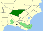
Yakamia is bounded by North Road to the south, Chester Pass Road to the west, Hudson and Bond Roads to the north and Ulster Road to the southeast. Yakamia Creek runs through the suburb.[3]
Facilities
Yakamia is a residential suburb, and used to consist primarily of bushland, however, this has slowly disappeared with the bush making way for new housing developments. The suburb contains Yakamia Primary School, which opened in 1970 and now has around 620 students. There is also a small shopping centre on North Road. The City of Albany's council offices are located in Yakamia along North Road.
References
- ↑ Australian Bureau of Statistics (31 October 2012). "Yakamia (State Suburb)". 2011 Census QuickStats. Retrieved 16 February 2014.
- ↑ "Naming of Localities - Town of Albany (per 3773/57 V4)". Western Australia Government Gazette. 8 June 1979. p. 1979:1501.
- ↑ Department of Land Information. StreetSmart® Perth Street Directory (54 (2013) ed.). West Australian Newspapers Ltd. pp. Maps A2. ISBN 978-0-909439-67-5.