Yarriambiack Creek
| Yarriambiack | |
| Creek[1][2][3] | |
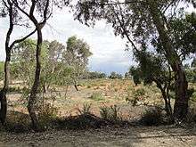
 Yarriambiack Creek at Brim | |
| Country | Australia |
|---|---|
| State | Victoria |
| Regions | Murray Darling Depression (IBRA), Wimmera |
| Local government areas | Horsham, Yarriambiack |
| Part of | Wimmera catchment |
| Towns | Warracknabeal, Brim, Beulah, Beulah |
| Primary source | Great Dividing Range |
| Secondary source | Wimmera River |
| - location | near Drung Drung, east of Horsham |
| - elevation | 147 m (482 ft) |
| - coordinates | 36°42′26.7″S 142°24′43.9″E / 36.707417°S 142.412194°E |
| Mouth | Lake Coorong |
| - location | east of Hopetoun |
| - elevation | 76 m (249 ft) |
| - coordinates | 35°44′29.6″S 142°23′6.8″E / 35.741556°S 142.385222°ECoordinates: 35°44′29.6″S 142°23′6.8″E / 35.741556°S 142.385222°E |
| Length | 141 km (88 mi) |
| [2][4] | |
The Yarriambiack Creek, an inland intermittent watercourse of the Wimmera catchment, is located in the Wimmera region of the Australian state of Victoria. Rising on the northern slopes of the Great Dividing Range, the Yarriambiack Creek flows generally north and drains into Lake Coorong, one of a series of ephemeral lakes, northeast of Hopetoun.
Location and features
The Yarriambiack Creek is a distributary[5] of the Wimmera River and leaves the river near Drung Drung, approximately 20 kilometres (12 mi) east of Horsham.
The watercourse flows northwards through Warracknabeal and empties into Lake Coorong just east of Hopetoun. The flow of the watercourse is intermittent and depends almost entirely on the level of the Wimmera River. After not flowing for most of the previous 15 years, it flooded in September 2010 and January 2011. Water was released from the Wimmera River in 2012 and flowed through the creek and ended in Warracknabeal. There are a number of weirs built along the creek to hold water. The Yarriambiack Creek descends 71 metres (233 ft) over its 141-kilometre (88 mi) course.[4]
At Warracknabeal, Brim, Beulah and Hopetoun there are picnic spots, camping areas, gardens and walking trails.
The creek is crossed by the Henty Highway at multiple points between Warracknabeal and Hopetoun.
See also
References
- ↑ "Yarriambiack Creek (VIC)". Gazetteer of Australia online. Geoscience Australia, Australian Government.
- 1 2 "Yarriambiack Creek (entry 622381)". VICNAMES. Government of Victoria. Retrieved 23 October 2014.
- ↑ Smyth, Robert Brough (1878). The Aborigines of Victoria. Melbourne: Victorian Government Printer. p. 176.
- 1 2 "Map of Yarriambiack Creek, VIC". Bonzle Digital Atlas of Australia. Retrieved 23 October 2014.
- ↑ "Wimmera waterways". Wimmera Catchment Management Authority. Victorian Government. Retrieved 27 October 2014.
| |
|