Yuam River
| Yuam River (แม่น้ำยวม) | |
 The Yuam River near Mae Sariang | |
| Countries | Thailand, Burma |
|---|---|
| State | Mae Hong Son Province (Thailand) |
| Districts | Khun Yuam District, Mae La Noi District, Mae Sariang District, Sop Moei District |
| Source | |
| - location | Thanon Thong Chai Range, Khun Yuam District, Mae Hong Son Province, Thailand |
| Mouth | Moei River |
| - location | At the border with Burma |
| - elevation | 52 m (171 ft) |
| - coordinates | TH 17°49′55″N 97°41′31″E / 17.83194°N 97.69194°ECoordinates: TH 17°49′55″N 97°41′31″E / 17.83194°N 97.69194°E |
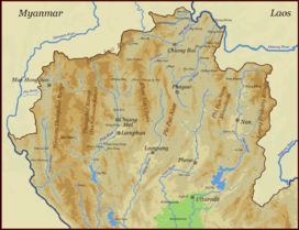 Map of the Thai highlands | |
The Yuam River (Thai: แม่น้ำยวม is a river in northwestern Thailand, part of the Salween watershed. It originates in the mountains of the Thanon Thong Chai Range, Khun Yuam District, Mae Hong Son Province, Thailand. The river flows in a north–south direction and then in Sop Moei District it bends westwards and then northwestwards, forming a stretch of the Thai/Burmese border shortly before it joins the left bank of the Moei River, shortly before its confluence with the Salween.
A major dam is projected on this river as part of a water diversion plan from the Salween to the Chao Phraya River.[1]
The Ngao River, which unlike most rivers in Thailand flows northwards, is one of the Yuam's main tributaries.[2]
See also
- River systems of Thailand
- Mae Ngao National Park
References
External links
| Wikimedia Commons has media related to Yuam River. |
- Nam Ngao
- Salawin National Park
- Thailand's Salween River and Mae Ngao National Park
- A New Noemacheiline Loach from Thailand and Burma
This article is issued from Wikipedia - version of the 7/3/2016. The text is available under the Creative Commons Attribution/Share Alike but additional terms may apply for the media files.