Mae Hong Son Province
| Mae Hong Son แม่ฮ่องสอน | ||
|---|---|---|
| Province | ||
| ||
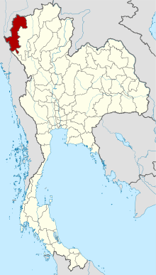 Map of Thailand highlighting Mae Hong Son Province | ||
| Country | Thailand | |
| Capital | Mae Hong Son | |
| Government | ||
| • Governor | Suepsak Iamwichan (since October 2016) | |
| Area | ||
| • Total | 12,681 km2 (4,896 sq mi) | |
| Area rank | Ranked 8th | |
| Population (2014) | ||
| • Total | 248,178[1] | |
| • Rank | Ranked 72nd | |
| • Density rank | Ranked 76th | |
| Human Achievement Index[2] | ||
| • HAI (2014) | 0.5214 low (76th) | |
| Time zone | ICT (UTC+7) | |
| postal code | 58xxx | |
| calling code | 052 & 053 | |
| ISO 3166 code | TH-58 | |

Mae Hong Son Province (Thai: แม่ฮ่องสอน, pronounced [mɛ̂ː.hɔ̂ŋ.sɔ̌ːn]; formerly called Mae Rong Son), also spelled Maehongson, Mae Hong Sorn or Maehongsorn, is one of the northern provinces (changwat) of Thailand, on the country's western border. Neighboring provinces are (clockwise from north) Shan State of Myanmar, Chiang Mai and Tak. To the west, the province borders Kayin State and Kayah State of Myanmar.
Mae Hong Son's nickname is "the city of three mists". It is hemmed in by the high mountain ranges of the Shan Hills and is the most mountainous province in Thailand, occupying 13,814 square kilometres (5,334 sq mi). The province is often covered with mist. Mae Hong Son town was originally established in the early 19th century as an elephant training camp as ordered by the then King of Chiang Mai.
As of 2012 Mae Hong Son was the poorest province in Thailand.[3]
Geography

Mae Hong Son Province is approximately 924 kilometres (574 mi) north of Bangkok. To the north and west it connects to a total of three states in the Union of Burma, namely the southern portion of Shan State, Kayah State, and Kawthoolei State, via the West Thanon Thongchai Mountains, and the rivers Salween and Moei. These formations serve as natural boundaries between the countries. To the south, it connects to the district of Tha Song Yang and Tak, via the rivers Yuam and Ngao, which serve as a provincial boundary. To the east it connects to the districts of Wiang Haeng, Chiang Dao, Mae Taeng, Mae Chaem, Hot and Omkoi in Chiang Mai Province, via the central and east sections of the Thanon Thongchai mountain ranges, which serve as a boundary between the two provinces.
Every district in Mae Hong Son Province shares a common border, measuring approximately 483 kilometres in total length, with Myanmar. The common border consists of approximately 326 km (203 mi) of land boundary and 157 km (98 mi) of river boundary (not counting the Salween, 127 km (79 mi), and Moei, 30 km (19 mi)).
Most of the areas of Mae Hong Son Province are the complex mountain ranges of the Thai highlands, parts of which are still covered with rain forest. Of the approximately 6,976,650 rai of national forest reserves, it is estimated that 88 percent is pristine virgin forest.
The Daen Lao Range, in the northernmost portion of the province, marks the northern boundary between Thailand and Burma, while the Dawna Range in the west serves as the boundary between Thailand and Burma. The Thanon Thongchai Range in the east of the province serves as the boundary between the provinces of Mae Hong Son and Chiang Mai. The highest point of the province is Doi Mae Ya (ยอดเขาแม่ยะ), in the Pai District in the province's northeast, at 2,005 metres (6,578 ft) elevation.
History
The territory of Mae Hong Son Province was formerly part of Mawkmai State, one of the Shan States which had been founded in 1767 by Hsai Khiao, hailing from a noble family of Chiang Mai.[4]
As a result of the Anglo-Siamese Boundary Commission of 1892-93 Mae Hong Son District was ceded to Siam,[5] but the adjacent Möngmaü and Mehsakun trans-Salween Districts also claimed by Siam (as territories on the eastern side of the Salween River), were kept as part of British Burma.[6]
Demographics
The population in the province consists of hill tribes (63 percent), including the Hmong, Yao, Lahu, Lisu, Akha, Karen, and the Shan (Thai Yai). The province has the lowest population density of all the provinces of Thailand.
The Karen are not one single group, but rather a mix of closely related tribes. Padaung is a Karen language from the Shan State and the Kayah State. Among the smallest of the Karen tribes in Thailand are Kayan Lahwi. This group's women are recognized by the large brass rings they wear around their necks.
Symbols
The provincial seal, Rup chang nai thong nam (รูปช้างในท้องน้ำ), meaning "image of an elephant in a body of water", is a reference to the training of wild elephants for battle and various types of animal labour. "Rup chang nai thong nam" was selected as the provincial seal because it refers to Mae Hong Son's founding, which began with Lord Kaeo of Ma being sent to capture elephants for the Lord of Chiang Mai (1825–1846). Once in Mae Hong Son, he gathered the scattered Shan settlements to establish two main villages, Ban Pang Mu and Ban Mae Hong Son, that would be ruled by their elected leaders.
The provincial flag is horizontally divided in dark brown/blue/dark brown (1:3:1) with the image of the provincial seal in the middle of the flag.
The provincial tree is the Millettia brandisiana (Thai: กระพี้จั่น; rtgs: kraphichan).
The provincial flower is the tree marigold (Thai: บัวตอง; rtgs: buatong).
The official provincial slogan promoted by the Thai government is หมอกสามฤดู กองมูเสียดฟ้า ป่าเขียวขจี ผู้คนดี ประเพณีงาม ลือนามถิ่นบัวตอง (rtgs: mok sam ruedu, kong mu siat fa, pa khiao khachi, phu khon di, prapheni ngam, lue nam thin bua tong) "Mists throughout the three seasons, the Kong Mu (monastery) that scrapes the sky, verdant forests, gentle people, beautiful customs; renowned land of sunflowers".
Administrative divisions
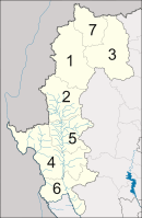
The province is divided into seven districts (amphoe). These are further subdivided into 45 sub-districts (tambon) and 402 villages (muban).
Events and festivals
- Poi Sang Long Procession (งานประเพณีปอยส่างลอง)
- Chong Phara Procession (งานประเพณีจองพารา)
- Bua Tong Blossom Festival (งานวันดอกบัวตองบาน)
- Loi Krathong Festival (ประเพณีลอยกระทง หรือ งานเหลินสิบสอง)
Further reading
- "A Season in Mae Hong Son", in: Forbes, Andrew, and Henley, David, Ancient Chiang Mai Volume 3. Chiang Mai, Cognoscenti Books, 2012. ASIN: B006IN1RNW
See also
References
- ↑ "Population of the Kingdom" (PDF). Department of Provincial Affairs (DOPA) Thailand (in Thai). 2014-12-31. Retrieved 19 Mar 2015.
- ↑ Thailand Human Development Report 2014 by UNDP
- ↑ "Richest 0.1% own half of nation's assets". The Nation. 23 September 2014. Retrieved 30 October 2016.
- ↑ Ben Cahoon (2000). "World Statesmen.org: Shan and Karenni States of Burma". Retrieved 21 December 2010.
- ↑ Home News General - Thailand and Britain Swap Boundary Maps
- ↑ Imperial Gazetteer of India, v. 17, p. 236.
External links
 Mae Hong Son travel guide from Wikivoyage
| Wikimedia Commons has media related to Mae Hong Son. |
 |
|
| ||
| |
|
Chiang Mai Province | ||
| ||||
| | ||||
| |
Tak Province |
Coordinates: 19°17′17″N 97°57′52″E / 19.28806°N 97.96444°E