Zürich–Enge Alpenquai
Zürich–Enge Alpenquai is one of the 111 serial sites of the UNESCO World Heritage Site Prehistoric pile dwellings around the Alps, of which 56 are located in Switzerland.[1][2]
Geography

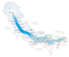
Located on the then-swampland between Limmat and Lake Zurich around Sechseläutzenplatz on small islands and peninsulas in Zürich, the settlements were set on piles to protect against occasional flooding by the Linth and Jona Rivers. Because the lake has grown in size over time, most of the original piles are now around 4 metres (13 ft) to 7 metres (23 ft) under the water level of 406 metres (1,332 ft), giving modern observers the false impression that they always had been underwater. Zürich–Enge Alpenquai is located on Lake Zurich lakeshore in Enge, a locality of the municipality of Zürich in the Canton of Zürich in Switzerland. The settlement comprises 2.93 hectares (7.24 acres), and the buffer zone, including the lake area, comprises 17.40 hectares (43.00 acres) in all. It was neighbored by the settlements at Kleiner Hafner and Grosser Hafner on a then peninsula respectively island in the effluence of the Limmat, within an area of about 0.2 square kilometres (49.42 acres) in the city of Zürich.
Description
Alpenquai in the city of Zürich is one of the most important Late Bronze Age lakeside settlements in Central Europe; its huge size and its almost uninterrupted occupation from 1050 BC to 800 BC, rich imports, and the excellent state of preservation of the layers with unique organic finds and architectural elements, mark it as a cultural heritage site of worldwide importance. In addition, the final phase dates from the transition to the Iron Age, a period otherwise rarely found.[3]
Finds
On the occasion of construction works, investigation conducted by probes and probing ditches occurred in 1970. Despite the dredging for the construction of the Seequai between 1916 and 1919, an amazingly big area of approximately 2.8 hectares (7 acres) with two cultural layers was preserved. Both, the upper and the lower cultural layer, were separated by an about 10 centimetres (3.94 in) cm thick layer of lake marl composed of several layers of different materials. There were found pile shoes at different altitudes in the cultural layers and rich bar decoration of ceramics occurred exclusively in the lower layer, while the decoration on cannelure groups was limited to the upper layer, as well as some graphite-decorated fragments.[4]

So-called Potin lumps, those largest weights 59.2 kilograms (131 lb), where found at Alpenquai in 1890. They consist of a large number of fused Celtic coins, which are mixed with charcoal remnants. Some of the about 18,000 coins originate from the Eastern Gaul, others are of the Zürich type, that were assigned to the local Helvetii, and date to around 100 BC. The find is so far unique, and the scientific research assumes that the melting down of the lumps was not completed, therefore the aim was to form cultic offerings. The site of the find was at that time at least 50 metres (164 ft) from the lake shore, and probably 1 metre (3 ft) to 3 metres (10 ft) deep in the water.[5][6]
Protection
As well as being part of the 56 Swiss sites of the UNESCO World Heritage Site Prehistoric pile dwellings around the Alps, the settlement is also listed in the Swiss inventory of cultural property of national and regional significance as a Class A object of national importance.[7] Hence, the area is provided as a historical site under federal protection, within the meaning of the Swiss Federal Act on the nature and cultural heritage (German: Bundesgesetz über den Natur- und Heimatschutz NHG) of 1 July 1966. Unauthorised researching and purposeful gathering of findings represent a criminal offense according to Article 24.[8]
See also
Literature
- Peter J. Suter, Helmut Schlichtherle et al.: Pfahlbauten – Palafittes – Palafitte. Palafittes, Biel 2009. ISBN 978-3-906140-84-1.
- Margrit Balmer: Zürich in der Spätlatène- und frühen Kaiserzeit. Vom keltischen Oppidum zum römischen Vicus Turicum. (Monographien der Kantonsarchäologie Zürich 39). Hochbaudepartement der Stadt Zürich, Stadtarchäologie. FO Print & Media AG, Zürich and Egg 2009, ISBN 978-3-905681-37-6.
- Beat Eberschweiler: Ur- und frühgeschichtliche Verkehrswege über den Zürichsee: Erste Ergebnisse aus den Taucharchäologischen Untersuchungen beim Seedamm. In: Mitteilungen des Historischen Vereins des Kantons Schwyz, Volume 96, Schwyz 2004.[9]
References
- ↑ "Prehistoric Pile Dwellings in Switzerland". Swiss Coordination Group UNESCO Palafittes (palafittes.org). Retrieved 2014-12-10.
- ↑ "World Heritage". palafittes.org. Retrieved 2014-12-10.
- ↑ "Sites Switzerland: Zürich–Enge Alpenquai (CH-ZH-09)". palafittes.org. Retrieved 2014-12-10.
- ↑ "Ältere Eisenzeit = Premier Age du Fer = Prima Età del Ferro". Jahrbuch der Schweizerischen Gesellschaft für Ur- und Frühgeschichte = Annuaire de la Société Suisse de Préhistoire et d'Archéologie = Annuario della Società Svizzera di Preistoria e d'Archeologia 59/1976. 1975. Retrieved 2014-12-12.
- ↑ Keltisches Geld in Zürich: Der spektakuläre «Potinklumpen». Amt für Städtebau der Stadt Zürich, Stadtarchäologie, Zürich October 2007.
- ↑ Michael Nick. "75 kilogrammes of Celtic small coin - Recent research on the "Potinklumpen" from Zürich" (PDF). Ministerio de Educación, Cultura y Deporte, España. Retrieved 2014-12-12.
- ↑ "A-Objekte KGS-Inventar" (PDF). Schweizerische Eidgenossenschaft, Amt für Bevölkerungsschutz. 2015-01-01. Retrieved 2015-09-13.
- ↑ "Bundesgesetz über den Natur- und Heimatschutz (NHG)" (PDF) (in German). Hochbaudepartement Stadt Zürich. 2014-10-12. Retrieved 2015-08-21.
- ↑ Beat Eberschweiler (2004). "Ur- und frühgeschichtliche Verkehrswege über den Zürichsee: Erste Ergebnisse aus den Taucharchäologischen Untersuchungen beim Seedamm" (in German). ETH Bibliothek. Retrieved 2014-12-08.
External links
| Wikimedia Commons has media related to Alpenquai (Zürich). |
| Wikimedia Commons has media related to Der See erzählt. |
Coordinates: 47°21′52.06″N 8°32′19.47″E / 47.3644611°N 8.5387417°E
