Zouérat
| Zouérat الزويرات | |
|---|---|
| Commune and town | |
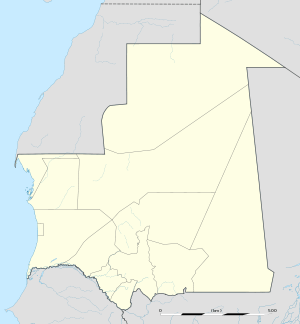 Zouérat Location in Mauritania | |
| Coordinates: 22°41′N 12°28′W / 22.683°N 12.467°WCoordinates: 22°41′N 12°28′W / 22.683°N 12.467°W | |
| Country |
|
| Region | Tiris Zemmour |
| Elevation | 380 m (1,250 ft) |
| Population (2013 census) | |
| • Total | 44,649 |
Zouérat (Arabic: الزويرات) is the largest town in northern Mauritania and the capital of Tiris Zemmour region, with an approximate population of 44,649 (2012). It lies at the eastern end of the Mauritania Railway to Nouadhibou.
Overview
The town is a centre for iron ore mining, including the mines of Fderîck, Tazadit and Rouessa. Iron ore deposits were first discovered near Kediet ej Jill in 1952 and in 1958 concessions on iron extraction were given to Miferma, Société des mines de fer de Mauritanie, which is dominated by European-based mining companies. In 1974 Miferma was nationalized by the Mauritanian government. The industry in the area has evolved over the decades; in 1981 a new iron ore deposit was discovered at guelb el Rhein, 35 km north of Zouérat and in 1990 another was found at Guelb M'Haoudat, which lies about 65 km from Zouérat.[1]
Other companies exploring for iron ore in the region include Xstrata and Arcelor Mittal.
The reserves of SNIM's (Tazadit mine) are estimated at 200 million tons of hematite. The freight trains that take the iron ore to the coast can be as much as 3 km long. Its people are also employed by regional administration and the military and the town has a notable population of foreign workers from other African countries. A clinic, a club, a pool, a school and a shop are included. An airfield is served by regular flights from/to Nouadhibou and seasonally from/to Casablanca using Mauritania Airlines International Boeing 737-500 and Boeing 737-700 planes.
On the mine roads, vehicles travel on the left side, elsewhere on the right. There is a crossing at SNIM's north entrance.
Water is brought by train from Boulenoir, which is on the route from Nouadhibou. A shanty town is growing around the town and a wall is being built to separate the two towns. It is called "mur de la honte" (wall of shame) by the Zouerati. The lack of houses for the Mauritanian workers has gone to build new flats between Zouerate and the Kediet.
Climate
The climate is hot and dry throughout the year, a description accredited to the town's location within the extremes of the Sahara.
| Climate data for Zouerat | |||||||||||||
|---|---|---|---|---|---|---|---|---|---|---|---|---|---|
| Month | Jan | Feb | Mar | Apr | May | Jun | Jul | Aug | Sep | Oct | Nov | Dec | Year |
| Record high °C (°F) | 34 (93) |
34 (93) |
37 (99) |
40 (104) |
43 (109) |
46 (115) |
47 (117) |
46 (115) |
44 (111) |
41 (106) |
38 (100) |
36 (97) |
47 (117) |
| Average high °C (°F) | 22 (72) |
25 (77) |
26 (79) |
31 (88) |
33 (91) |
36 (97) |
40 (104) |
40 (104) |
37 (99) |
32 (90) |
27 (81) |
23 (73) |
31 (88) |
| Average low °C (°F) | 12 (54) |
15 (59) |
16 (61) |
18 (64) |
20 (68) |
23 (73) |
26 (79) |
27 (81) |
26 (79) |
22 (72) |
18 (64) |
14 (57) |
20 (68) |
| Record low °C (°F) | 6 (43) |
8 (46) |
10 (50) |
10 (50) |
12 (54) |
15 (59) |
16 (61) |
18 (64) |
17 (63) |
12 (54) |
10 (50) |
6 (43) |
6 (43) |
| Average precipitation mm (inches) | 4 (0.16) |
2 (0.08) |
2 (0.08) |
1 (0.04) |
1 (0.04) |
2 (0.08) |
3 (0.12) |
8 (0.31) |
21 (0.83) |
5 (0.2) |
4 (0.16) |
3 (0.12) |
56 (2.22) |
| Source: Weatherbase | |||||||||||||